 industry
Similar presentations:


Ice Cover. Segmentation Service
1.
Ice CoverSegmentation Service
2.
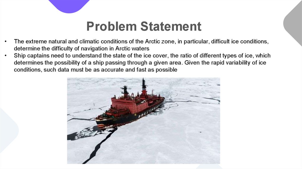
Problem StatementThe extreme natural and climatic conditions of the Arctic zone, in particular, difficult ice conditions,
determine the difficulty of navigation in Arctic waters
Ship captains need to understand the state of the ice cover, the ratio of different types of ice, which
determines the possibility of a ship passing through a given area. Given the rapid variability of ice
conditions, such data must be as accurate and fast as possible
3.
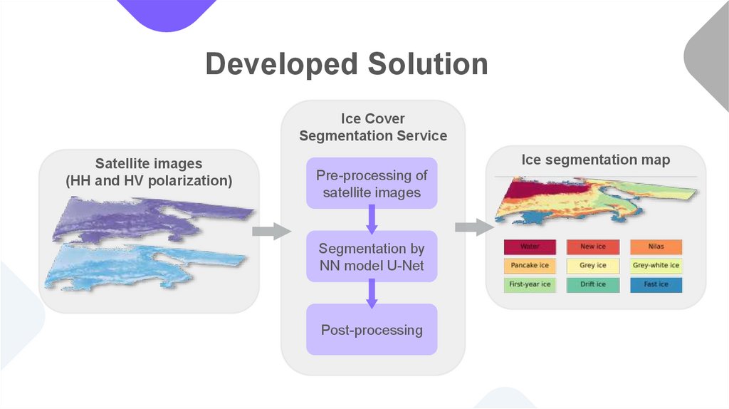
Developed SolutionIce Cover
Segmentation Service
Satellite images
(HH and HV polarization)
Ice segmentation map
Pre-processing of
satellite images
Segmentation by
NN model U-Net
Post-processing
4.
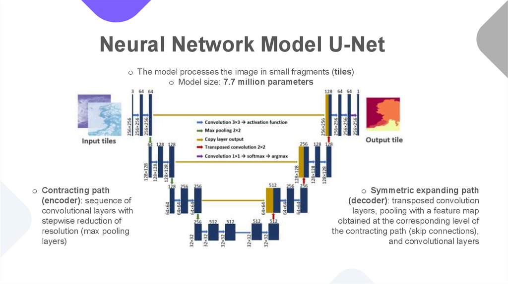
Neural Network Model U-Neto The model processes the image in small fragments (tiles)
o Model size: 7.7 million parameters
o Contracting path
(encoder): sequence of
convolutional layers with
stepwise reduction of
resolution (max pooling
layers)
o Symmetric expanding path
(decoder): transposed convolution
layers, pooling with a feature map
obtained at the corresponding level of
the contracting path (skip connections),
and convolutional layers
5.
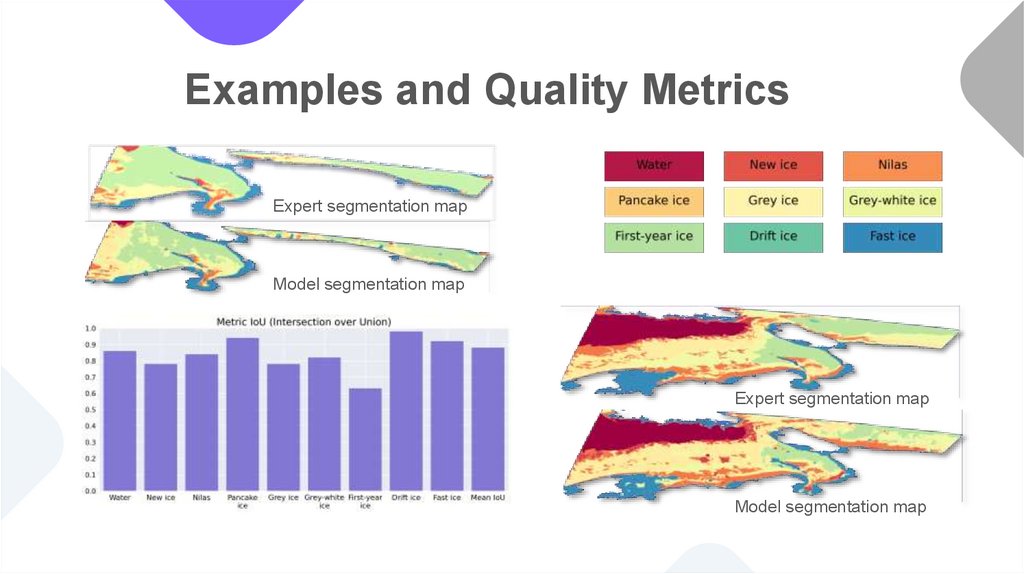
Examples and Quality MetricsExpert segmentation map
Model segmentation map
Expert segmentation map
Model segmentation map
6.
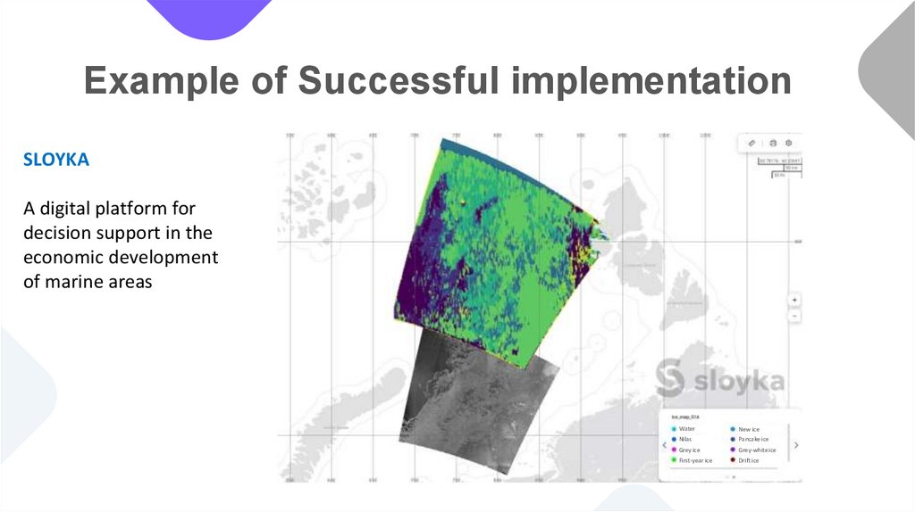
Example of Successful implementationSLOYKA
A digital platform for
decision support in the
economic development
of marine areas
Water
New ice
Nilas
Pancake ice
Grey ice
Grey-white ice
First-year ice
Drift ice