


 geography
Similar presentations:


Architecture urban design landscape
1.
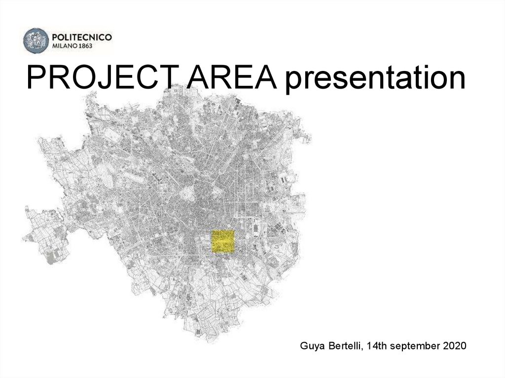
PROJECT AREA presentationGuya Bertelli, 14th september 2020
2.
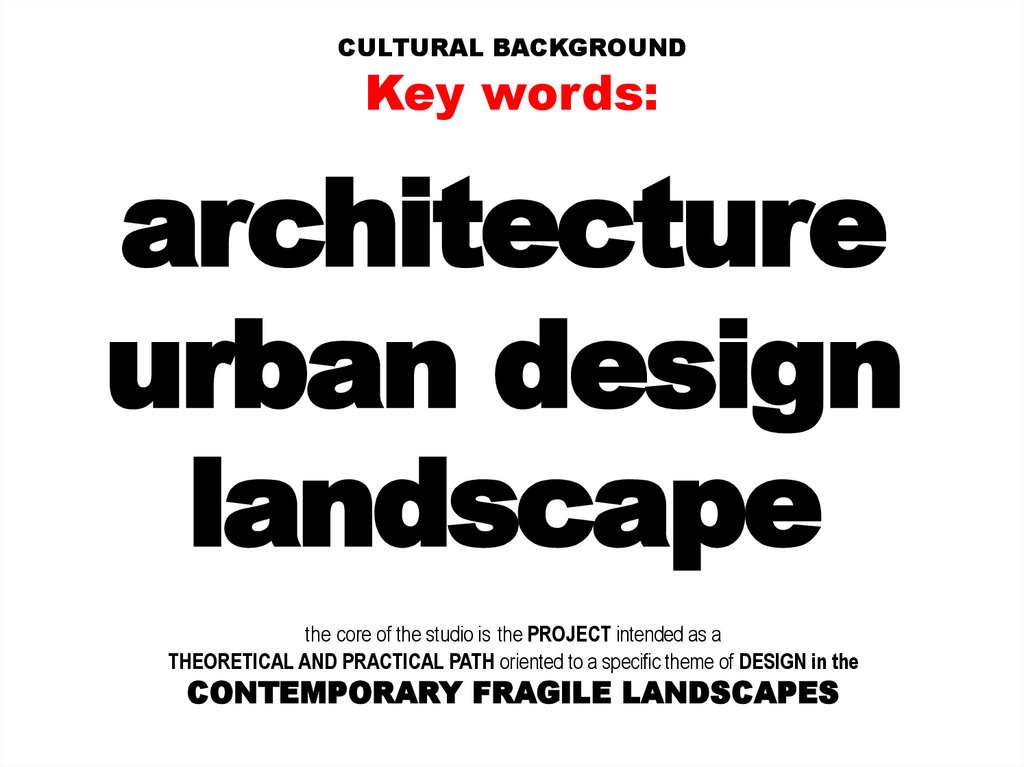
CULTURAL BACKGROUNDKey words:
architecture
urban design
landscape
the core of the studio is the PROJECT intended as a
THEORETICAL AND PRACTICAL PATH oriented to a specific theme of DESIGN in the
CONTEMPORARY FRAGILE LANDSCAPES
3.
RESILIENT LANDSCAPES INFRASTRUCTURESAND PUBLIC SPACES
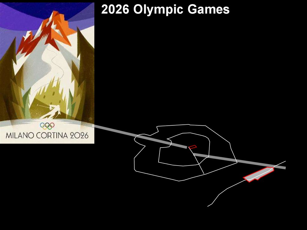
Within a complex urban reality and its large landscape and territorial potentials, «using» the
occasion of 2026 Olympic Games, the Studio will work on the main goals consisting in the
construction of an architectural and urban resilient system,
able to react at the fragile and critic contemporary conditions
» The project is intended as a multifunctional organism;
» Focused on the relationship between construction (structure) and composition (figure);
» It is Interpreted according to the different frameworks of forms, materials, uses and connections;
» It is Integrated among open, relational and built-up spaces.
The project area: Milano, Porta Romana
[ 45°26’38’’ N, 09°12’20’’]
4.
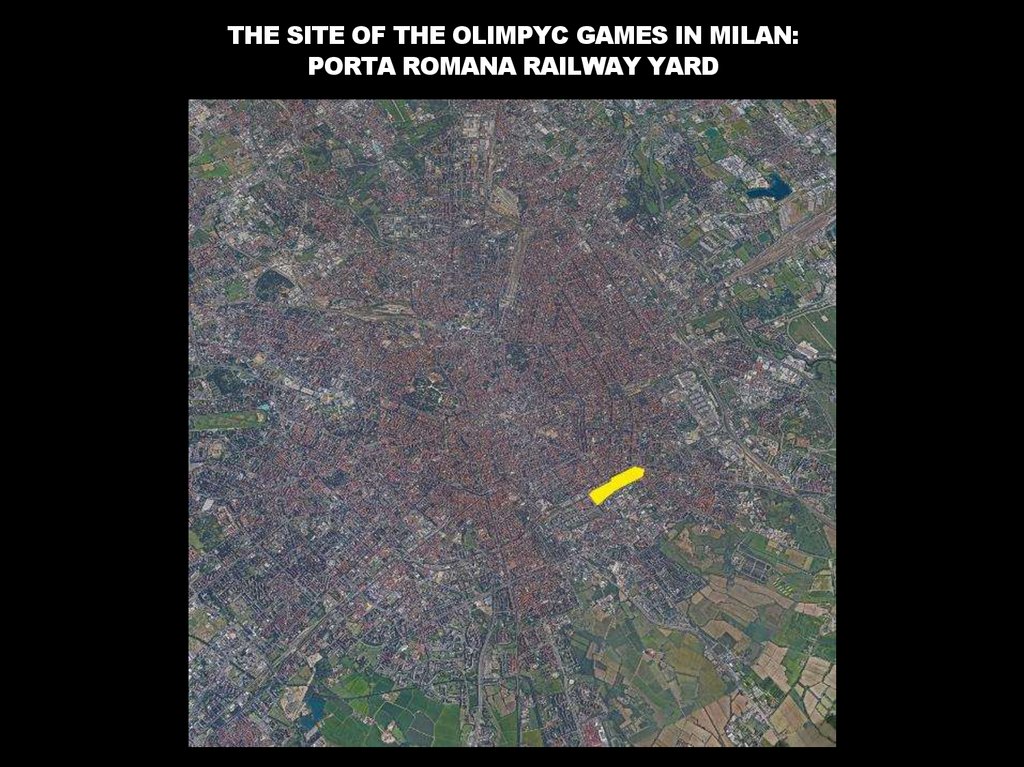
2026 Olympic Games5.
THE SITE OF THE OLIMPYC GAMES IN MILAN:PORTA ROMANA RAILWAY YARD
6.
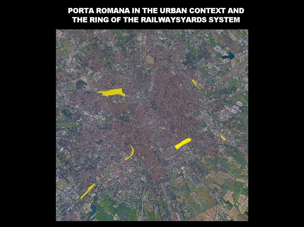
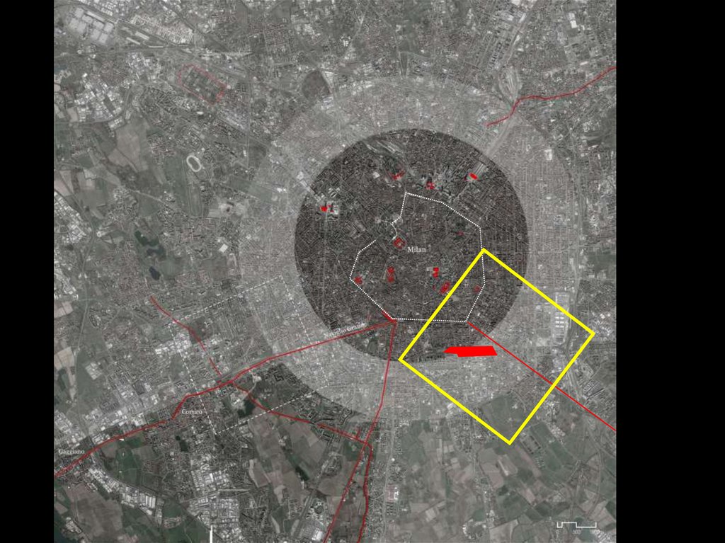
PORTA ROMANA IN THE URBAN CONTEXT ANDTHE RING OF THE RAILWAYSYARDS SYSTEM
7.
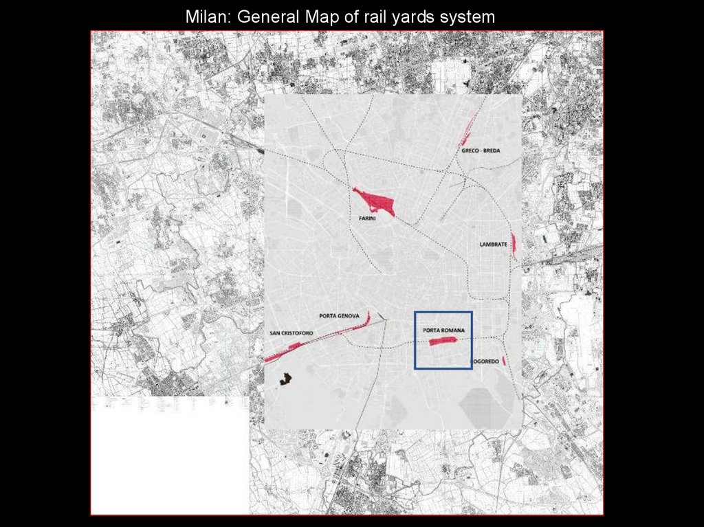
Milan: General Map of rail yards system8.
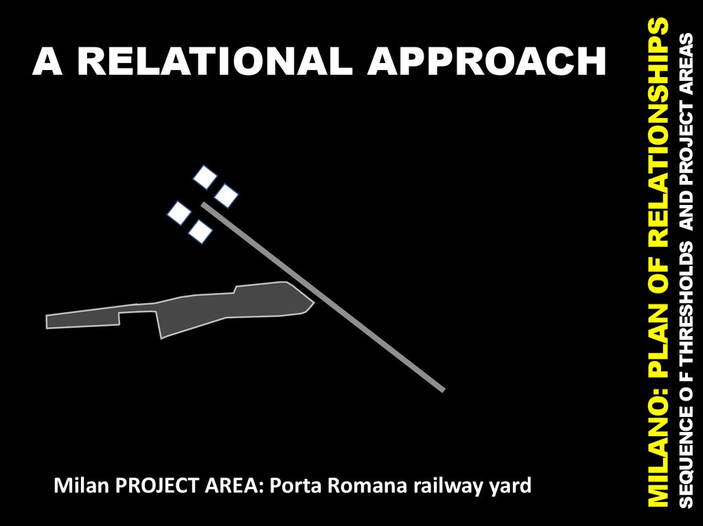
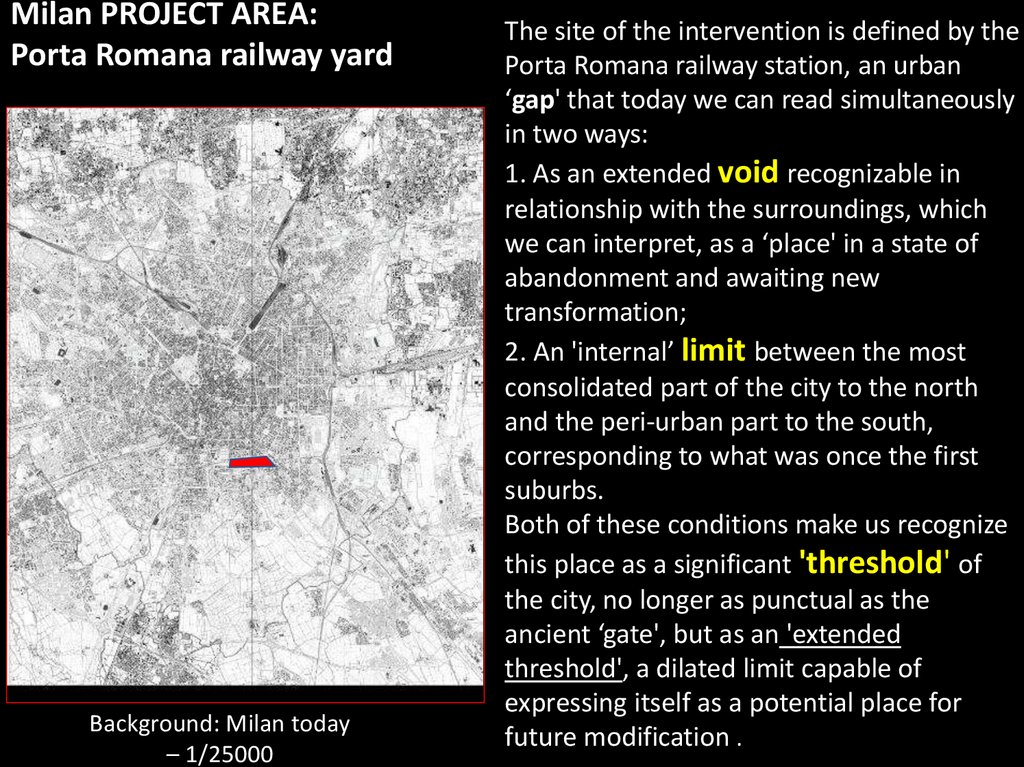
Milan PROJECT AREA: Porta Romana railway yardSEQUENCE O F THRESHOLDS AND PROJECT AREAS
MILANO: PLAN OF RELATIONSHIPS
A RELATIONAL APPROACH
9.
Milan PROJECT AREA:Porta Romana railway yard
Background: Milan today
– 1/25000
The site of the intervention is defined by the
Porta Romana railway station, an urban
‘gap' that today we can read simultaneously
in two ways:
1. As an extended void recognizable in
relationship with the surroundings, which
we can interpret, as a ‘place' in a state of
abandonment and awaiting new
transformation;
2. An 'internal’ limit between the most
consolidated part of the city to the north
and the peri-urban part to the south,
corresponding to what was once the first
suburbs.
Both of these conditions make us recognize
this place as a significant 'threshold' of
the city, no longer as punctual as the
ancient ‘gate', but as an 'extended
threshold', a dilated limit capable of
expressing itself as a potential place for
future modification .
10.
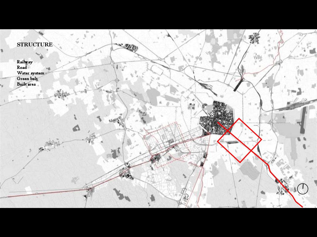
11.
STRUCTURERailway
Road
Water system
Green belt
Built area
12.
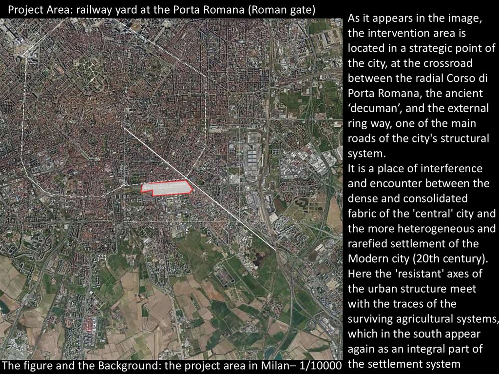
Project Area: railway yard at the Porta Romana (Roman gate)As it appears in the image,
the intervention area is
located in a strategic point of
the city, at the crossroad
between the radial Corso di
Porta Romana, the ancient
‘decuman’, and the external
ring way, one of the main
roads of the city's structural
system.
It is a place of interference
and encounter between the
dense and consolidated
fabric of the 'central' city and
the more heterogeneous and
rarefied settlement of the
Modern city (20th century).
Here the 'resistant' axes of
the urban structure meet
with the traces of the
surviving agricultural systems,
which in the south appear
again as an integral part of
The figure and the Background: the project area in Milan– 1/10000 the settlement system
13.
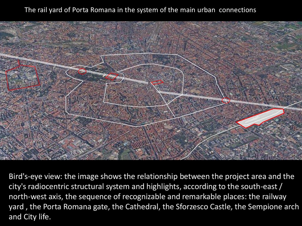
The rail yard of Porta Romana in the system of the main urban connectionsBird's-eye view: the image shows the relationship between the project area and the
city's radiocentric structural system and highlights, according to the south-east /
north-west axis, the sequence of recognizable and remarkable places: the railway
yard , the Porta Romana gate, the Cathedral, the Sforzesco Castle, the Sempione arch
and City life.
14.
23
1
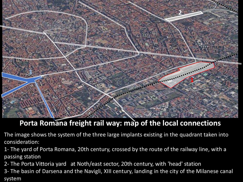
Porta Romana freight rail way: map of the local connections
The image shows the system of the three large implants existing in the quadrant taken into
consideration:
1- The yard of Porta Romana, 20th century, crossed by the route of the railway line, with a
passing station
2- The Porta Vittoria yard at Noth/east sector, 20th century, with 'head' station
3- The basin of Darsena and the Navigli, XIII century, landing in the city of the Milanese canal
system
15.
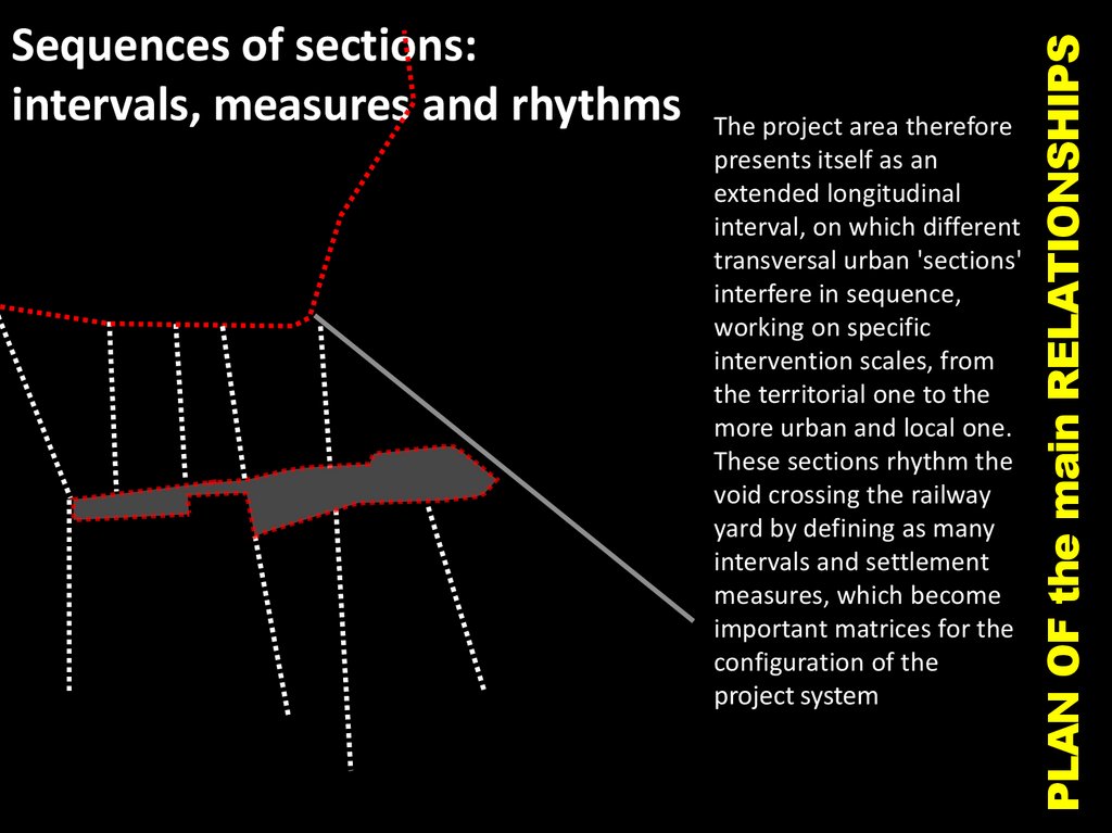
The project area thereforepresents itself as an
extended longitudinal
interval, on which different
transversal urban 'sections'
interfere in sequence,
working on specific
intervention scales, from
the territorial one to the
more urban and local one.
These sections rhythm the
void crossing the railway
yard by defining as many
intervals and settlement
measures, which become
important matrices for the
configuration of the
project system
PLAN OF the main RELATIONSHIPS
Sequences of sections:
intervals, measures and rhythms
16.
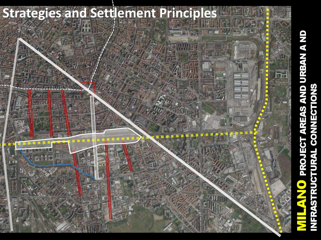
INFRASTRUCTURAL CONNECTIONSMILANO PROJECT AREAS AND URBAN A ND
Strategies and Settlement Principles
17.
65
3
4
1
2
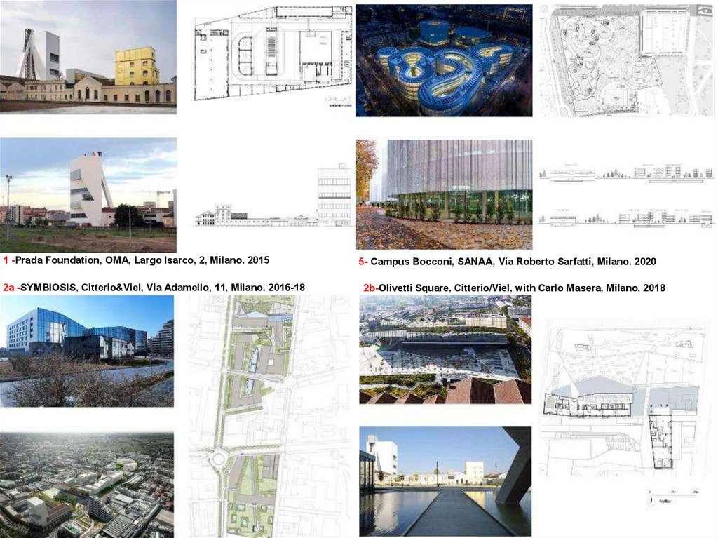
Map of recent interventions: 1.Prada Museum, Rem Koolhaas / 2.Fastweb building, Citterio&Viel and partners /
3. Magazzini Generali/ 4. Ex OM Towers, Fuksas /5. Bocconi Building, Sejima/ 6. Bocconi Building,Grafton Architects /
7. Rolex Building, M. Albini
SEQUENCE O F THRESHOLDS AND PROJECT AREAS
7
MILANO: PLAN OF RELATIONSHIPS
Milan PROJECT AREA: Porta Romana railway yard
18.
1 -Prada Foundation, OMA, Largo Isarco, 2, Milano. 20152a -SYMBIOSIS, Citterio&Viel, Via Adamello, 11, Milano. 2016-18
5- Campus Bocconi, SANAA, Via Roberto Sarfatti, Milano. 2020
2b-Olivetti Square, Citterio/Viel, with Carlo Masera, Milano. 2018
19.
A look to the past20.
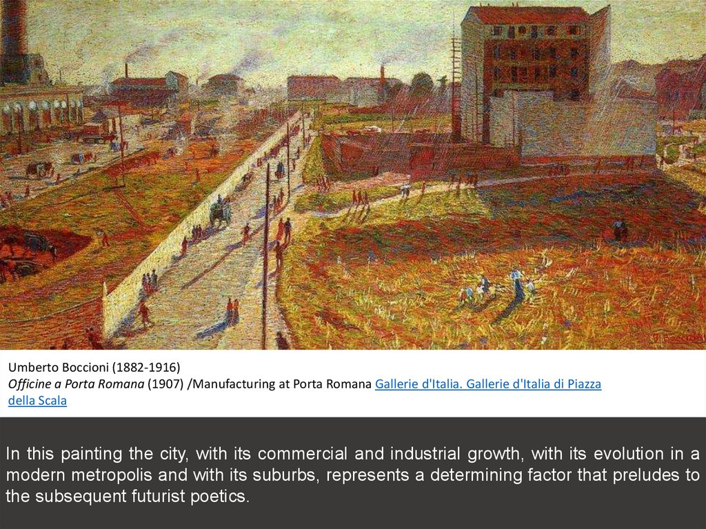
Umberto Boccioni (1882-1916)Officine a Porta Romana (1907) /Manufacturing at Porta Romana Gallerie d'Italia. Gallerie d'Italia di Piazza
della Scala
In this painting the city, with its commercial and industrial growth, with its evolution in a
modern metropolis and with its suburbs, represents a determining factor that preludes to
the subsequent futurist poetics.
21.
Porta Romana Gate in the 16th century22.
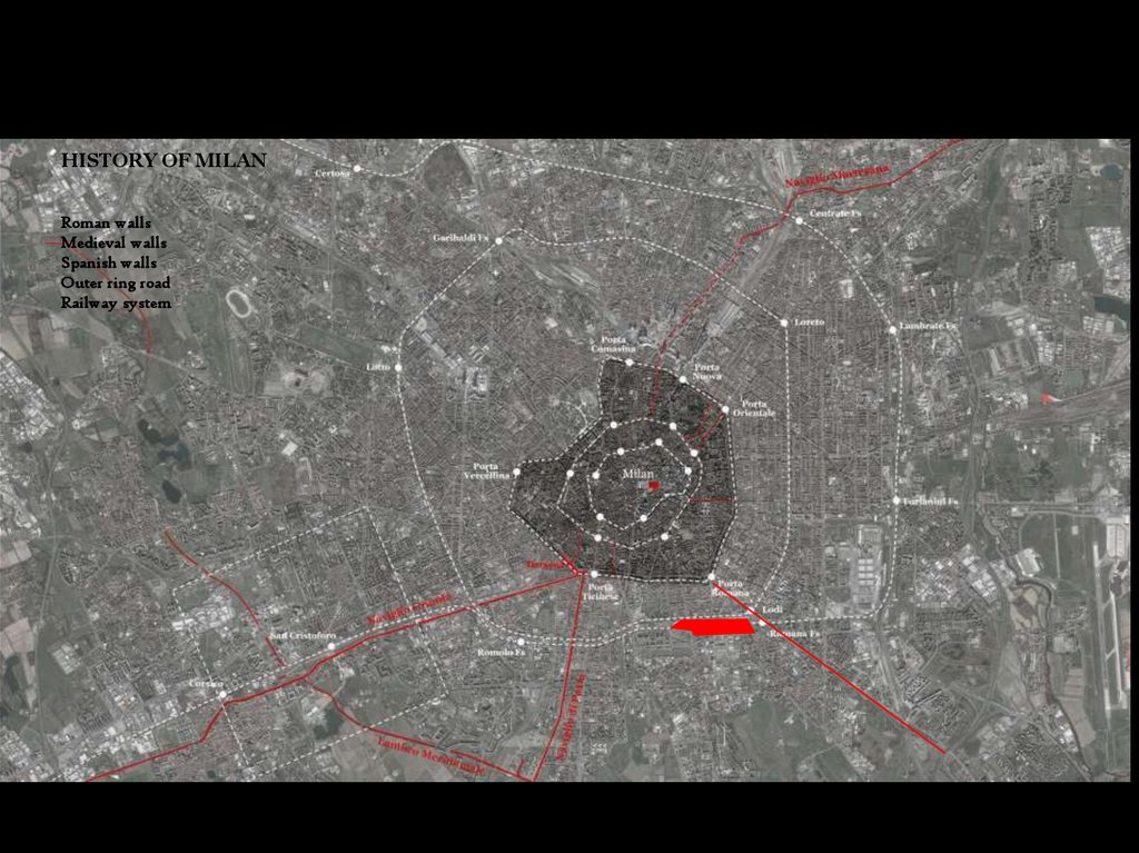
HISTORY OF MILANRoman walls
Medieval walls
Spanish walls
Outer ring road
Railway system
23.
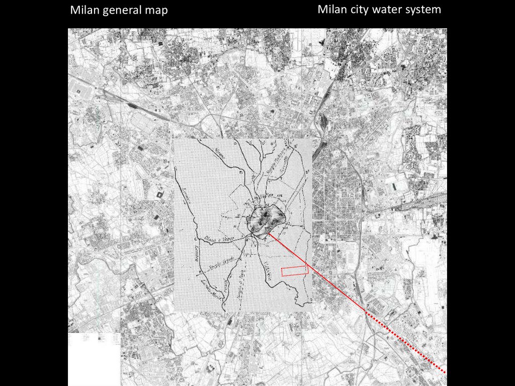
Milan general mapMilan city water system
24.
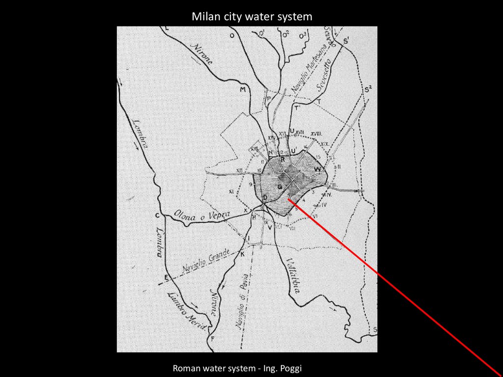
Milan city water systemRoman water system - Ing. Poggi
25.
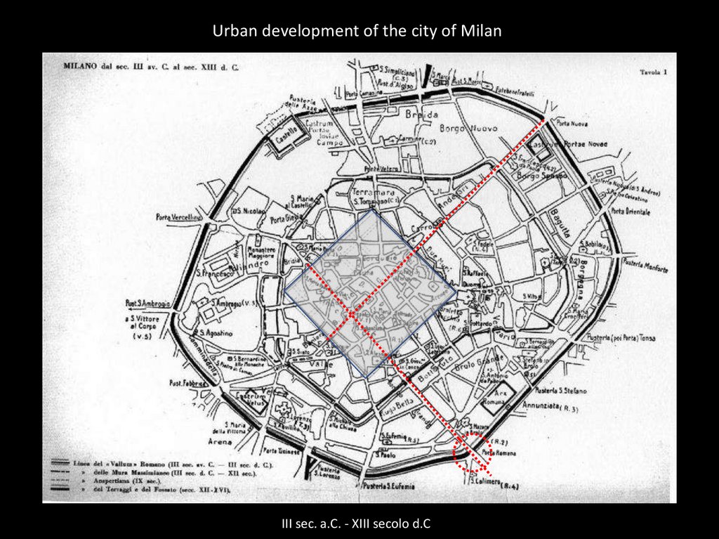
Urban development of the city of MilanIII sec. a.C. - XIII secolo d.C
26.
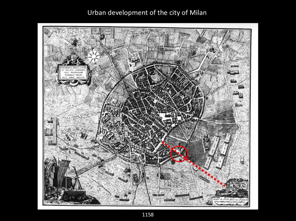
Urban development of the city of Milan1158
27.
The defensive system of the city walls of MilanMarco Antonio Baratieri, 1629
28.
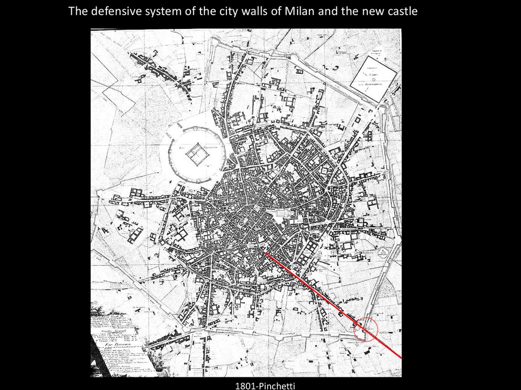
The defensive system of the city walls of Milan and the new castle1801-Pinchetti
29.
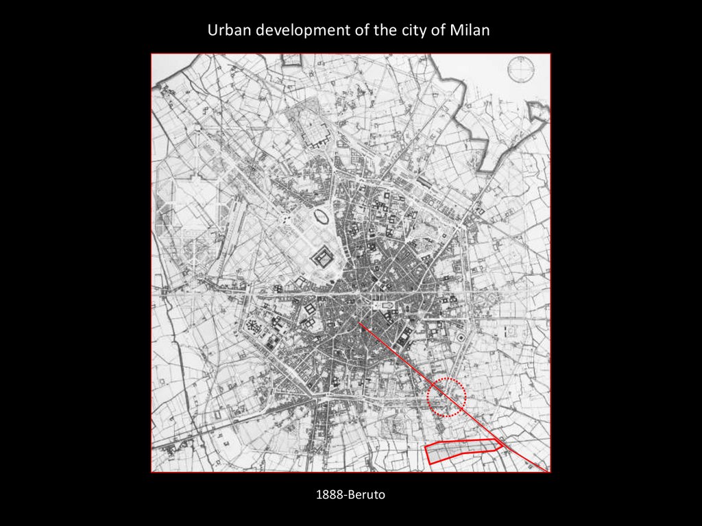
Urban development of the city of Milan1888-Beruto
30.
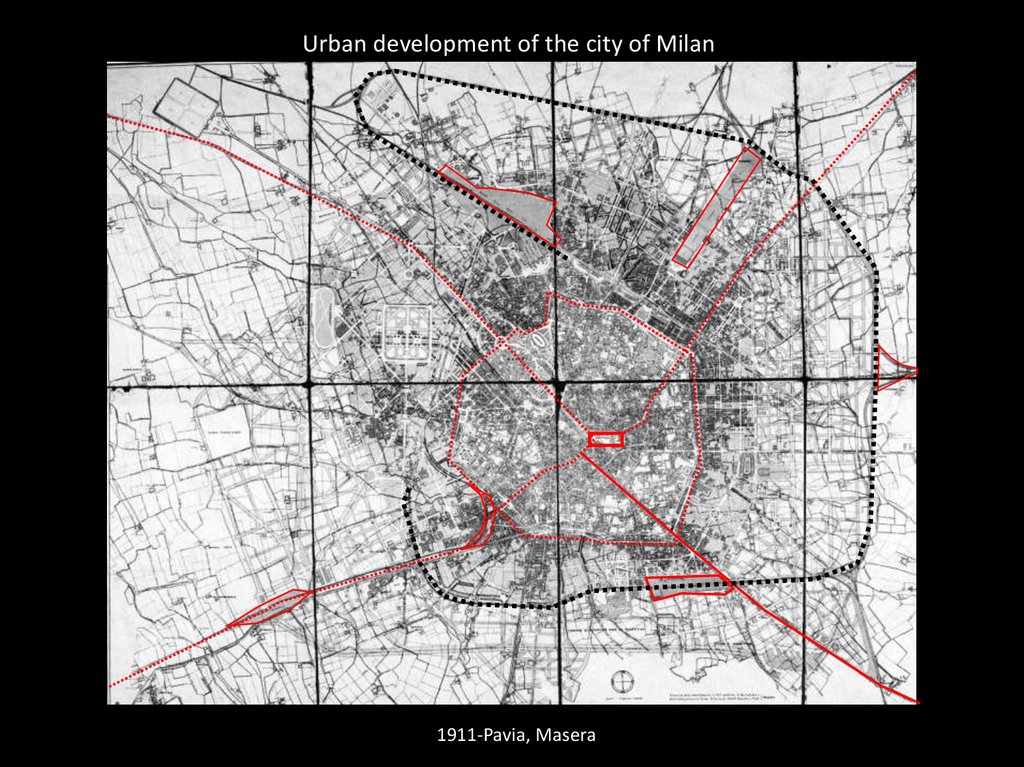
Urban development of the city of Milan1911-Pavia, Masera
31.
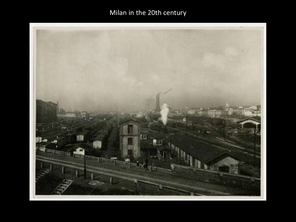
Milan in the 20th century32.
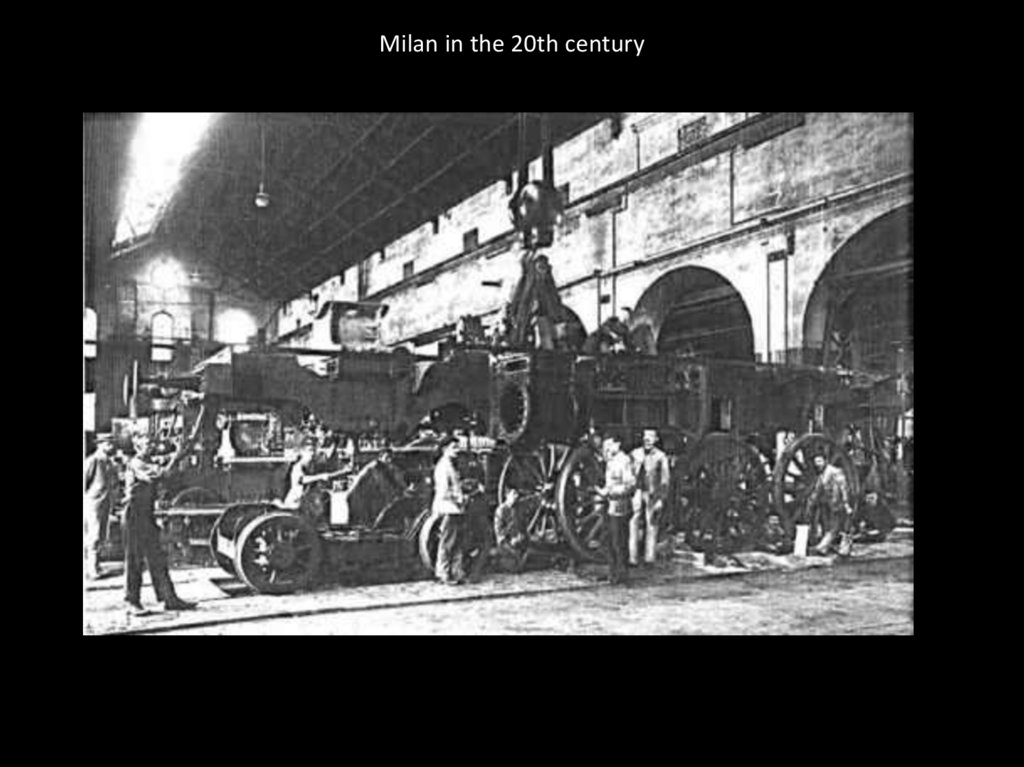
Milan in the 20th century33.
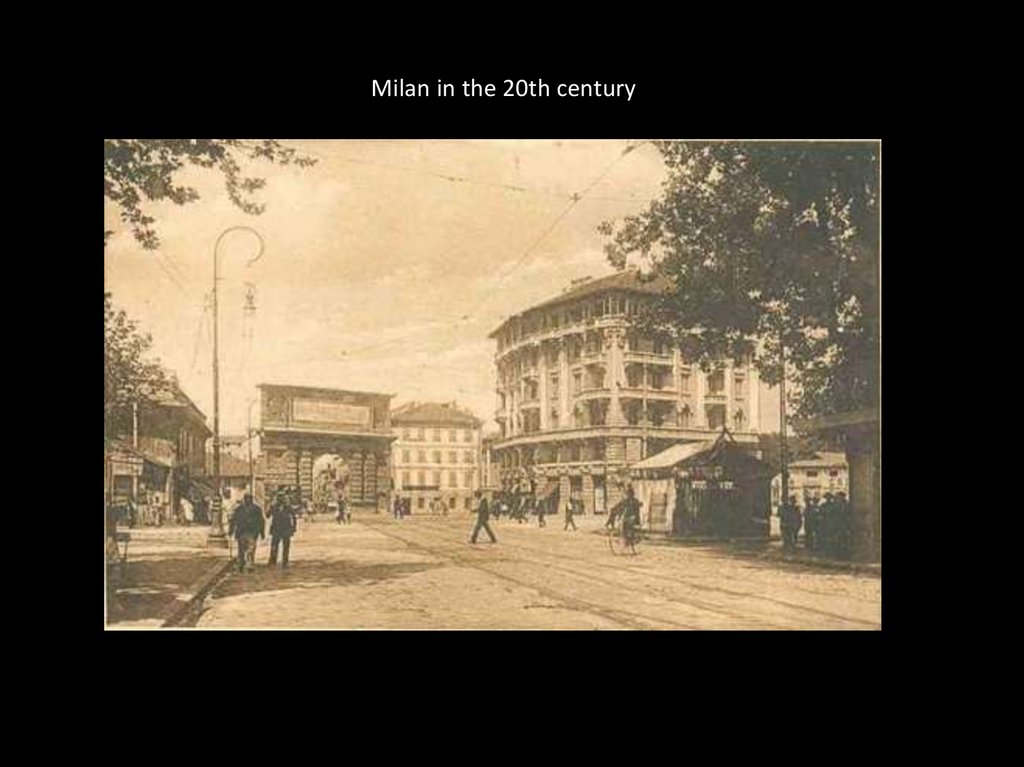
Milan in the 20th century34.
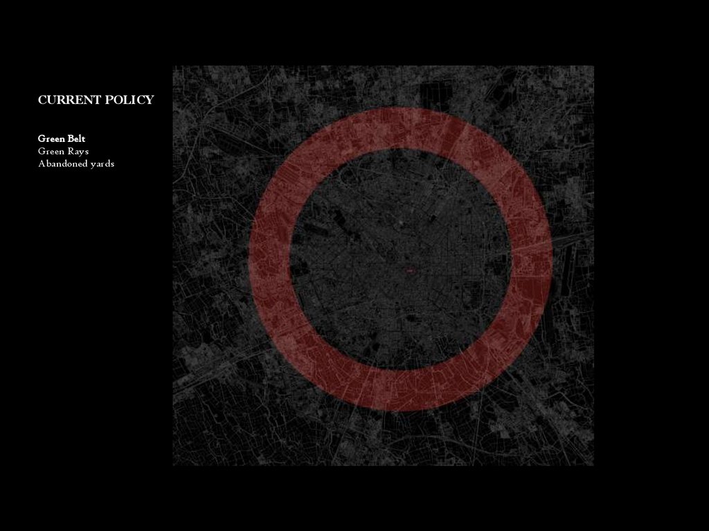
CURRENT POLICYGreen Belt
Green Rays
Abandoned yards
35.
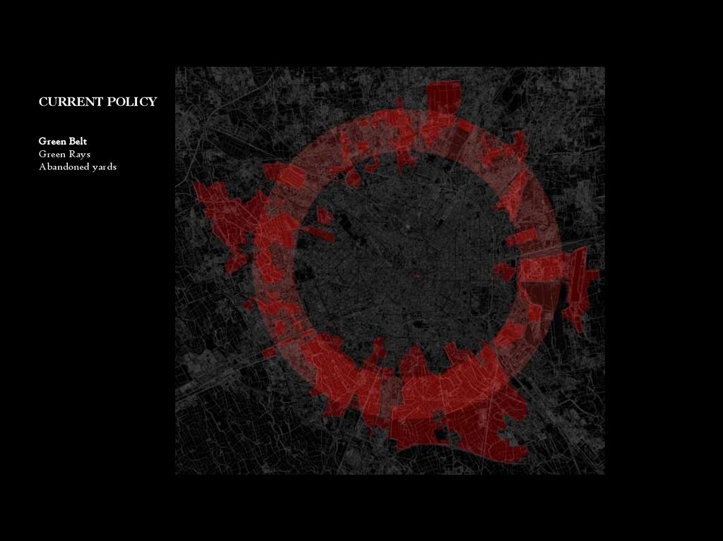
CURRENT POLICYGreen Belt
Green Rays
Abandoned yards
36.
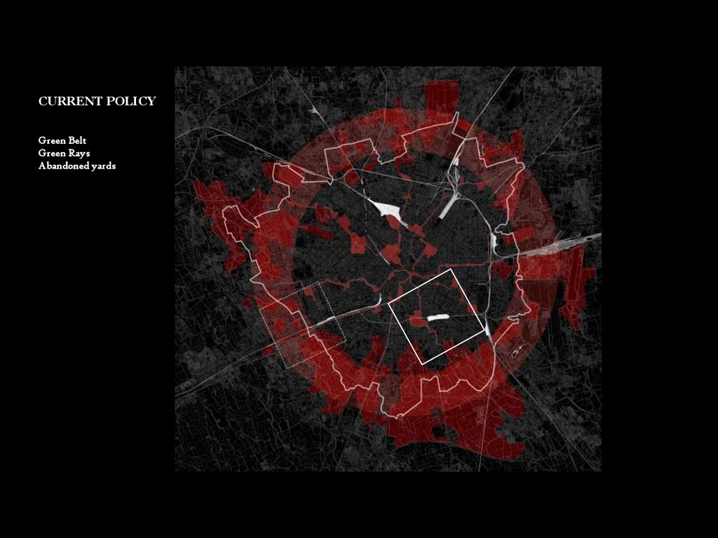
CURRENT POLICYGreen Belt
Green Rays
Abandoned yards
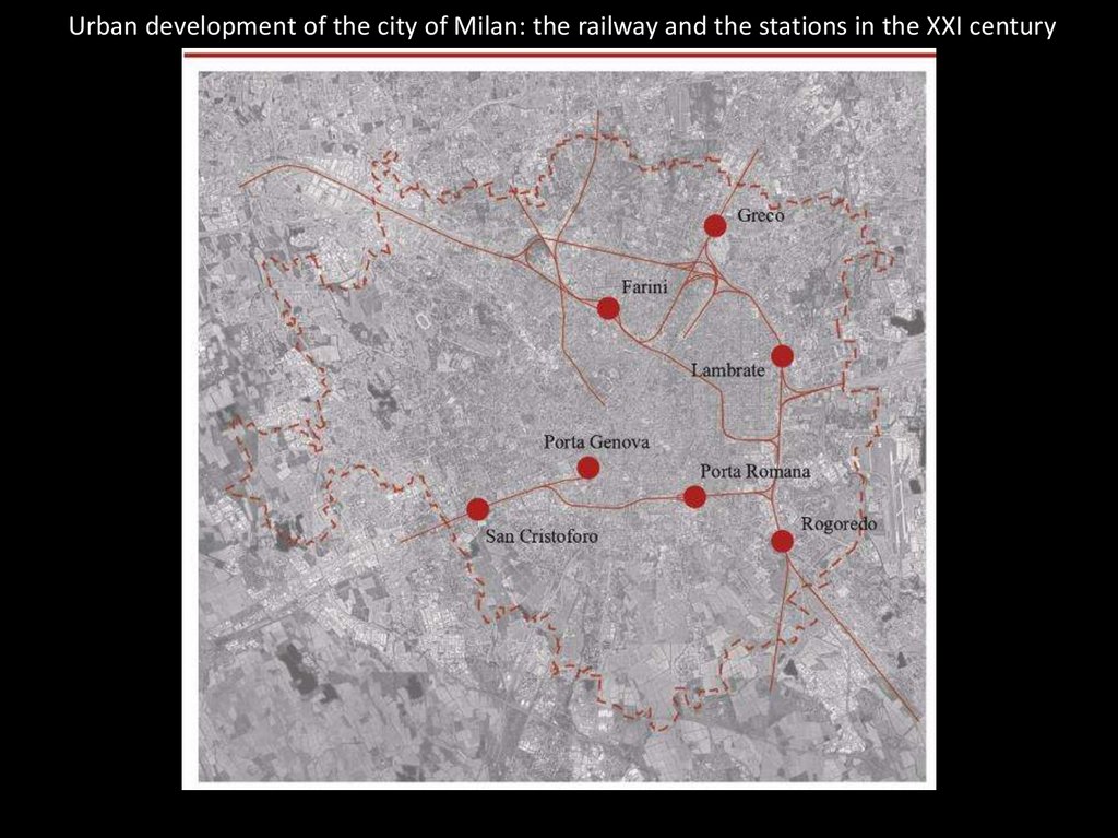
37.
Urban development of the city of Milan: the railway and the stations in the XXI century38.
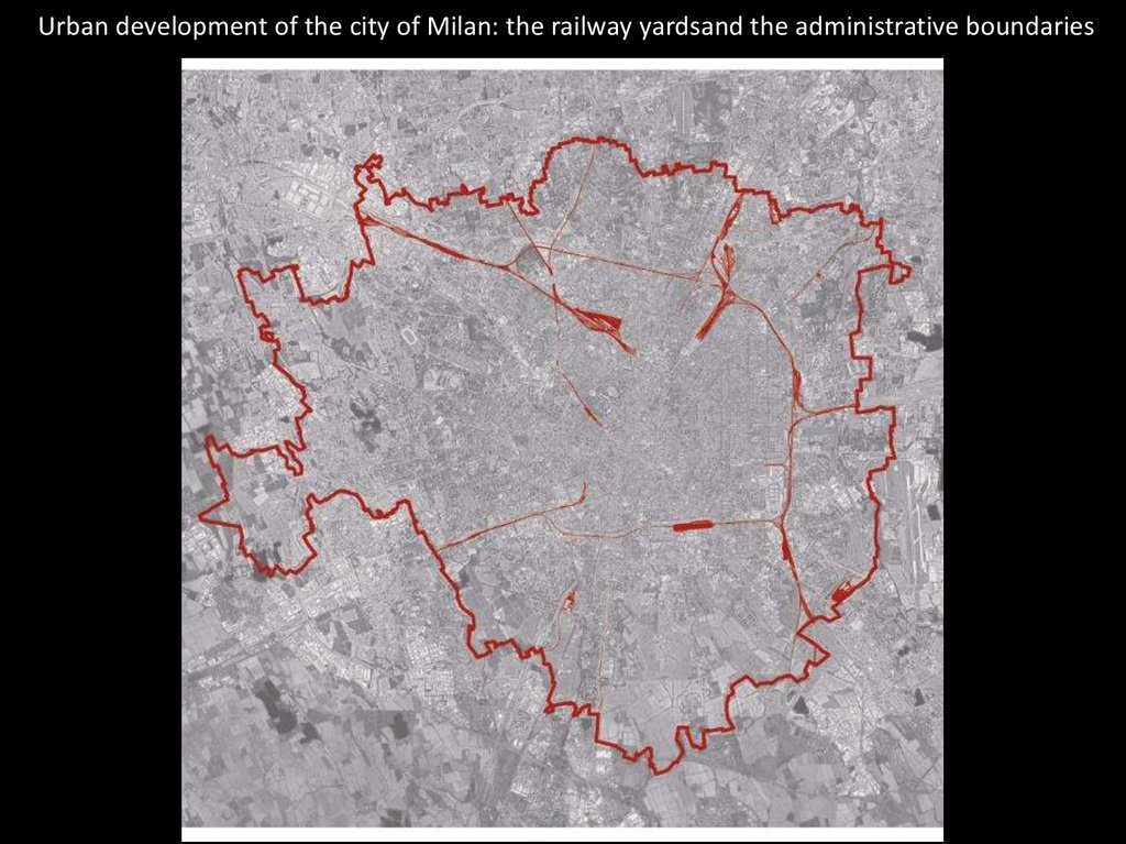
Urban development of the city of Milan: the railway yardsand the administrative boundaries39.
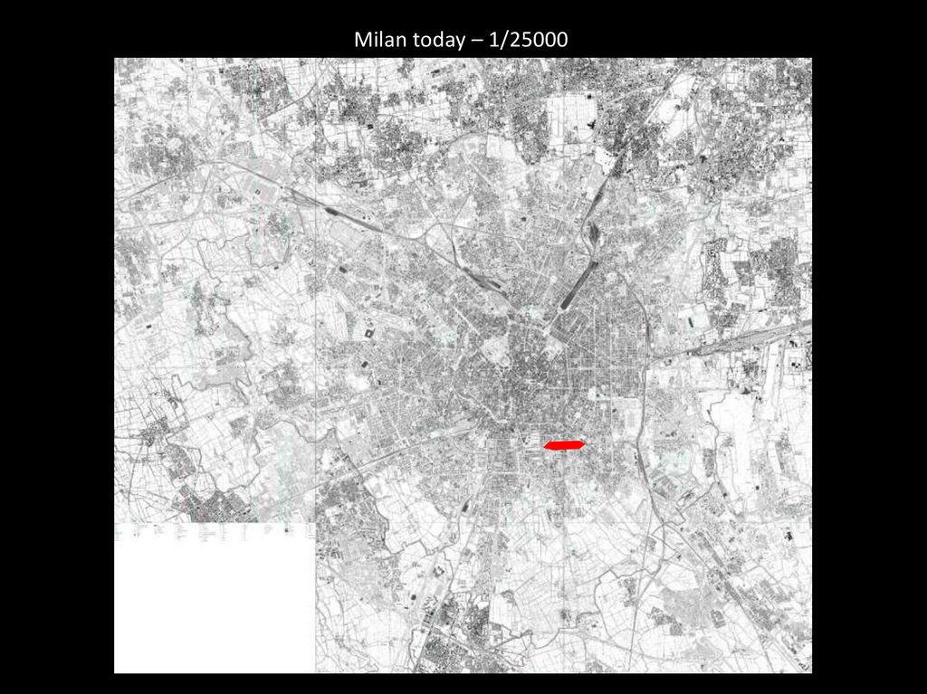
Milan today – 1/2500040.
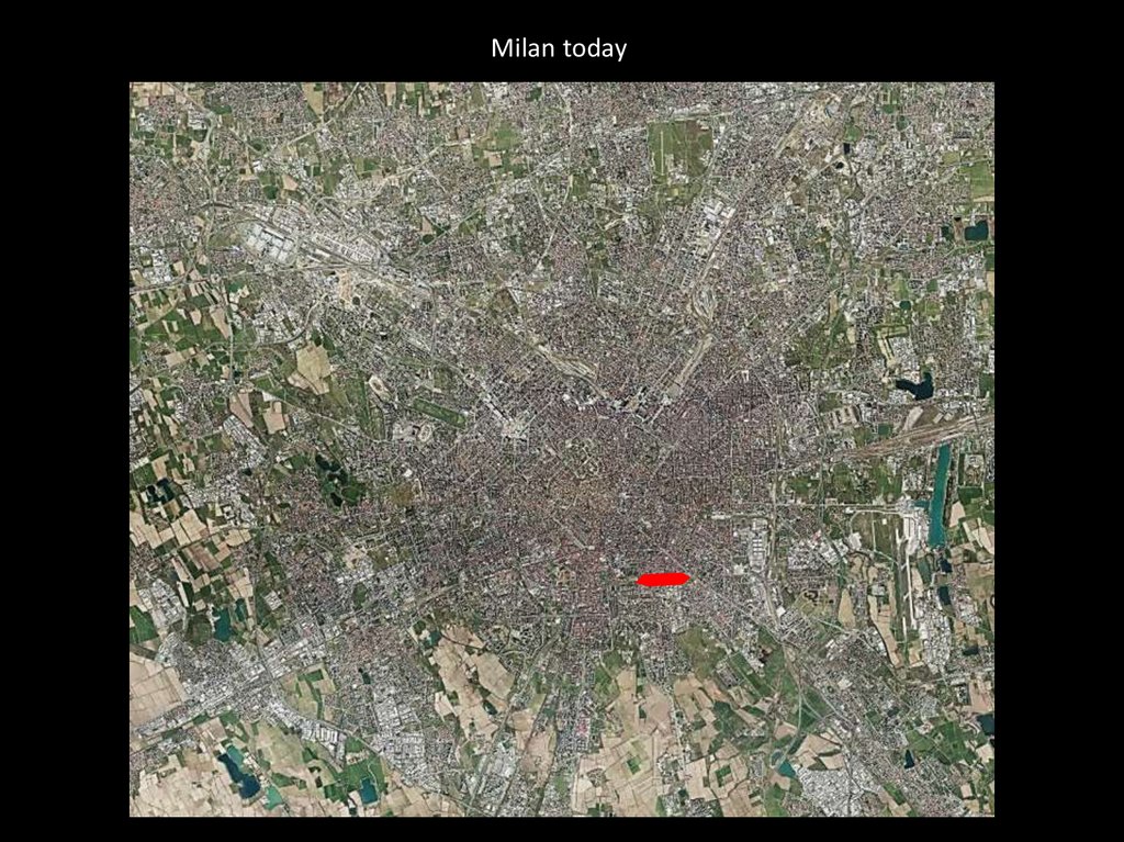
Milan today41.
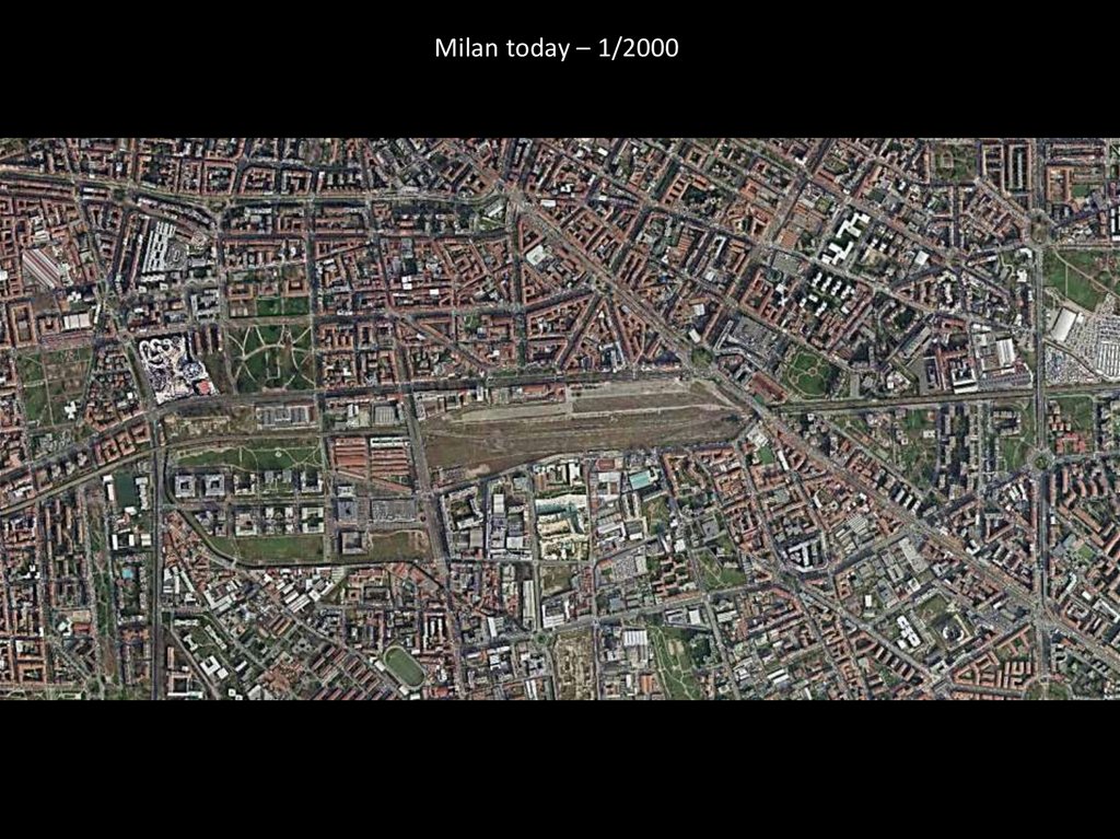
Milan today – 1/200042.
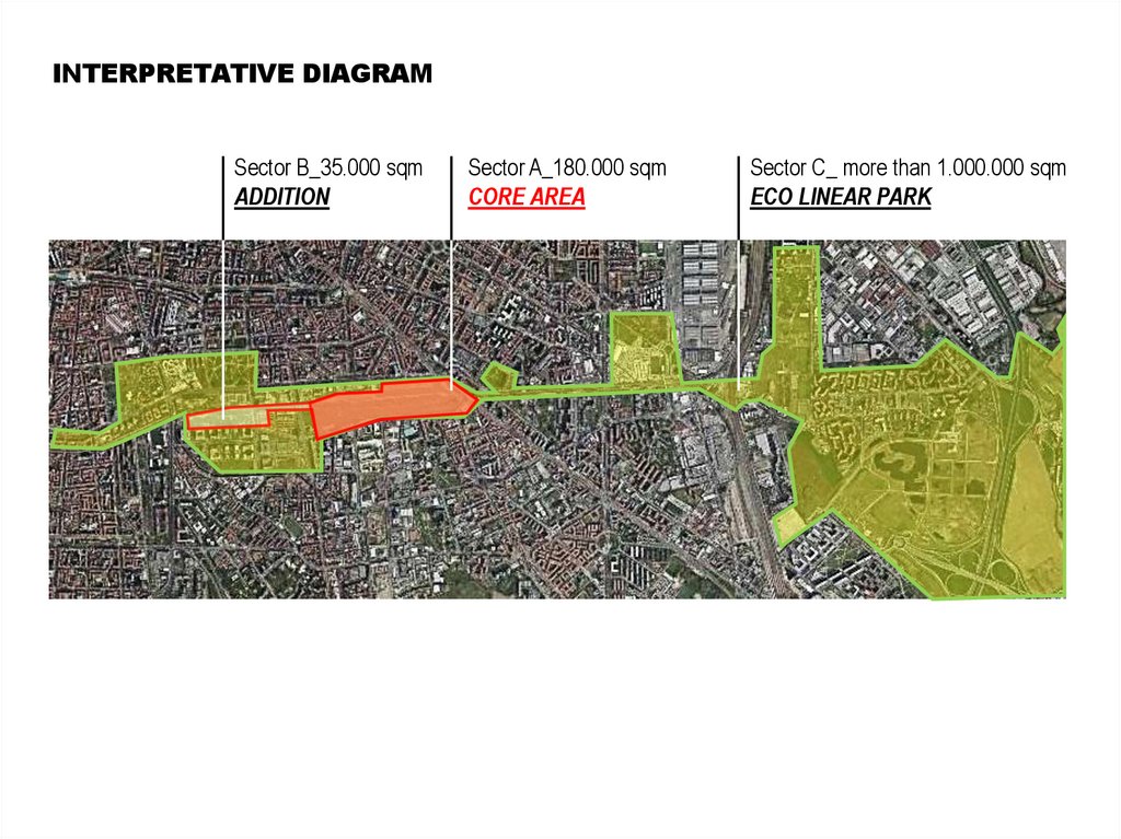
INTERPRETATIVE DIAGRAMSector B_35.000 sqm
ADDITION
Sector A_180.000 sqm
CORE AREA
Sector C_ more than 1.000.000 sqm
ECO LINEAR PARK