


 geography
Similar presentations:


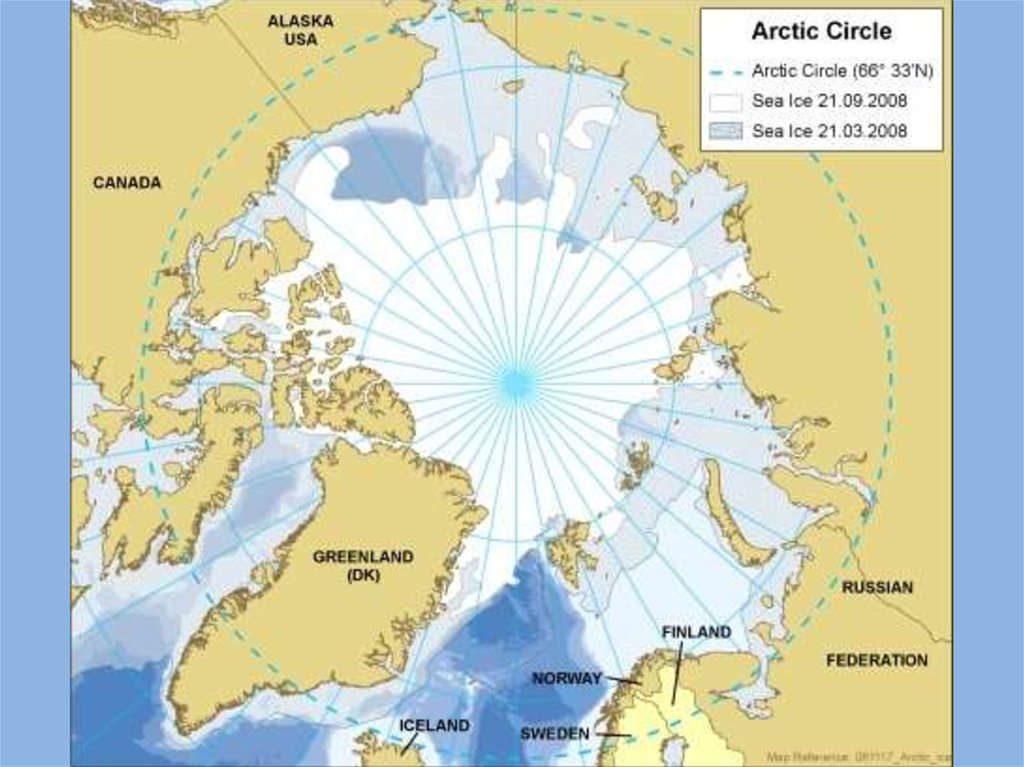
Arctic - the northern area
1.
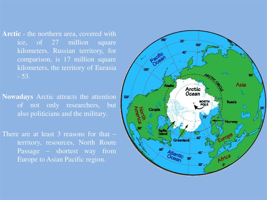
Arctic - the northern area, covered withice, of 27 million square
kilometers. Russian territory, for
comparison, is 17 million square
kilometers, the territory of Eurasia
- 53.
Nowadays Arctic attracts the attention
of not only researchers, but
also politicians and the military.
There are at least 3 reasons for that –
territory, resources, North Route
Passage – shortest way from
Europe to Asian Pacific region.
2.
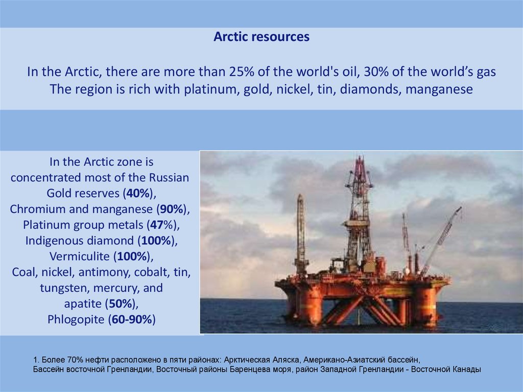
Arctic resourcesIn the Arctic, there are more than 25% of the world's oil, 30% of the world’s gas
The region is rich with platinum, gold, nickel, tin, diamonds, manganese
In the Arctic zone is
concentrated most of the Russian
Gold reserves (40%),
Chromium and manganese (90%),
Platinum group metals (47%),
Indigenous diamond (100%),
Vermiculite (100%),
Coal, nickel, antimony, cobalt, tin,
tungsten, mercury, and
apatite (50%),
Phlogopite (60-90%)
1. Более 70% нефти расположено в пяти районах: Арктическая Аляска, Американо-Азиатский бассейн,
Бассейн восточной Гренландии, Восточный районы Баренцева моря, район Западной Гренландии - Восточной Канады
3.
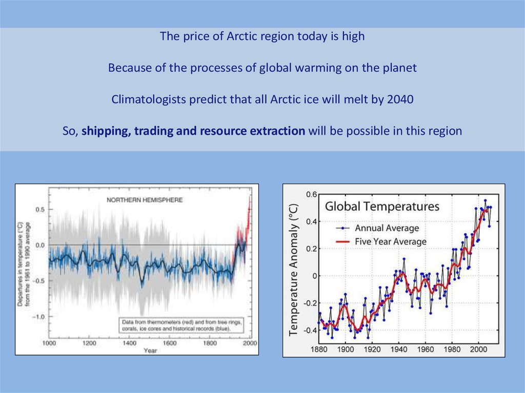
The price of Arctic region today is highBecause of the processes of global warming on the planet
Climatologists predict that all Arctic ice will melt by 2040
So, shipping, trading and resource extraction will be possible in this region
4.
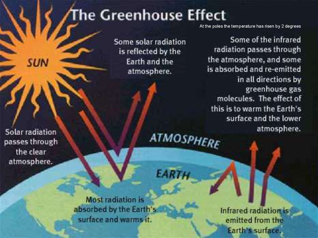
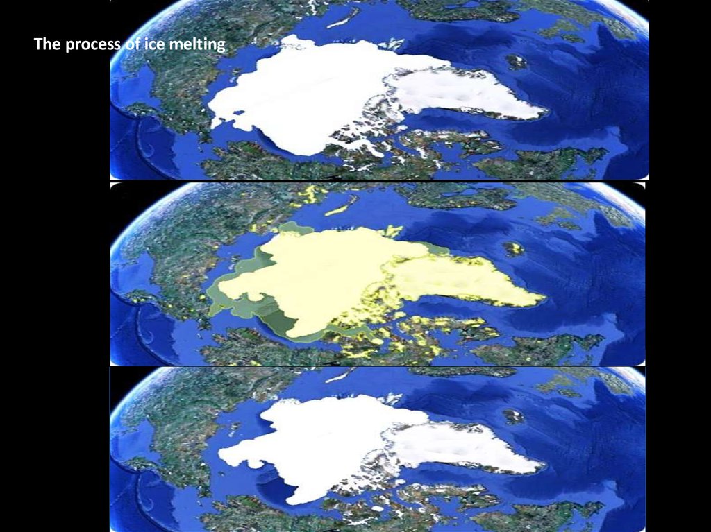
At the poles the temperature has risen by 2 degrees5.
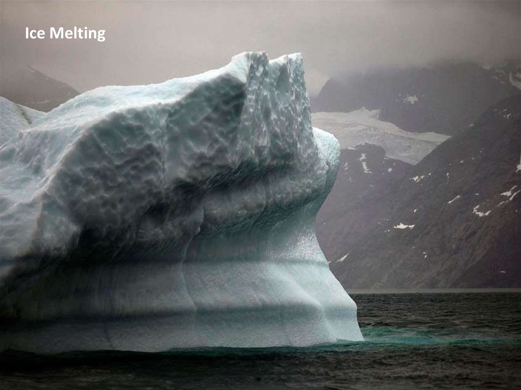
The process of ice melting6.
7.
8.
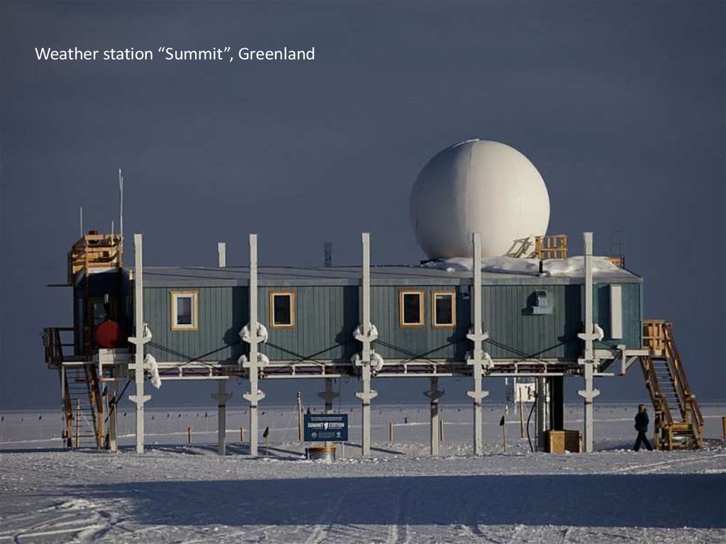
Weather station “Summit”, Greenland9.
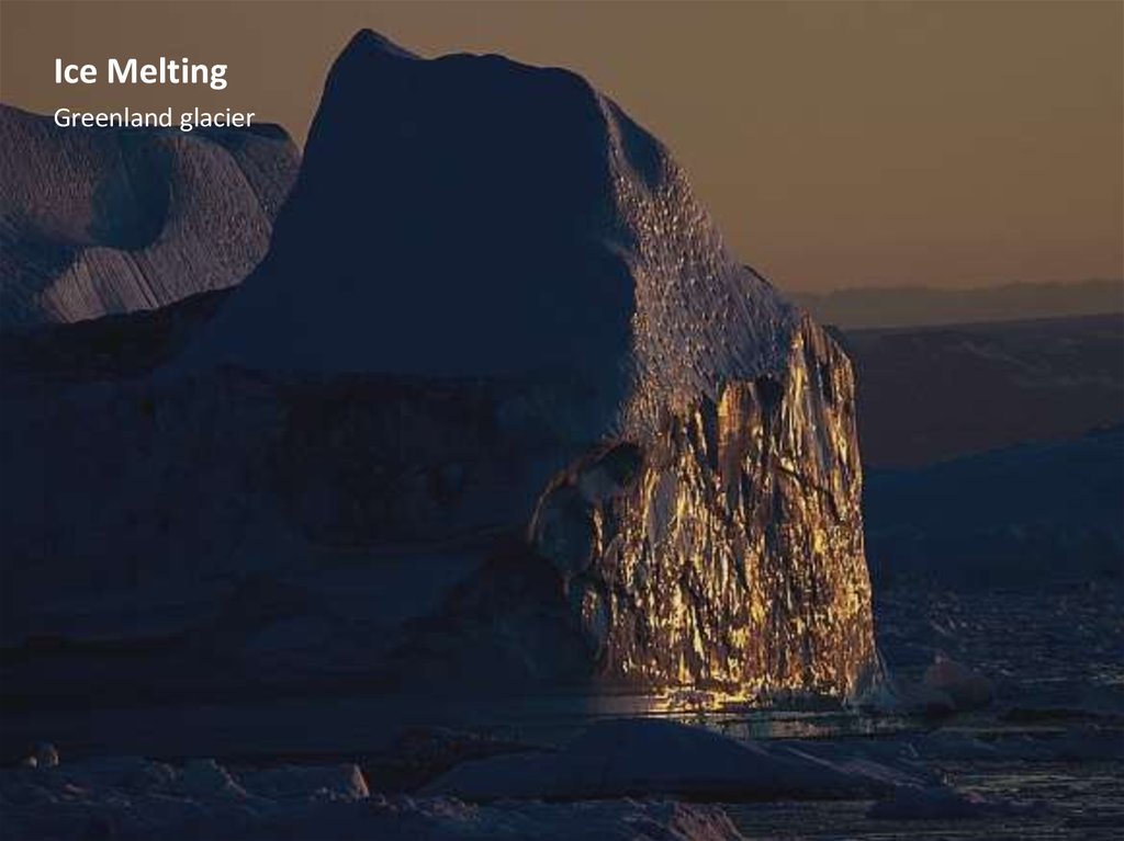
Ice MeltingGreenland glacier, the area of more than 1.5 million square feet. km
The second spaciousness of fresh water ice after Antarctica
Now it appeared the river, the depth of 4 meters and a length of more than 30 meters, the volume of water in the newly
formed river is longer than in the English Thames
10.
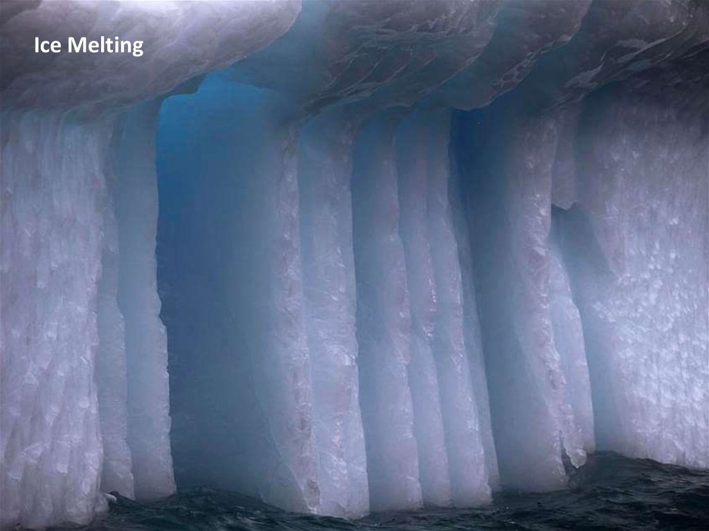
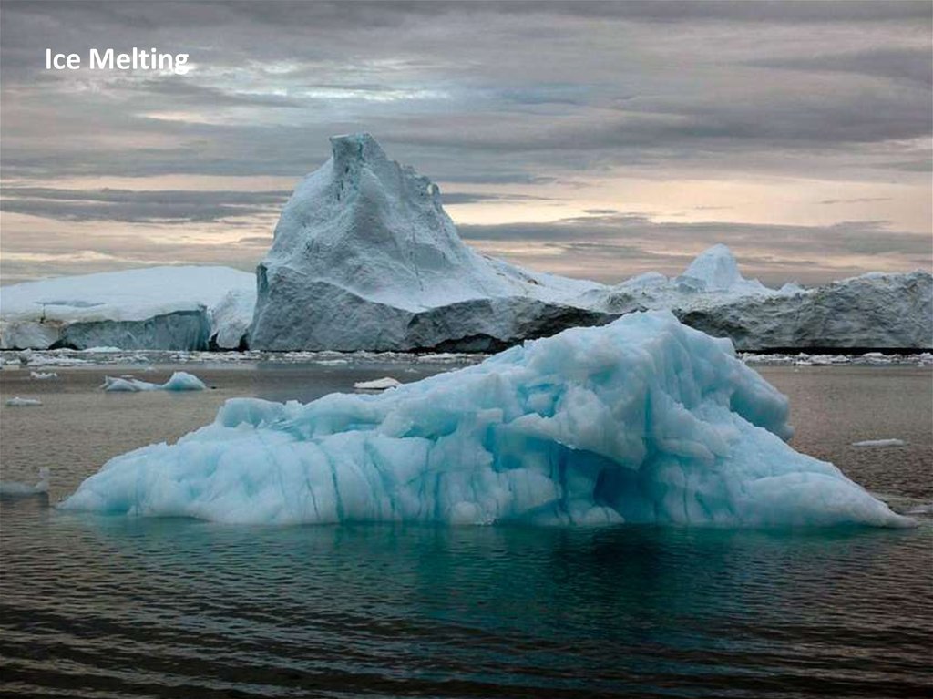
Ice MeltingGreenland glacier
11.
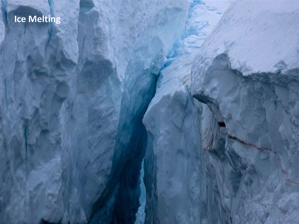
Ice Melting12.
Ice Melting13.
Ice Melting14.
Ice Melting15.
Ice Melting16.
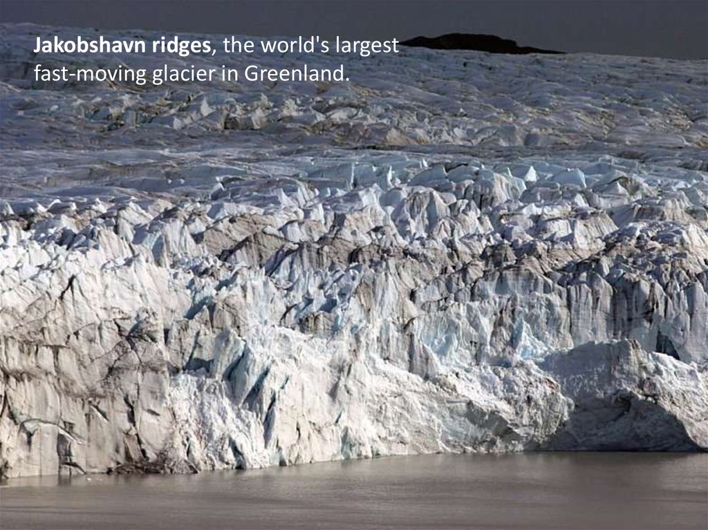
Jakobshavn ridges, the world's largestfast-moving glacier in Greenland
17.
Jakobshavn ridges, the world's largestfast-moving glacier in Greenland.
18.
Jakobshavn ridges, the world's largestfast-moving glacier in Greenland , brooks
19.
Jakobshavn ridges, the world's largestfast-moving glacier melts
20.
The Ice of Ilulissat, Denmark21.
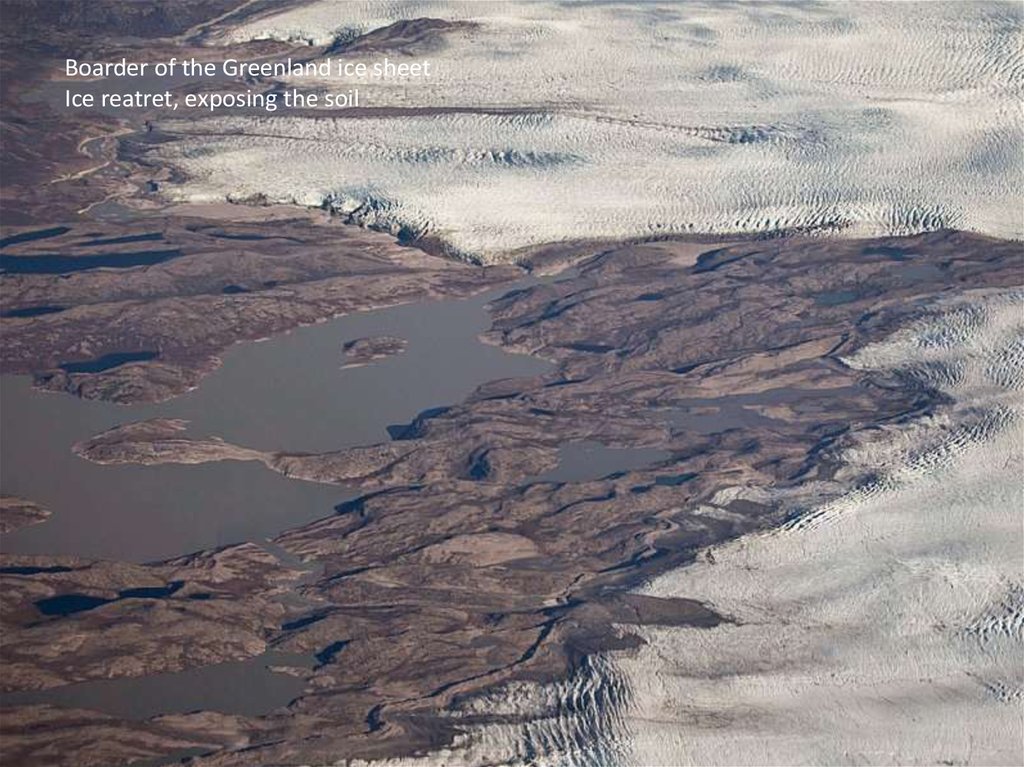
Boarder of the Greenland ice sheetIce reatret, eхposing the soil
22.
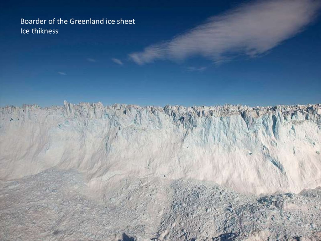
Boarder of the Greenland ice sheetIce thikness
23.
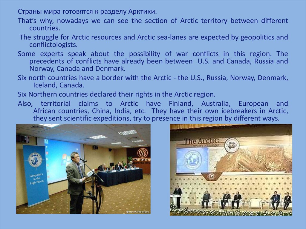
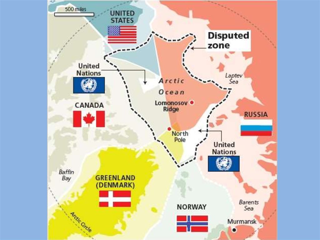
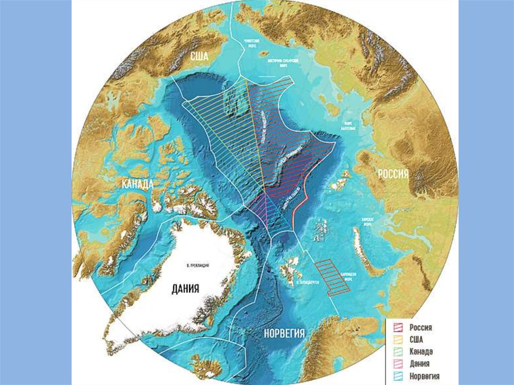
Страны мира готовятся к разделу Арктики.That’s why, nowadays we can see the section of Arctic territory between different
countries.
The struggle for Arctic resources and Arctic sea-lanes are expected by geopolitics and
conflictologists.
Some experts speak about the possibility of war conflicts in this region. The
precedents of conflicts have already been between U.S. and Canada, Russia and
Norway, Canada and Denmark.
Six north countries have a border with the Arctic - the U.S., Russia, Norway, Denmark,
Iceland, Canada.
Six Northern countries declared their rights in the Arctic region.
Also, territorial claims to Arctic have Finland, Australia, European and
African countries, China, India, etc. They have their own icebreakers in Arctic,
they sent scientific expeditions, try to presence in this region by different ways.
24.
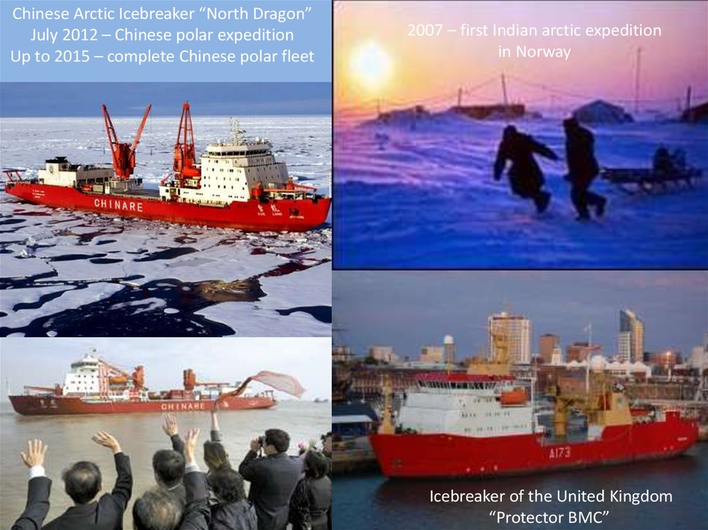
Chinese Arctic Icebreaker “North Dragon”July 2012 – Chinese polar expedition
Up to 2015 – complete Chinese polar fleet
2007 – first Indian arctic expedition
in Norway
Icebreaker of the United Kingdom
“Protector ВМС”
25.
26.
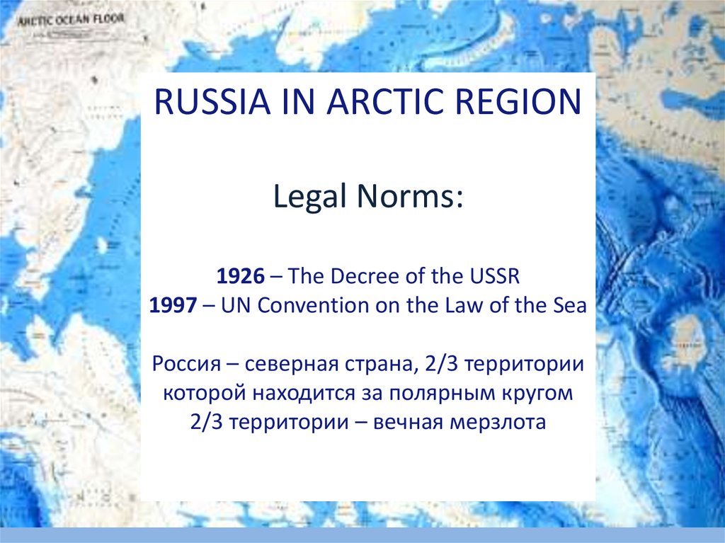
RUSSIA IN ARCTIC REGIONLegal Norms:
1926 – The Decree of the USSR
1997 – UN Convention on the Law of the Sea
Россия – северная страна, 2/3 территории
которой находится за полярным кругом
2/3 территории – вечная мерзлота
27.
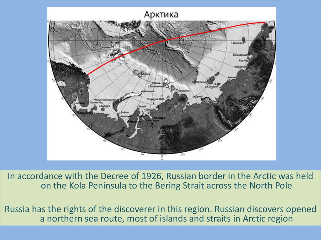
In accordance with the Decree of 1926, Russian border in the Arctic was heldon the Kola Peninsula to the Bering Strait across the North Pole
Russia has the rights of the discoverer in this region. Russian discovers opened
a northern sea route, most of islands and straits in Arctic region
28.
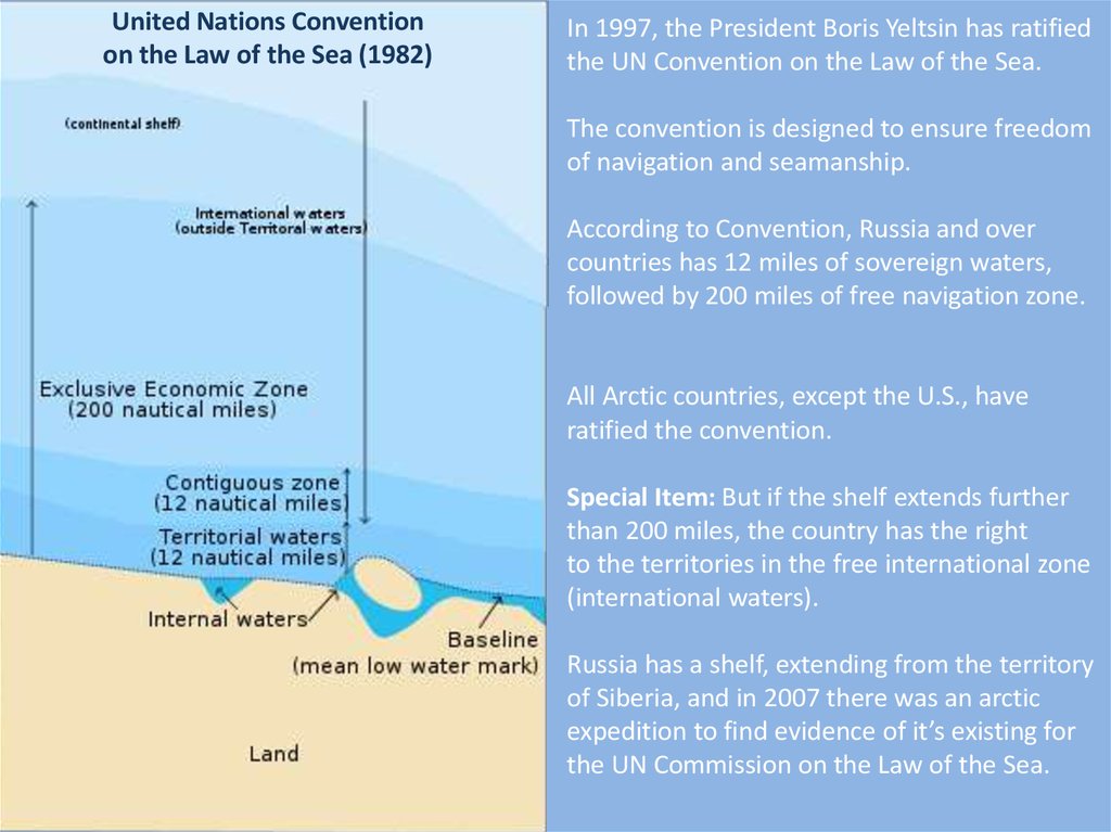
United Nations Conventionon the Law of the Sea (1982)
In 1997, the President Boris Yeltsin has ratified
the UN Convention on the Law of the Sea.
The convention is designed to ensure freedom
of navigation and seamanship.
According to Convention, Russia and over
countries has 12 miles of sovereign waters,
followed by 200 miles of free navigation zone.
All Arctic countries, except the U.S., have
ratified the convention.
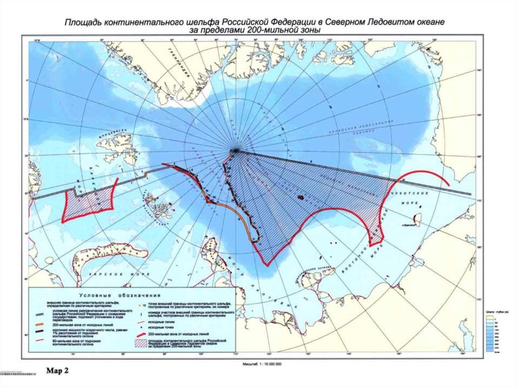
Special Item: But if the shelf extends further
than 200 miles, the country has the right
to the territories in the free international zone
(international waters).
Russia has a shelf, extending from the territory
of Siberia, and in 2007 there was an arctic
expedition to find evidence of it’s existing for
the UN Commission on the Law of the Sea.
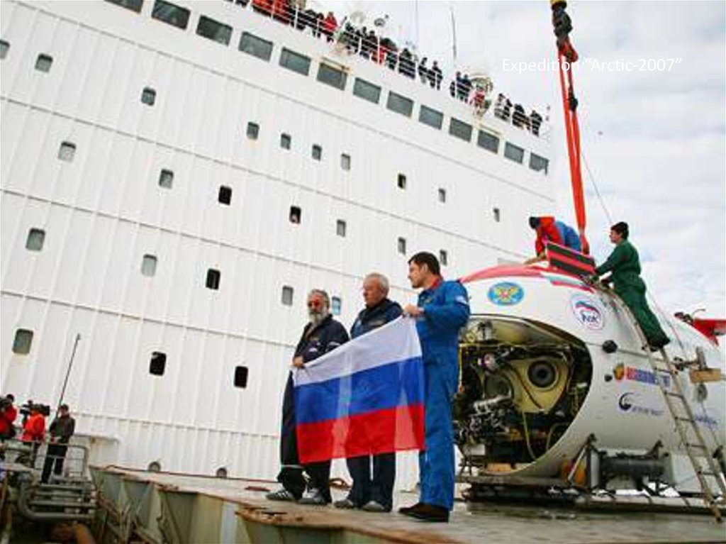
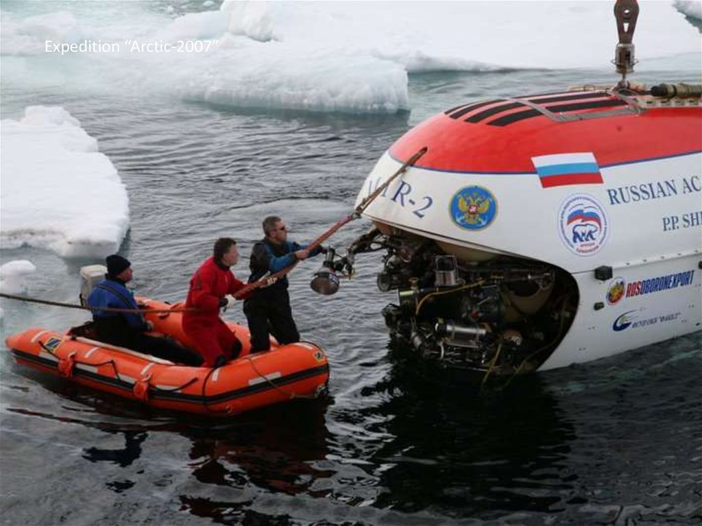
29.
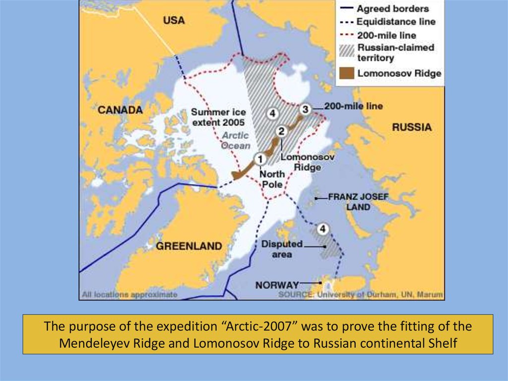
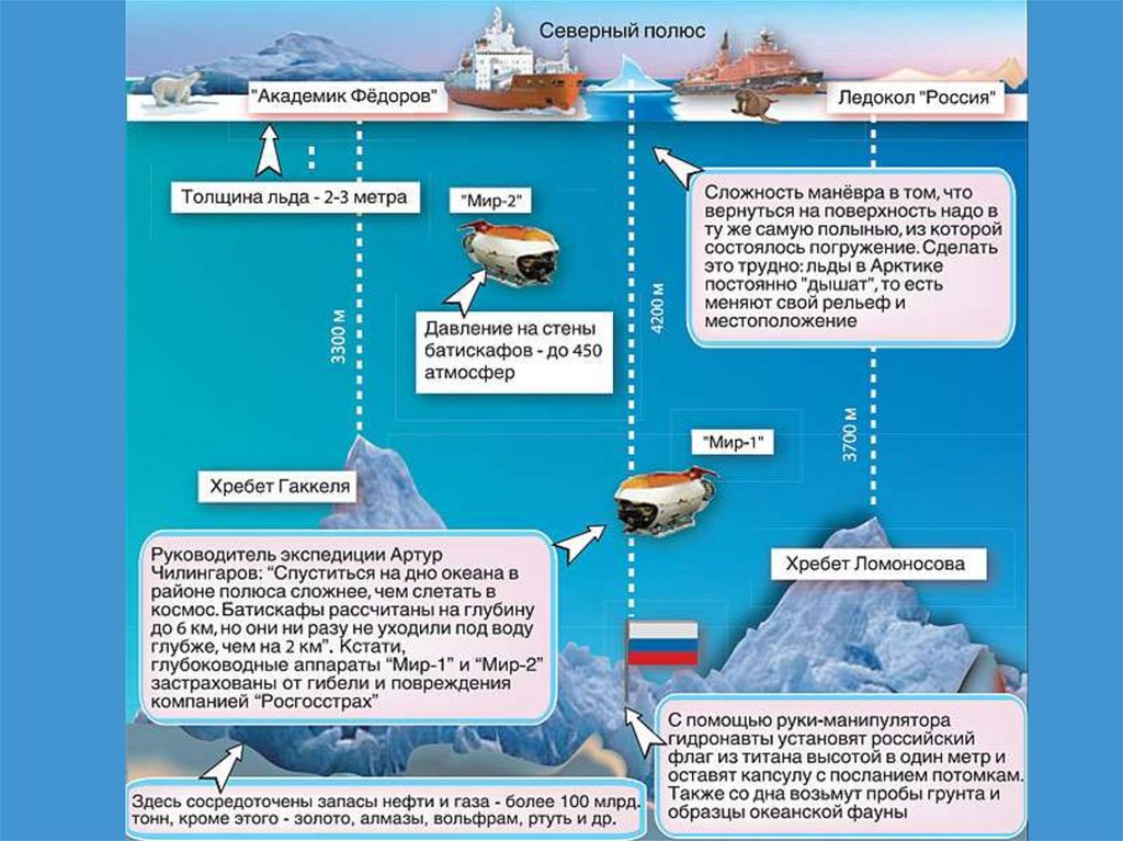
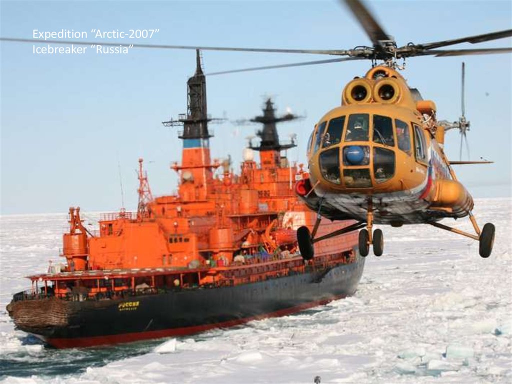
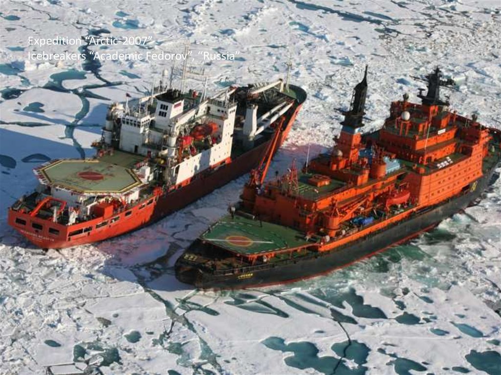
The purpose of the expedition “Arctic-2007” was to prove the fitting of theMendeleyev Ridge and Lomonosov Ridge to Russian continental Shelf
30.
31.
Expedition “Arctic-2007”Icebreaker “Russia”
32.
Expedition “Arctic-2007”Icebreakers “Academic Fedorov”, “Russia”
33.
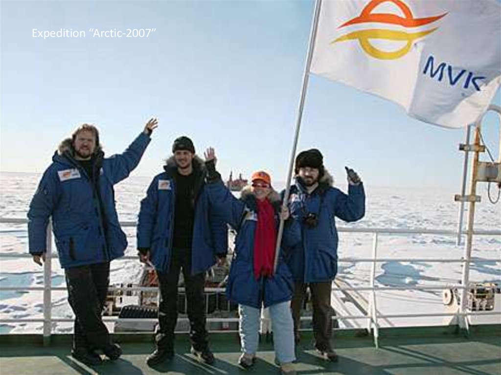
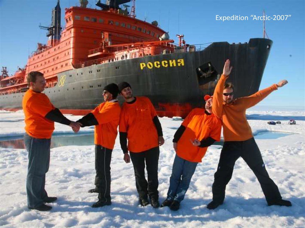
Expedition “Arctic-2007”34.
Expedition “Arctic-2007”35.
Expedition “Arctic-2007”36.
xpedition “Arctic-2007”37.
Expedition “Arctic-2007”38.
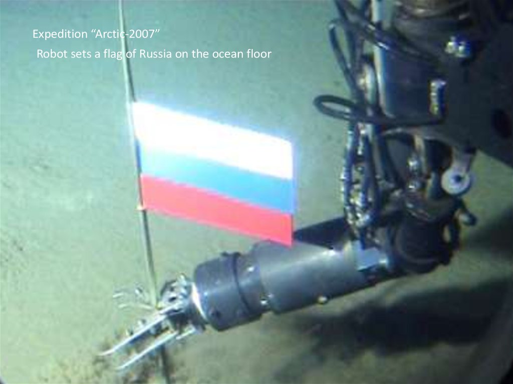
Expedition “Arctic-2007”Robot sets a flag of Russia on the ocean floor
39.
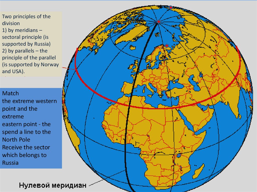
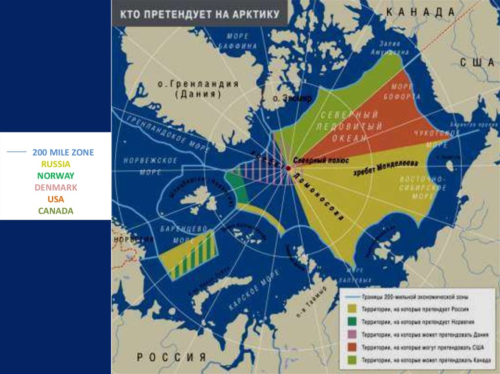
Two principles of thedivision
1) by meridians –
sectoral principle (is
supported by Russia)
2) by parallels – the
principle of the parallel
(is supported by Norway
and USA).
Match
the extreme western
point and the
extreme
eastern point - the
spend a line to the
North Pole
Receive the sector
which belongs to
Russia
40.
41.
200 MILE ZONERUSSIA
NORWAY
DENMARK
USA
CANADA
42.
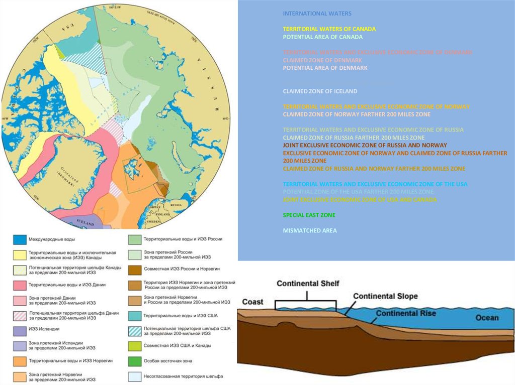
INTERNATIONAL WATERSTERRITORIAL WATERS OF CANADA
POTENTIAL AREA OF CANADA
TERRITORIAL WATERS AND EXCLUSIVE ECONOMIC ZONE OF DENMARK
CLAIMED ZONE OF DENMARK
POTENTIAL AREA OF DENMARK
EXCLUSIVE ECONOMIC ZONE OF ICELAND
CLAIMED ZONE OF ICELAND
TERRITORIAL WATERS AND EXCLUSIVE ECONOMIC ZONE OF NORWAY
CLAIMED ZONE OF NORWAY FARTHER 200 MILES ZONE
TERRITORIAL WATERS AND EXCLUSIVE ECONOMIC ZONE OF RUSSIA
CLAIMED ZONE OF RUSSIA FARTHER 200 MILES ZONE
JOINT EXCLUSIVE ECONOMIC ZONE OF RUSSIA AND NORWAY
EXCLUSIVE ECONOMIC ZONE OF NORWAY AND CLAIMED ZONE OF RUSSIA FARTHER
200 MILES ZONE
CLAIMED ZONE OF RUSSIA AND NORWAY FARTHER 200 MILES ZONE
TERRITORIAL WATERS AND EXCLUSIVE ECONOMIC ZONE OF THE USA
POTENTIAL ZONE OF THE USA FARTHER 200 MILES ZONE
JOINT EXCLUSIVE ECONOMIC ZONE OF USA AND CANADA
SPECIAL EAST ZONE
MISMATCHED AREA
43.
44.
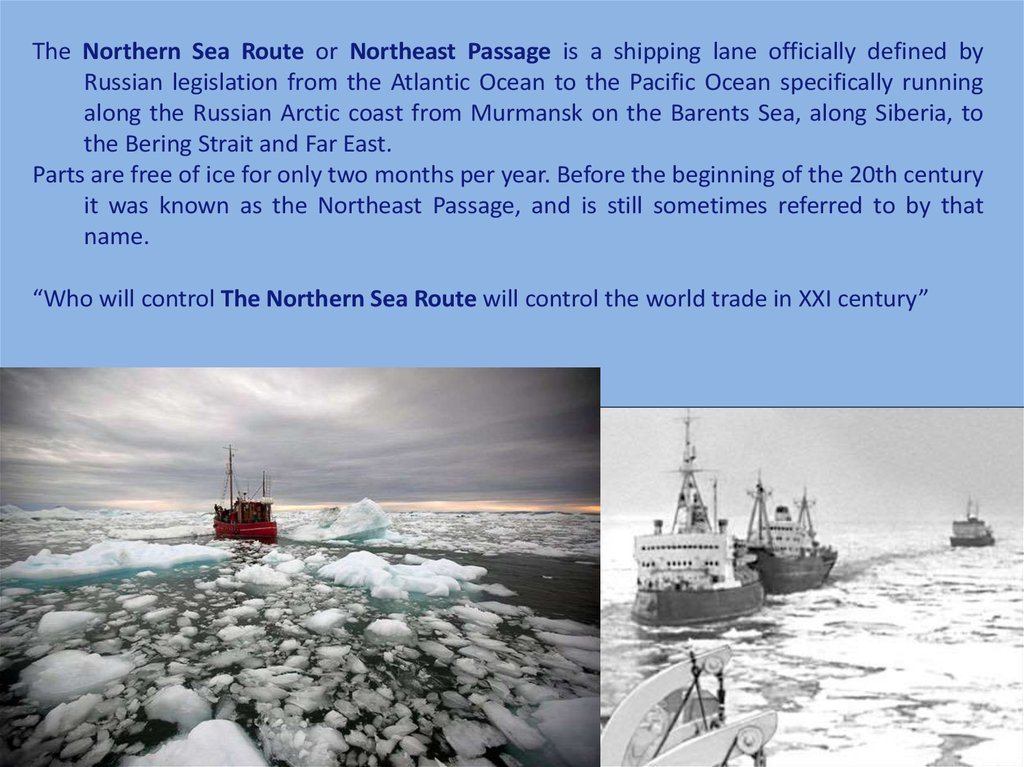
The Northern Sea Route or Northeast Passage is a shipping lane officially defined byRussian legislation from the Atlantic Ocean to the Pacific Ocean specifically running
along the Russian Arctic coast from Murmansk on the Barents Sea, along Siberia, to
the Bering Strait and Far East.
Parts are free of ice for only two months per year. Before the beginning of the 20th century
it was known as the Northeast Passage, and is still sometimes referred to by that
name.
“Who will control The Northern Sea Route will control the world trade in XXI century”
45.
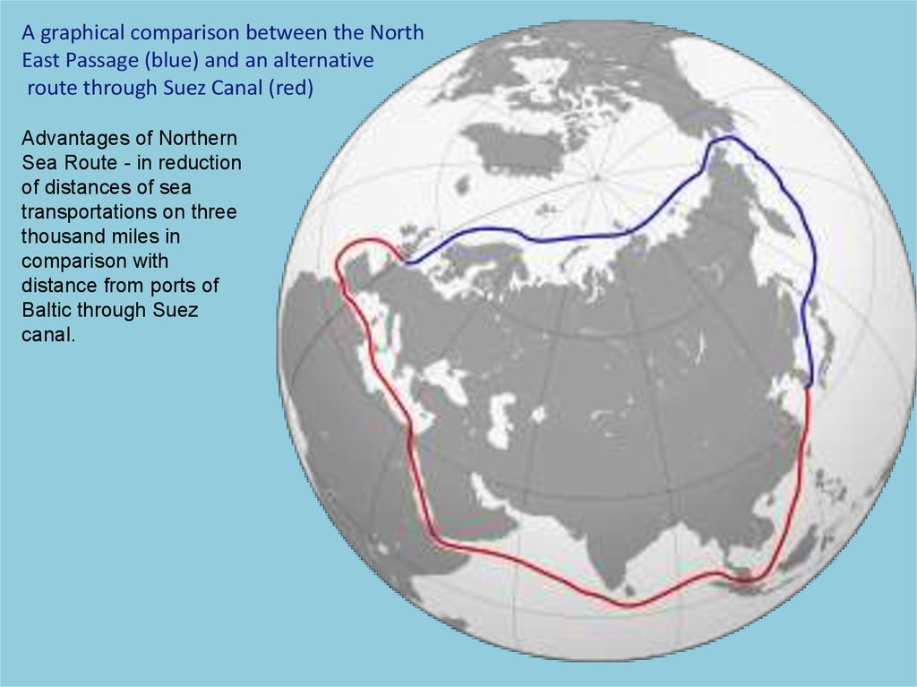
A graphical comparison between the NorthEast Passage (blue) and an alternative
route through Suez Canal (red)
Advantages of Northern
Sea Route - in reduction
of distances of sea
transportations on three
thousand miles in
comparison with
distance from ports of
Baltic through Suez
canal.
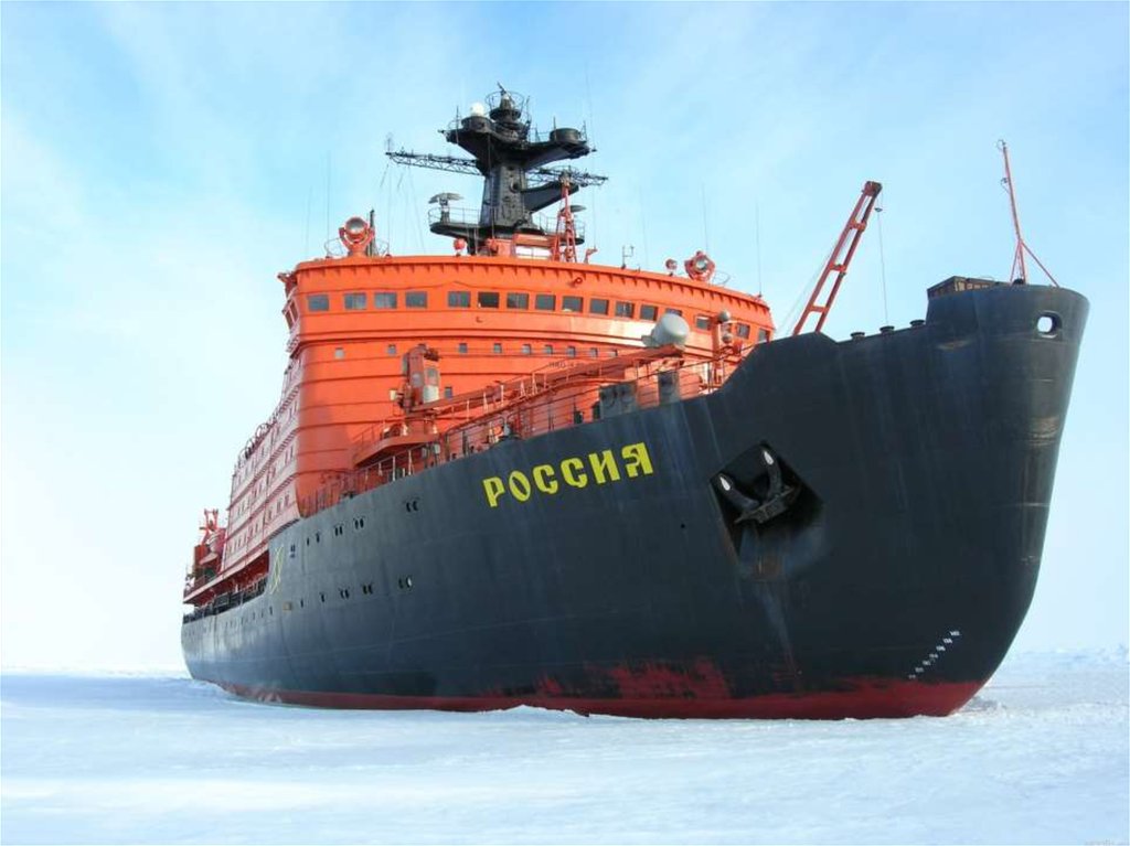
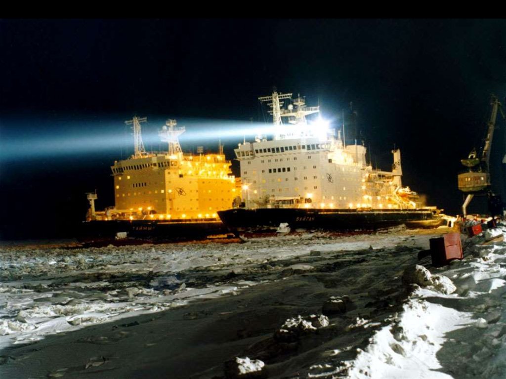
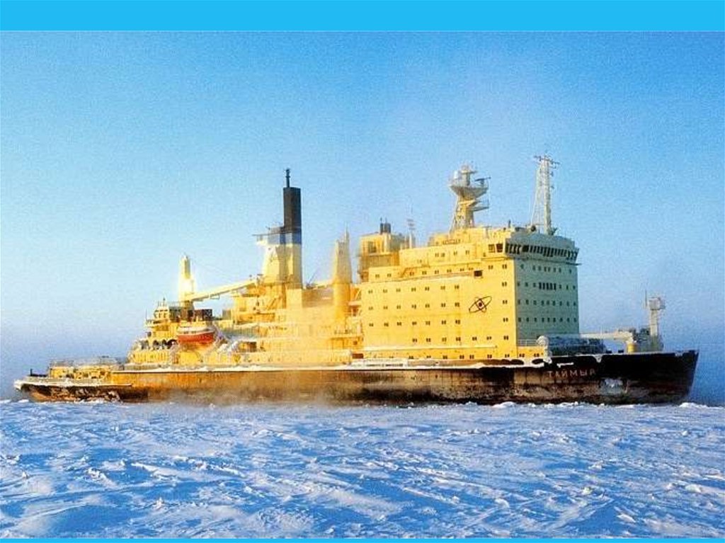
46.
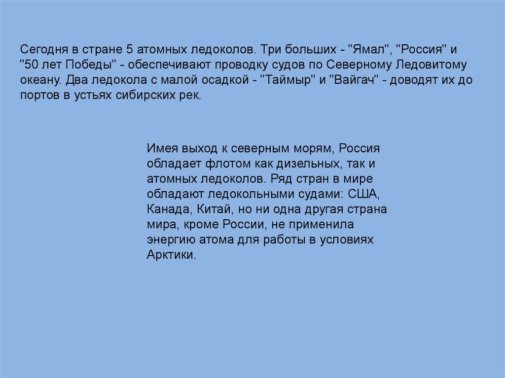
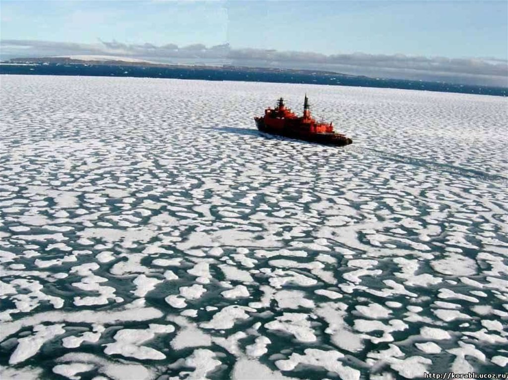
Сегодня в стране 5 атомных ледоколов. Три больших - "Ямал", "Россия" и"50 лет Победы" - обеспечивают проводку судов по Северному Ледовитому
океану. Два ледокола с малой осадкой - "Таймыр" и "Вайгач" - доводят их до
портов в устьях сибирских рек.
Имея выход к северным морям, Россия
обладает флотом как дизельных, так и
атомных ледоколов. Ряд стран в мире
обладают ледокольными судами: США,
Канада, Китай, но ни одна другая страна
мира, кроме России, не применила
энергию атома для работы в условиях
Арктики.
47.
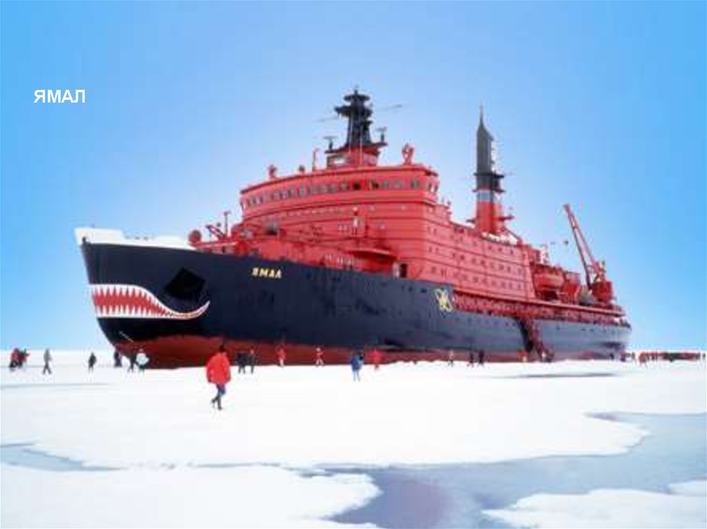
ЯМАЛ48.
49.
50.
51.
52.
53.
54.
55.
56.
57.
58.
59.
60.
61.
62.
63.
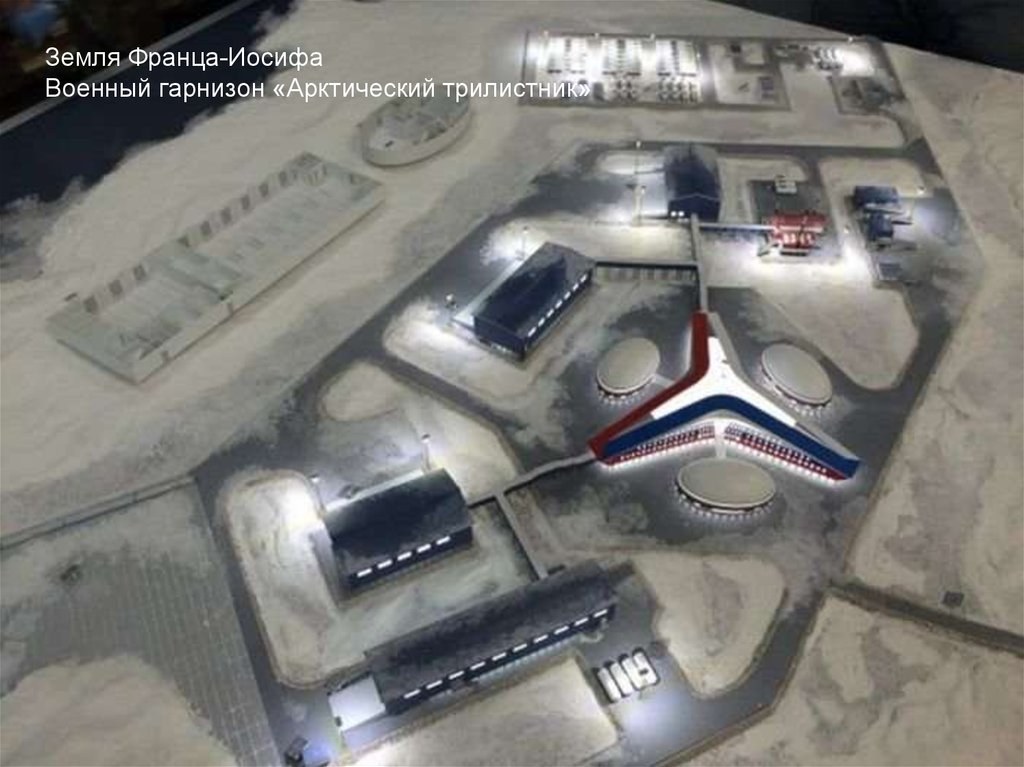
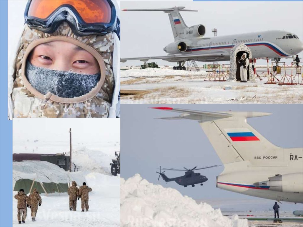
Земля Франца-ИосифаВоенный гарнизон «Арктический трилистник»
64.
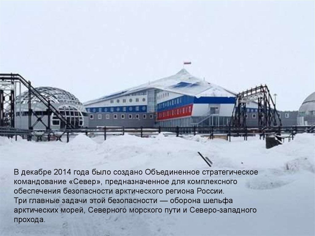
В декабре 2014 года было создано Объединенное стратегическоекомандование «Север», предназначенное для комплексного
обеспечения безопасности арктического региона России.
Три главные задачи этой безопасности — оборона шельфа
арктических морей, Северного морского пути и Северо-западного
прохода.
65.
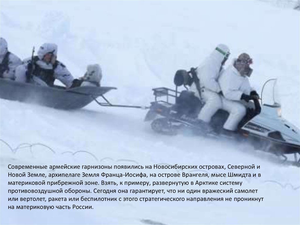
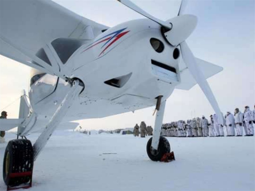
Современные армейские гарнизоны появились на Новосибирских островах, Северной иНовой Земле, архипелаге Земля Франца-Иосифа, на острове Врангеля, мысе Шмидта и в
материковой прибрежной зоне. Взять, к примеру, развернутую в Арктике систему
противовоздушной обороны. Сегодня она гарантирует, что ни один вражеский самолет
или вертолет, ракета или беспилотник с этого стратегического направления не проникнут
на материковую часть России.
66.
• Напомним, что сейчас арктическую зону России прикрываютнесколько полков зенитных ракетных систем С-400 «Триумф». В этом
году их поставили на боевое дежурство на Новой Земле
и в Тикси. А ранее развернули на Кольском полуострове.
• Почему свой выбор генералы остановили именно на С-400,
становится понятным, если знать: серийные «Триумфы» могут
на расстоянии до 400 км вести одновременный обстрел до 36 целей
и наводить на них до 72 ракет.
• «Четырехсотка» способна решать задачи как противовоздушной, так
и нестратегической противоракетной обороны. А используемые в этой
зенитной ракетной системе средства автоматизации практически
исключают ошибки, вызванные человеческим фактором.
67.
68.
69.
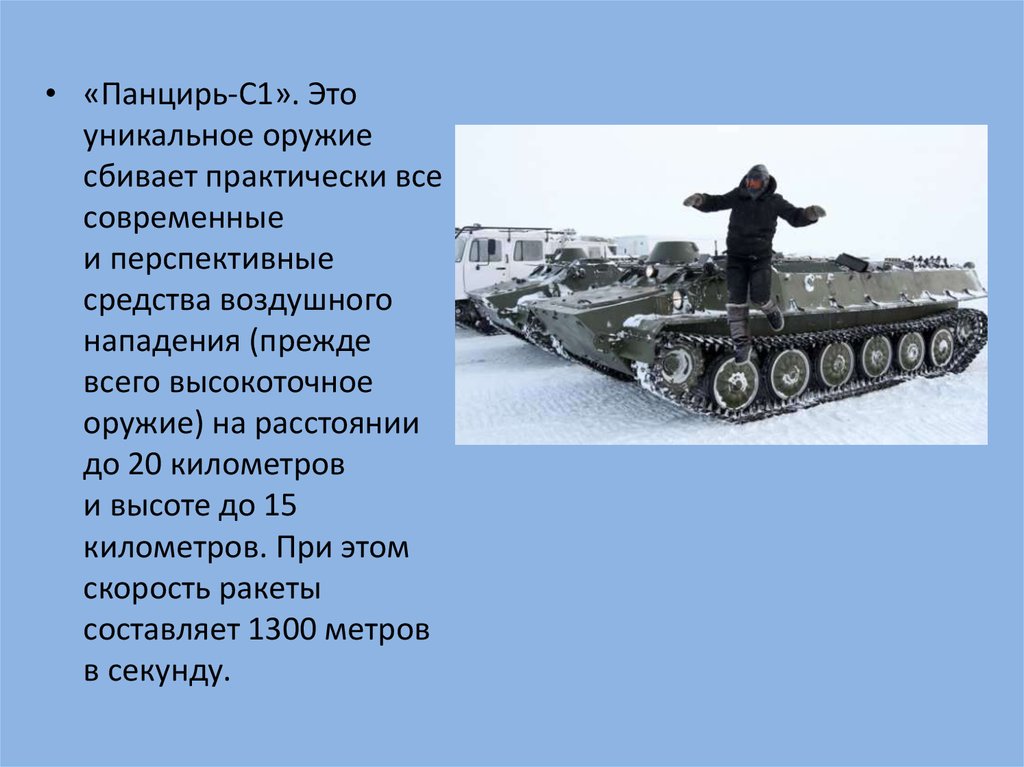
• «Панцирь-С1». Этоуникальное оружие
сбивает практически все
современные
и перспективные
средства воздушного
нападения (прежде
всего высокоточное
оружие) на расстоянии
до 20 километров
и высоте до 15
километров. При этом
скорость ракеты
составляет 1300 метров
в секунду.
70.
71.
• Развитие военной инфраструктуры наСахалине, островах Курильской гряды и в
Арктической зоне до 2020 года является
приоритетной государственной задачей в
сфере обороны.