


 ecology
 geography
Similar presentations:


Extreme ice-jam flood at the junction of the Sukhona – Yug – Malaya Northern Dvina
1.
Extreme ice-jam flood at the junction of theSukhona – Yug – Malaya Northern Dvina
Rivers near the town of Velikiy Ustyug in
spring 2016
Mikhail Georgievsky
(State Hydrological Institute, St. Petersburg, Russia)
(mgeorgievsky@hotmail.com)
Based on materials :
State Hydrological Institute, Saint Petersburg
Vologda Centre for Hydrometeorology and Environmental
Monitoring, Vologda
Northern Territorial Administration for Hydrometeorological
and Environmental Monitoring, Arkhangelsk
2.
Presentation Outline1. Features of formation of ice jams and ice-jam
floods at the junction of Sukhona – Yug – Malaya
Northern Dvina Rivers near Velikiy Ustyug
2. Formation of a giant ice jam on the Sukhona river
near Velikiy Ustyug in winter 2015-2016
3. Field research of the giant ice jam in spring 2016
4. A catastrophic ice-jam flood in Velikiy Ustyug and
its environs during the spring of 2016 and its
consequences
3.
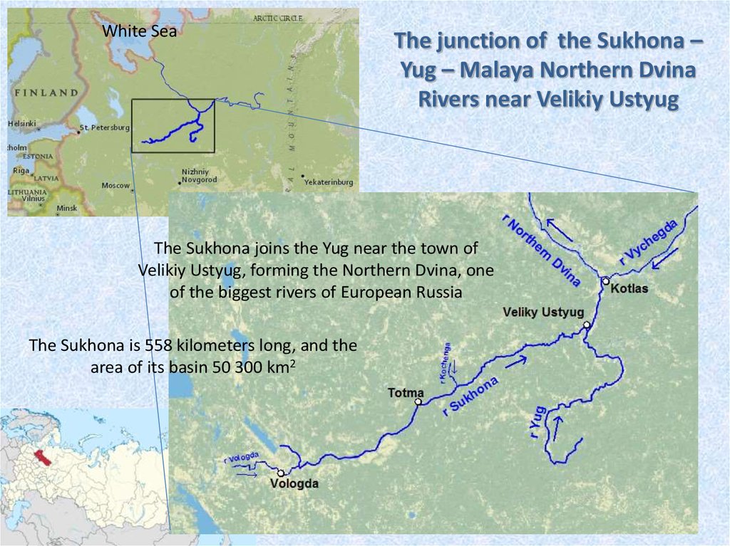
White SeaThe junction of the Sukhona –
Yug – Malaya Northern Dvina
Rivers near Velikiy Ustyug
The Sukhona joins the Yug near the town of
Velikiy Ustyug, forming the Northern Dvina, one
of the biggest rivers of European Russia
The Sukhona is 558 kilometers long, and the
area of its basin 50 300 km2
4.
Velikiy UstyugVelikiy Ustyug is a town in Vologda region,
Russia, located in the northeast of the region at
the confluence of the Sukhona and Yug Rivers.
Velikiy Ustyug was first mentioned in a chronicle
in 1207.
Velikiy Ustyug has a great historical significance
and was one of the major cities of the Russian
North.
As of the 2010 Census, its population was 31,665.
There are timber industry enterprises in Velikiy
Ustyug, as well as a shipyard, food industry, and
enterprises serving the tourist industry — in
particular, the jewelry production plant.
Tourism is an important branch
of economy in Velikiy Ustyug.
It started in the 1960s and got a
further boost in 1990s when
Velikiy Ustyug started to be
marketed as the residence of
Ded Moroz, also known as
"Grandfather Frost“.
5.
Features of formation of ice jams and ice-jam floods at thejunction of the Sukhona – Yug – Malaya Northern Dvina Rivers
near Velikiy Ustyug
Ice jam events very often occur on the Sukhona, the Yug and the Northern Dvina
WHY?
- Large volume of ice in river channels
- High flow velocity
- A lot of channel obstructions for the movement of ice floes in the form of bends,
rifts, islands and so on.
The most frequently flooded area due to ice jams on the Severnaya Dvina is the
territory of Velikiy Ustyug and its surroundings located near the confluence of the
Sukhona and the Yug Rivers.
Particular danger for this area is a situation when the steady ice cover at the
beginning of winter is destroyed due to a long thaw as a result ice jams are formed
which remain until the beginning of a spring flood.
6.
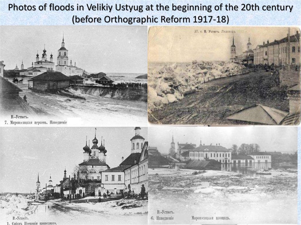
Photos of floods in Velikiy Ustyug at the beginning of the 20th century(before Orthographic Reform 1917-18)
7.
Имеющиеся в Летописной книгесведения о наводнениях в районе
г. Великий Устюг свидетельствует о
взаимосвязи зимних паводков и
масштабных наводнениях весной
следующего года.
Все зимние паводки в районе
Великого Устюга в 1515, 1741, 1898
и
1969
г.г.
способствовали
небывалым
по
масштабам
разрушений половодьям весной
следующего года.
«24 ноября 1515 г. вода в реке
Сухоне была великая, подобная
весенней, и стояла в одной мере
две недели…
В апреле 1516 г. шла Сухона
весьма грозно. Вода была велика,
такова и не бывала. Льдом город
стерло и посад по всему берегу
обрыло. Много дворов снесло,
много людям беды учинило…».
8.
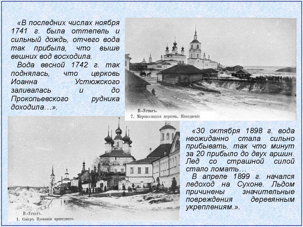
«В последних числах ноября1741 г. была оттепель и
сильный дождь, отчего вода
так прибыла, что выше
вешних вод восходила.
Вода весной 1742 г. так
поднялась,
что
церковь
Иоанна
Устюжского
заливалась
и
до
Прокопьевского
рудника
доходила…».
«30 октября 1898 г. вода
неожиданно стала сильно
прибывать, так что минут
за 20 прибыло до двух аршин.
Лед со страшной силой
стало ломать…
В апреле 1899 г. начался
ледоход на Сухоне. Льдом
причинены
значительные
повреждения
деревянным
укреплениям.».
9.
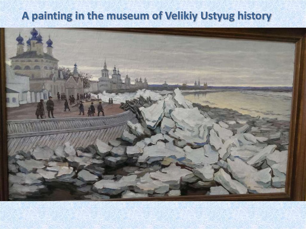
A painting in the museum of Velikiy Ustyug history10.
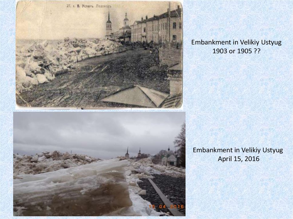
Embankment in Velikiy Ustyug1903 or 1905 ??
Embankment in Velikiy Ustyug
April 15, 2016
11.
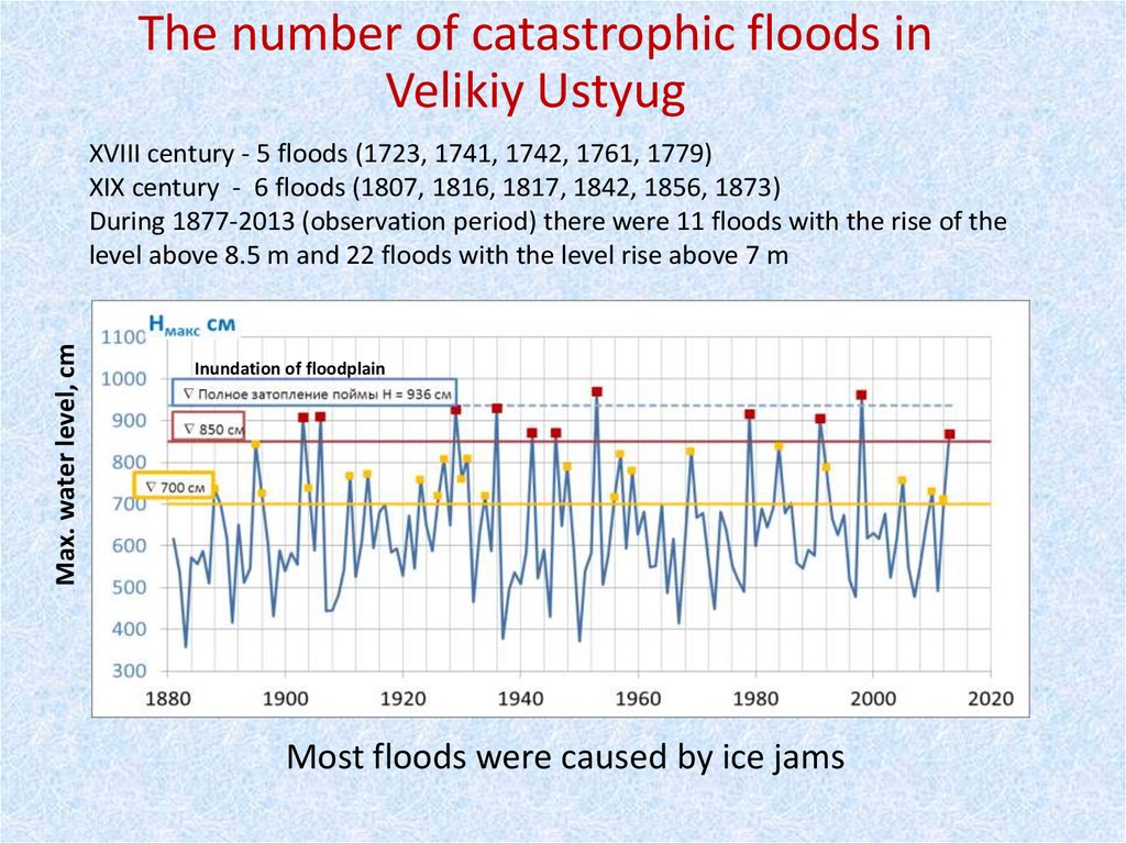
The number of catastrophic floods inVelikiy Ustyug
Max. water level, cm
XVIII century - 5 floods (1723, 1741, 1742, 1761, 1779)
XIX century - 6 floods (1807, 1816, 1817, 1842, 1856, 1873)
During 1877-2013 (observation period) there were 11 floods with the rise of the
level above 8.5 m and 22 floods with the level rise above 7 m
Inundation of floodplain
Most floods were caused by ice jams
12.
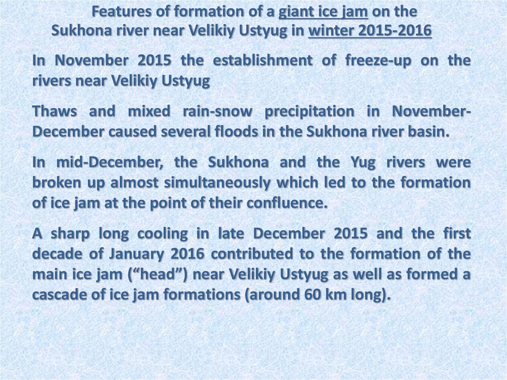
Features of formation of a giant ice jam on theSukhona river near Velikiy Ustyug in winter 2015-2016
In November 2015 the establishment of freeze-up on the
rivers near Velikiy Ustyug
Thaws and mixed rain-snow precipitation in NovemberDecember caused several floods in the Sukhona river basin.
In mid-December, the Sukhona and the Yug rivers were
broken up almost simultaneously which led to the formation
of ice jam at the point of their confluence.
А sharp long cooling in late December 2015 and the first
decade of January 2016 contributed to the formation of the
main ice jam (“head”) near Velikiy Ustyug as well as formed a
cascade of ice jam formations (around 60 km long).
13.
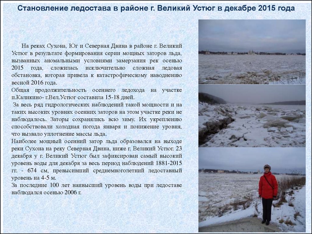
Становление ледостава в районе г. Великий Устюг в декабре 2015 годаНа реках Сухона, Юг и Северная Двина в районе г. Великий
Устюг в результате формирования серии мощных заторов льда,
вызванных аномальными условиями замерзания рек осенью
2015 года, сложилась исключительно сложная ледовая
обстановка, которая привела к катастрофическому наводнению
весной 2016 года.
Общая продолжительность осеннего ледохода на участке
п.Каликино- г.Вел.Устюг составила 15-18 дней.
За весь ряд гидрологических наблюдений такой мощности и на
таких высоких уровнях осенних заторов на этом участке реки не
наблюдалось. Заторы сохранялись всю зиму. Их укреплению
способствовали холодная погода января и понижение уровня,
что вызвало уплотнение массы льда.
Наиболее мощный осенний затор льда образовался на выходе
реки Сухона на реку Северная Двина, ниже г. Великий Устюг. 23
декабря у г. Великий Устюг был зафиксирован самый высокий
уровень воды для декабря за весь период наблюдений 1881-2015
гг. - 674 см, превысивший среднемноголетний ледоставный
уровень на 4-5 м.
За последние 100 лет наивысший уровень воды при ледоставе
наблюдался осенью 2006 г.
14.
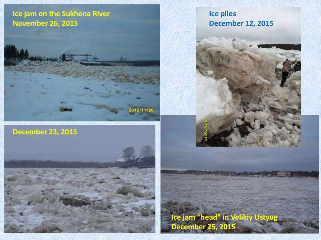
Ice jam on the Sukhona RiverNovember 26, 2015
Ice piles
December 12, 2015
December 23, 2015
Ice jam “head” in Velikiy Ustyug
December 25, 2015
15.
Field research of the ice jam in spring 2016An extremely dangerous hydrological situation, leading to the high probability
of the formation of a disastrous flood in the spring of 2016, formed at the
junction of the Sukhona – Yug – Malaya Northern Dvina Rivers near the town of
Velikiy Ustyug during the 2015-16 winter.
The situation caused a serious public outcry and concern among local residents
and the executive authorities of the Vologda region and Velikiy Ustyug.
At the beginning of 2016 the head of Vologda Centre for Hydrometeorology
and Environmental Monitoring (Vologda Centre) applied to State Hydrological
Institute (SHI) a request for joint field research in order to:
- estimate the main characteristics of the formed giant ice jam;
- specify a forecast of maximum ice-jam water level at Velikiy Ustyug water
gauge station (forecast method was developed in SHI and used now in the
Vologda Centre);
- develop recommendations on carrying out of ice-jam flood control activities.
16.
Why the Vologda Centre addressed to SHI?Method of short-term forecasting of ice jams and ice jam
floods at the junction of the Sukhona-Yug-Malaya Severnaya
Dvina rivers. – Report of State Hydrological Institute (SHI), S.
Petersburg, 2011 [in Russian].
Integrated research of river-bed processes and formation of
ice jams at the junction of the Sukhona-Yug-Malaya Severnaya
Dvina rivers in order to regulate the processes of ice jam
formation and develop ice-jam flood control activities near
Velikiy Ustyug. – Report of State Hydrological Institute (SHI), S.
Petersburg, 2014 [in Russian].
17.
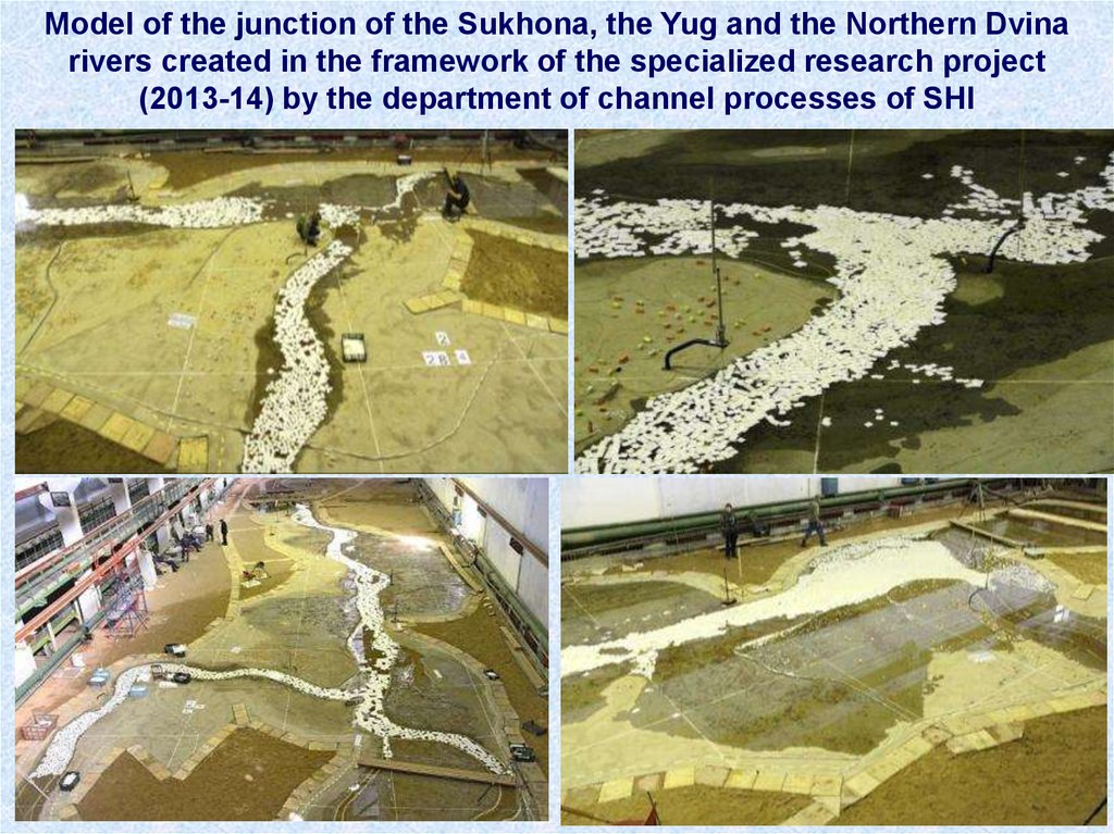
Model of the junction of the Sukhona, the Yug and the Northern Dvinarivers created in the framework of the specialized research project
(2013-14) by the department of channel processes of SHI
18.
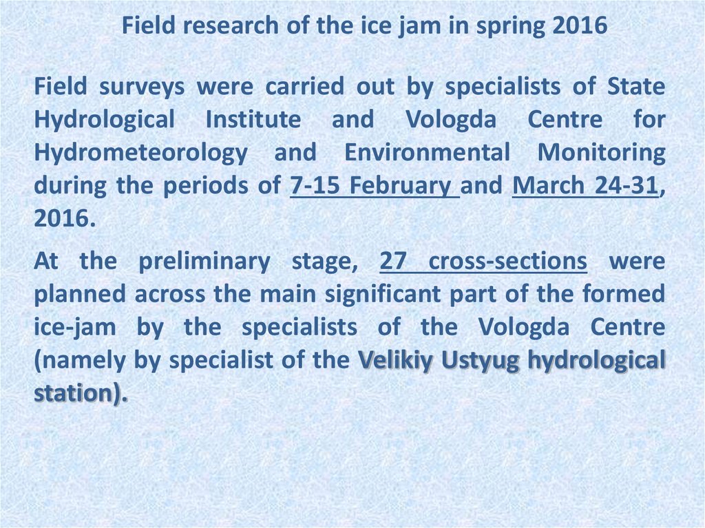
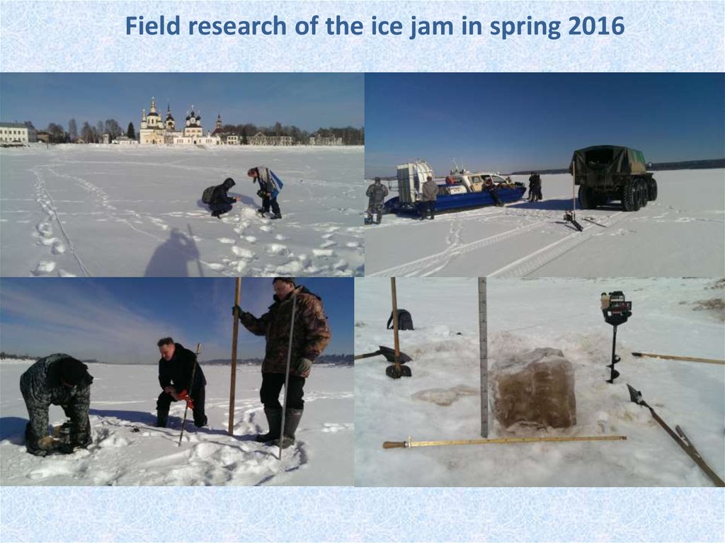
Field research of the ice jam in spring 2016Field surveys were carried out by specialists of State
Hydrological Institute and Vologda Centre for
Hydrometeorology and Environmental Monitoring
during the periods of 7-15 February and March 24-31,
2016.
At the preliminary stage, 27 cross-sections were
planned across the main significant part of the formed
ice-jam by the specialists of the Vologda Centre
(namely by specialist of the Velikiy Ustyug hydrological
station).
19.
27 cross-sections and ice jam structure(dark red – ice jam “heads”)
20.
Field research of the ice jam in spring 2016In February 2016 a complex of specialized hydrological
measurements was made at each of the planned crosssections.
Ice cover was drilled along a cross-section line usually in 30-50
meters (depending on the width of the river and the state of
the ice cover). Then at each point the following characteristics
were measured:
- depth of the river (direction and velocity of flow in same
cases);
- thickness and structure of ice cover layer;
- thickness of the slush layer (brash ice layer);
- height of snow cover (SWE);
- height of nearby hummocks (torosses);
- photo and GPS fixations.
21.
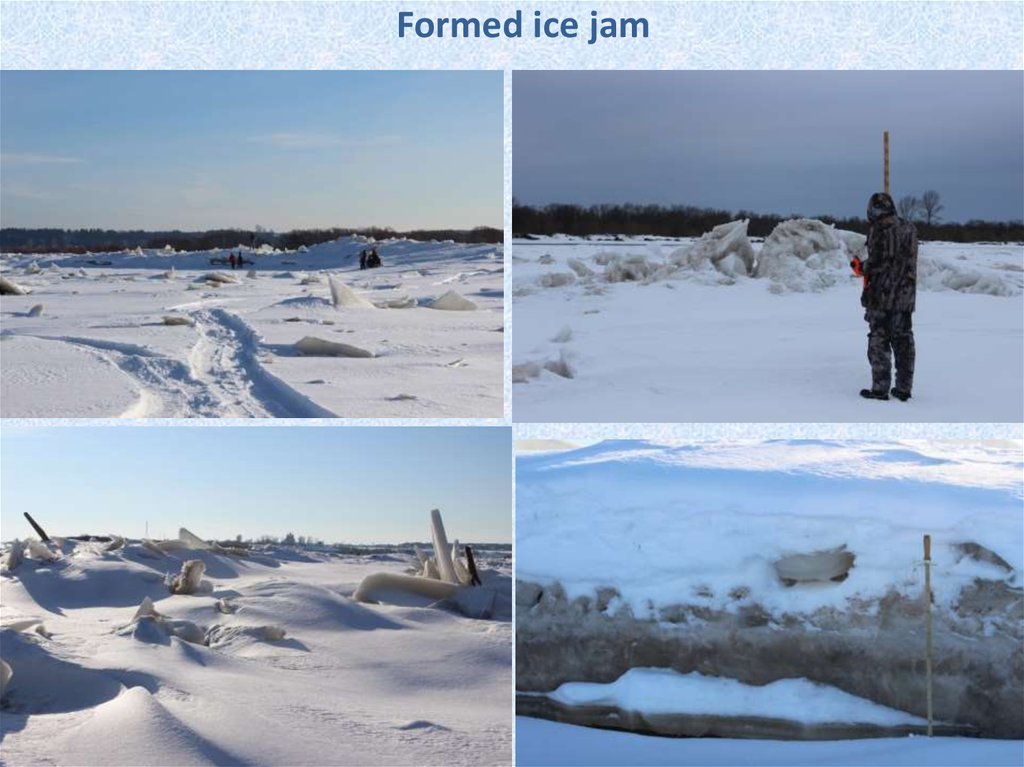
Formed ice jam22.
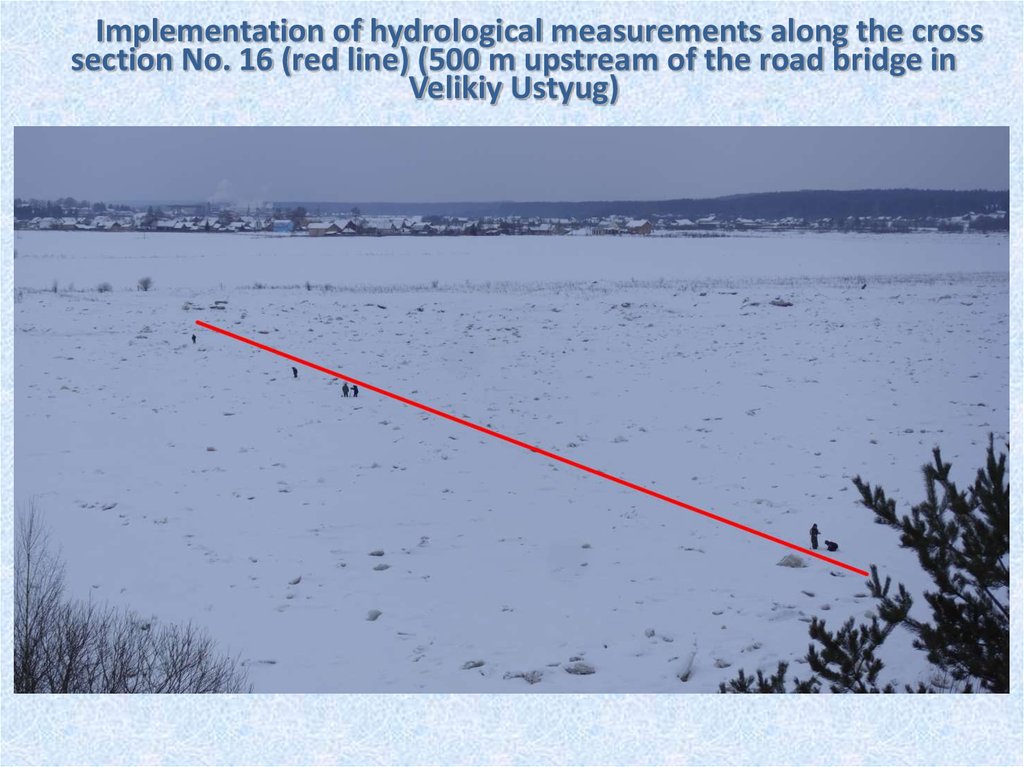
Implementation of hydrological measurements along the crosssection No. 16 (red line) (500 m upstream of the road bridge in
Velikiy Ustyug)
23.
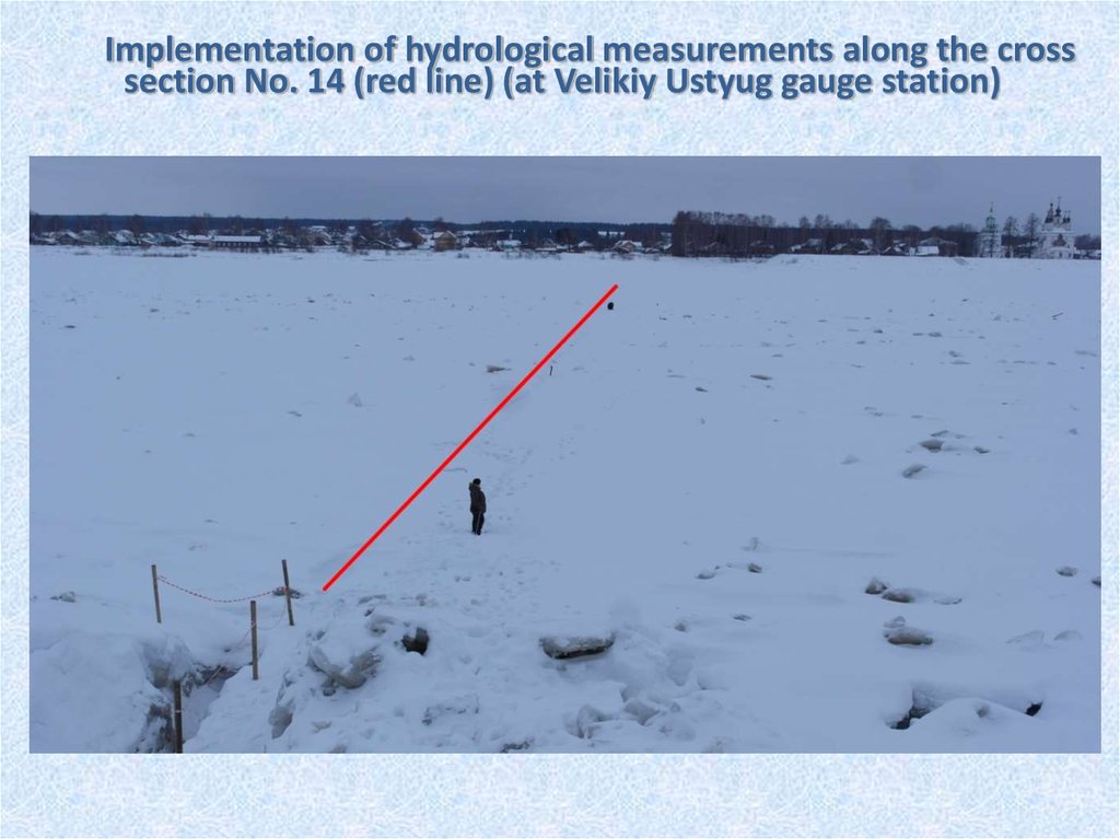
Implementation of hydrological measurements along the crosssection No. 14 (red line) (at Velikiy Ustyug gauge station)
24.
Field research of the ice jam in spring 201625.
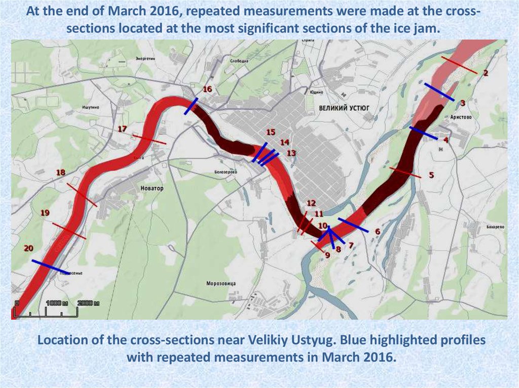
At the end of March 2016, repeated measurements were made at the crosssections located at the most significant sections of the ice jam.Location of the cross-sections near Velikiy Ustyug. Blue highlighted profiles
with repeated measurements in March 2016.
26.
It was found based on the analysis of field research data that:- The body of the main ice jam was located in the riverbed of the Sukhona
River from the village of Syvorotkino to Velikiy Ustyug, the length of the
main jam was about 10 km;
- A cascade of ice-jam formations was formed upstream of the Sukhona
from Velikiy Ustyug (about 60 km);
- Height of ice concentrations in the ice jam reached 0.5-1.0 m, height of
ice packs on the shores - 1.0-2.5 m;
- In the downstream of the Sukhona there was ice cover with hummocks
that reached 1,0-2,0 m;
- Ice in the ice jam had a complex layered structure;
- The thickness of ice cover throughout the whole ice jam was close to the
average annual thickness;
- Under the ice cover there was a dense sludge (ice brash) layer
(everywhere) with thickness from 0.5-1.0 m to 2.0-3.0 m;
- During the interval between measurements in February and March, ice
thickness increased and the slush layer decreased.
27.
The analysis of the field research results carried out in Februaryand March on the Sukhona River (profile section No. 4)
Вода
2
Шуг а
Лёд
hummock
т оросы
Снег
snow
ice
1
Глубина, м
0
-1
-2
ice brash
-3
February 9
-4
-5
2
0
46
72
Area of ice:
increased by 56 m2
water
г лубина
112
152
шуг а
188
230
лед
268
307
т оросы
359
403
снег
437
469
487
505
Расстояние от уреза левог о берег а, м
1
Area of ice brash:
decreased by 64 м2
Глубина, м
0
March 25, 2016
-1
Implementation of blasting upstream of
the river
-2
-3
March 25
-4
-5
0
46
72
112
2
152
глубина
188
230
шуга
268
лед
307
359
торосы
403
437
снег
469
487
505
Расст ояние от урез а левог о берег а, м
1
Area of ice:
didn’t change
Глубина, м
0
-1
Area of ice brash:
-2
decreased by 416 м2
-3
March 29
-4
-5
0
46
72
112
152
188
230
268
307
359
Расстояние от уреза левого берега, м
403
437
469
487
505
28.
Field research. Conclusions.The monitoring of the development of a powerful ice jam formed in 20152016 made it possible to specify the forecasting method of maximum
water level developed in SHI and used by the Vologda Center.
The results of the analysis of the obtained expedition data and the
updated forecast led to the conclusion that the forecasted maximum water
level in Velikiy Ustyug in the spring of 2016 will exceed the dangerous
level.
In February, a preliminary forecast of a dangerous hydrological event was
reported to the executive authorities – the raising of the level on the
Sukhona river in Velikiy Ustyug up to 960 cm.
Recommendations were also prepared on carrying out of ice-jam flood
control activities
Comprehensive measures were carried out:
- to prevent the population of the expected flooding;
- to prepare evacuation means from the expected flood zones;
- to prepare accommodations for evacuated population and material
values, food supplies and so on.
29.
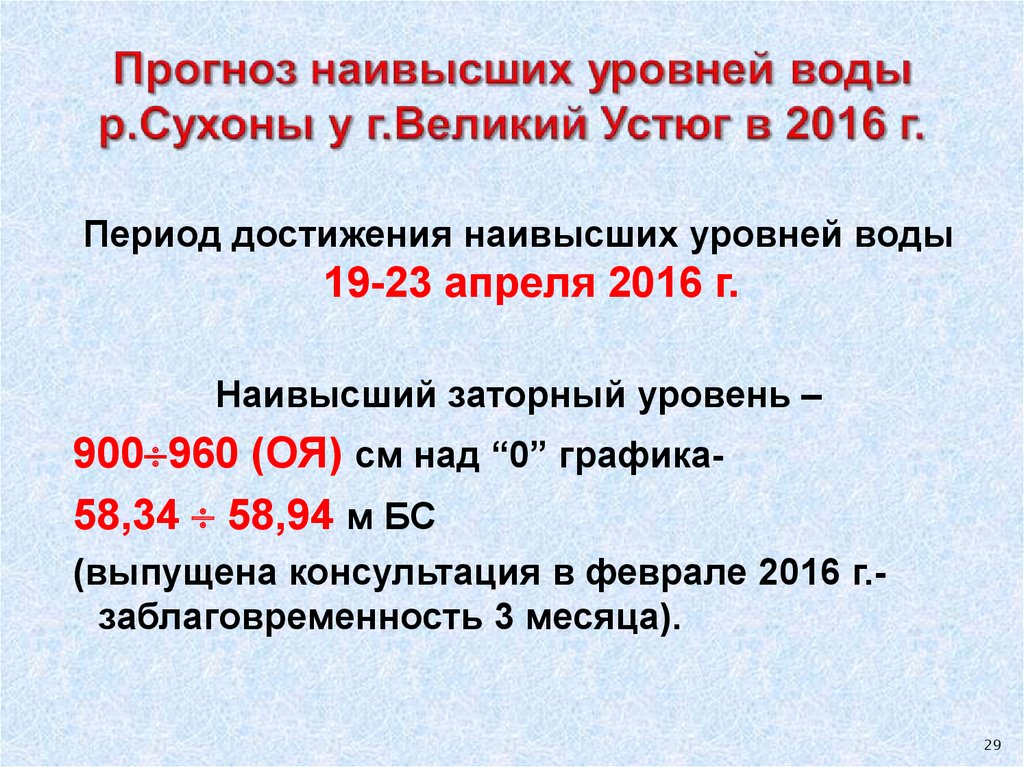
Период достижения наивысших уровней воды19-23 апреля 2016 г.
Наивысший заторный уровень –
900 960 (ОЯ) см над “0” графика58,34 58,94 м БС
(выпущена консультация в феврале 2016 г.заблаговременность 3 месяца).
29
30.
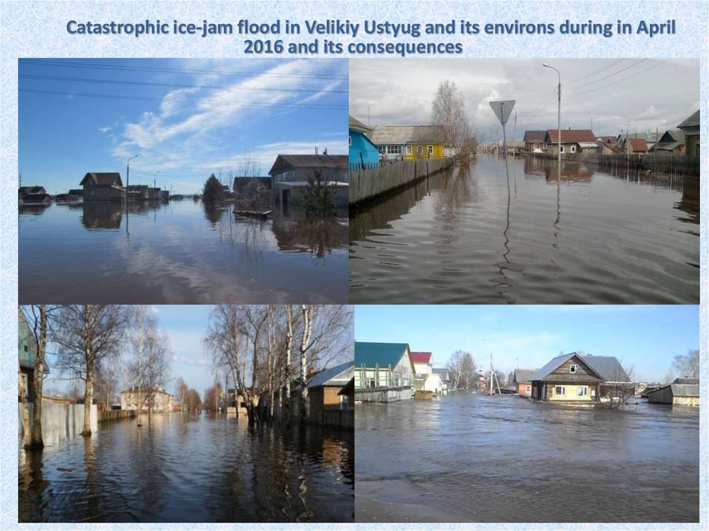
Catastrophic ice-jam flood in Velikiy Ustyug and its environsduring in April 2016 and its consequences
On April 15 the first ice movements began on the Sukhona river near Velikiy Ustyug.
At 12:25 the beginning of ice drift at the water level 815 cm which is almost 4 m above
the normal.
On April 15, a municipal emergency regime was declared over the territory of the Velikiy
Ustyug district, and on the evening of April 17 the emergency situation at the regional
level throughout the territory of the Vologda region.
On April 16 at 12:36 the water level at the Velikiy Ustyug water level gauging station
reached 964 cm (above 960 cm is a dangerous hydrological phenomenon), which is only
5 cm below the historical maximum of 1953.
On April 19 at 11:00 am there was a breakdown of the ice jam and water level started
decreasing.
The emergency regime was extended until May 24, 2016.
22 settlements (almost 2,000 houses with a population of about 8000 people) were
flooded.
The material damage, according to the Government of the Vologda region, amounted to
533 million rubles (9.1 million dollars).
31.
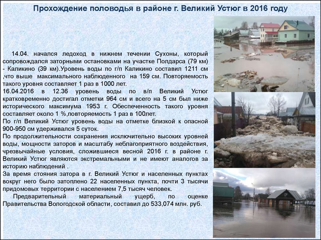
Прохождение половодья в районе г. Великий Устюг в 2016 году14.04. начался ледоход в нижнем течении Сухоны, который
сопровождался заторными остановками на участке Полдарса (79 км)
- Каликино (39 км).Уровень воды по г/п Каликино составил 1211 см
,что выше максимального наблюденного на 159 см. Повторяемость
такого уровня составляет 1 раз в 1000 лет.
16.04.2016 в 12.36 уровень воды по в/п Великий Устюг
кратковременно достигал отметки 964 см и всего на 5 см был ниже
исторического максимума 1953 г. Обеспеченность такого уровня
составляет около 1 %,повторяемость 1 раз в 100лет.
По г/п Великий Устюг уровень воды на отметке близкой к опасной
900-950 см удерживался 5 суток.
По продолжительности сохранения исключительно высоких уровней
воды, мощности заторов и масштабу неблагоприятного воздействия,
чрезвычайные условия, сложившиеся весной 2016 г. в районе г.
Великий Устюг являются экстремальными и не имеют аналогов за
историю наблюдений .
За время стояния затора в г. Великий Устюг и населенных пунктах
вокруг него было затоплено 22 населенных пункта, почти 3 тысячи
придомовых территории с населением 7,5 тысяч человек.
Предварительный
материальный
ущерб,
по
оценке
Правительства Вологодской области, составил до 533,074 млн. руб.
32.
Catastrophic ice-jam flood in Velikiy Ustyug and its environsduring in April 2016 and its consequences
33.
Catastrophic ice-jam flood in Velikiy Ustyug and its environs during in April2016 and its consequences
34.
35.
Thank youfor your attention!