


 geography
Similar presentations:


 and the most interesting places")


Kazahstan geography
1. Kazahstan geography
{Arystanova
Laura
BO-13
2.
Kazakhstan is located in Central Asia and Eastern Europe at 48°N 68°ECoordinates:48°N 68°E. With an area of about 2,724,800 square kilometers, Kazakhstan is more
than twice the combined size of the other four Central Asian states, or about twice
the size of Alaska. The country borders Turkmenistan, Uzbekistan, and Kyrgyzstan
to the south; Russia to the north; Russia and the Caspian Sea to the west; and China's
Xinjiang Uygur Autonomous Region to the east.
3.
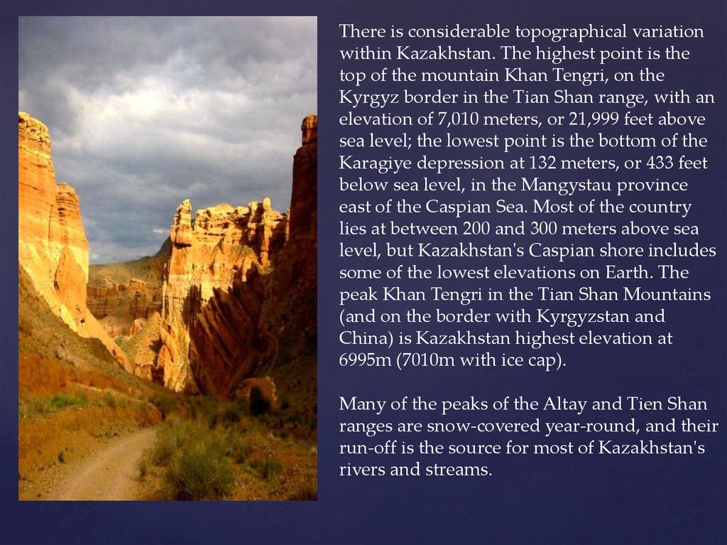
There is considerable topographical variationwithin Kazakhstan. The highest point is the
top of the mountain Khan Tengri, on the
Kyrgyz border in the Tian Shan range, with an
elevation of 7,010 meters, or 21,999 feet above
sea level; the lowest point is the bottom of the
Karagiye depression at 132 meters, or 433 feet
below sea level, in the Mangystau province
east of the Caspian Sea. Most of the country
lies at between 200 and 300 meters above sea
level, but Kazakhstan's Caspian shore includes
some of the lowest elevations on Earth. The
peak Khan Tengri in the Tian Shan Mountains
(and on the border with Kyrgyzstan and
China) is Kazakhstan highest elevation at
6995m (7010m with ice cap).
Many of the peaks of the Altay and Tien Shan
ranges are snow-covered year-round, and their
run-off is the source for most of Kazakhstan's
rivers and streams.
4.
Except for the Tobol, Ishim, and Irtysh rivers (the Kazak names for which are,respectively, Tobyl, Esil, and Ertis), portions of which flow through
Kazakhstan, all of Kazakhstan's rivers and streams are part of landlocked
systems. They either flow into isolated bodies of water such as the Caspian Sea
or simply disappear into the steppes and deserts of central and southern
Kazakhstan. Many rivers, streams, and lakes are seasonal, evaporating in
summer. The three largest bodies of water are Lake Balkhash, a partially fresh,
partially saline lake in the east, near Almaty, and the Caspian and Aral Seas,
both of which lie partially within Kazakhstan.
Some 9.4% of Kazakhstan's land is mixed prairie and forest or treeless prairie,
primarily in the north or in the basin of the Ural River in the west. More than
three-quarters of the country, including the entire west and most of the south,
is either semidesert (33.2%) or desert (44%). The terrain in these regions is bare,
eroded, broken uplands, with sand dunes in the Qizilqum ("The Red Sands"; in
the Russian form, Kyzylkum) and Moyunqum (in the Russian form,
Muyunkum (Муюнкум)) deserts, which occupy south-central Kazakhstan.
5.
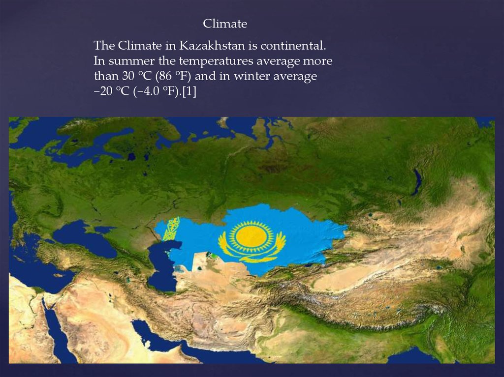
ClimateThe Climate in Kazakhstan is continental.
In summer the temperatures average more
than 30 °C (86 °F) and in winter average
−20 °C (−4.0 °F).[1]
6.
The environment of Kazakhstan has been badly damaged by human activity. Most ofthe water in Kazakhstan is polluted by industrial effluents, pesticide and fertilizer
residue, and, in some places, radioactive elements. The most visible damage has been
to the Aral Sea, which as recently as the 1970s was larger than any of the Great Lakes
of North America save Lake Superior. The sea began to shrink rapidly when sharply
increased irrigation and other demands on the only significant tributaries, the Syr
Darya and the Amu Darya (the latter reaching the Aral from neighboring
Uzbekistan), all but eliminated inflow. During the Soviet Era, Kazakhstan received
water from Tajikistan and Kyrgyzstan, and Kazakhstan, Turkmenistan, and
Kazakhstan provided oil and gas for these two nations in return. However, after the
collapse of the USSR this system had collapsed and no plan to replace this system has
been put in place. According to research conducted by the International Crisis Group,
there is little political will to solve this problem despite Central Asia's need for
mutual resource-sharing.[2] By 1993 the Aral Sea had lost an estimated 60% of its
volume, in the process breaking into three unconnected segments.
7.
Increasing salinity and reduced habitat have killed the Aral Sea's fish, hence destroyingits once-active fishing industry, and the receding shoreline has left the former port of
Aral'sk more than seventy kilometers from the water's edge. The depletion of this large
body of water has increased temperature variations in the region, which in turn have
had an impact on agriculture. A much greater agricultural impact, however, has come
from the salt- and pesticide-laden soil that the wind is known to carry as far away as the
Himalaya Mountains and the Pacific Ocean. Deposition of this heavily saline soil on
nearby fields effectively sterilizes them. Evidence suggests that salts, pesticides, and
residues of chemical fertilizers are also adversely affecting human life around the
former Aral Sea; infant mortality in the region approaches 10% compared with the 1991
national rate of 2.7%.
8.
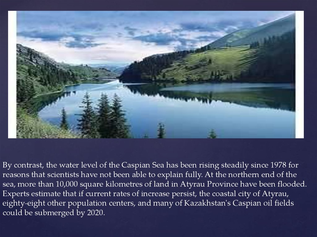
By contrast, the water level of the Caspian Sea has been rising steadily since 1978 forreasons that scientists have not been able to explain fully. At the northern end of the
sea, more than 10,000 square kilometres of land in Atyrau Province have been flooded.
Experts estimate that if current rates of increase persist, the coastal city of Atyrau,
eighty-eight other population centers, and many of Kazakhstan's Caspian oil fields
could be submerged by 2020.
9.
Wind erosion has also had an impact in the northern and central parts of the republicbecause of the introduction of wide-scale dryland wheat farming. In the 1950s and
1960s, much soil was lost when vast tracts of Kazakhstan's prairies were plowed under
as part of Khrushchev's Virgin Lands agricultural project. By the mid-1990s, an
estimated 60% of the republic's pastureland was in various stages of desertification.
Industrial pollution is a bigger concern in Kazakhstan's manufacturing cities, where
aging factories pump huge quantities of unfiltered pollutants into the air and
groundwater. The former capital, Almaty, is particularly threatened, in part because of
the postindependence boom in private automobile ownership.
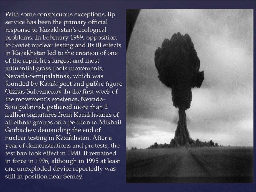
The gravest environmental threat to Kazakhstan comes from radiation, especially in
the Semey (Semipalatinsk) region of the northeast, where the Soviet Union tested
almost 500 nuclear weapons, 116 of them above ground. Often, such tests were
conducted without evacuating or even alerting the local population. Although nuclear
testing was halted in 1990[citation needed], radiation poisoning[citation needed], birth
defects[citation needed], severe anemia[citation needed], and leukemia[citation
needed] are thought to be very common in the area.[citation needed]
10.
With some conspicuous exceptions, lipservice has been the primary official
response to Kazakhstan's ecological
problems. In February 1989, opposition
to Soviet nuclear testing and its ill effects
in Kazakhstan led to the creation of one
of the republic's largest and most
influential grass-roots movements,
Nevada-Semipalatinsk, which was
founded by Kazak poet and public figure
Olzhas Suleymenov. In the first week of
the movement's existence, NevadaSemipalatinsk gathered more than 2
million signatures from Kazakhstanis of
all ethnic groups on a petition to Mikhail
Gorbachev demanding the end of
nuclear testing in Kazakhstan. After a
year of demonstrations and protests, the
test ban took effect in 1990. It remained
in force in 1996, although in 1995 at least
one unexploded device reportedly was
still in position near Semey.
11.
Once its major ecological objective was achieved, Nevada-Semipalatinsk made variousattempts to broaden into a more general political movement; it has not pursued a
broad ecological or "green" agenda. A very small green party, Tabigat, made common
cause with the political opposition in the parliament of 1994.
12.
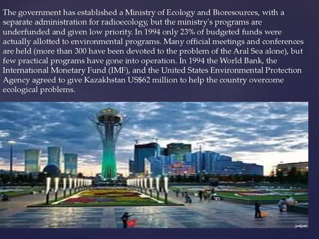
The government has established a Ministry of Ecology and Bioresources, with aseparate administration for radioecology, but the ministry's programs are
underfunded and given low priority. In 1994 only 23% of budgeted funds were
actually allotted to environmental programs. Many official meetings and conferences
are held (more than 300 have been devoted to the problem of the Aral Sea alone), but
few practical programs have gone into operation. In 1994 the World Bank, the
International Monetary Fund (IMF), and the United States Environmental Protection
Agency agreed to give Kazakhstan US$62 million to help the country overcome
ecological problems.