


 geography
Similar presentations:


 and the most interesting places")

Urban Planning Kazakhstan
1. Urban planning
URBANPLANNING
KAZAKHSTAN, City planning and Urbanization
Student: Mukhammed Aleumet Askar
2. Central Asia: Core and Periphery
CENTRAL ASIA:CORE AND PERIPHERY
Central Asia is, by its most common definition, those five “stans” that
were formerly Soviet republics: Kazakhstan, Kyrgyzstan, Tajikistan,
Turkmenistan, and Uzbekistan.
I am from Kazakhstan Republic and further the presentation will be
only about Kazakhstan’s urban planning and future urbanization designs of
major cities, especially capital city-Astana.
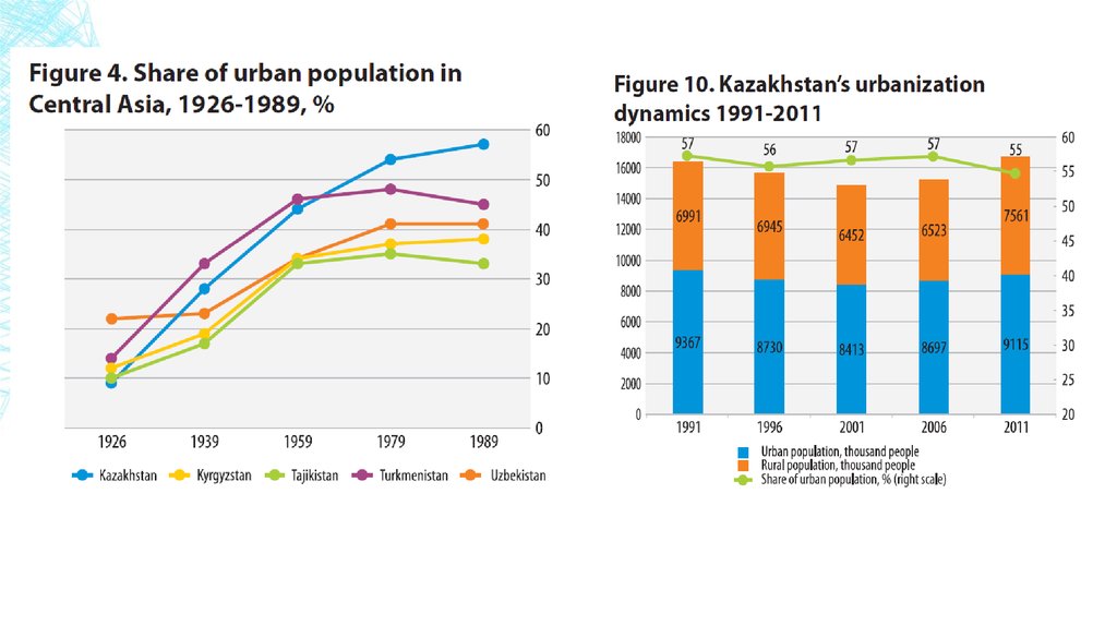
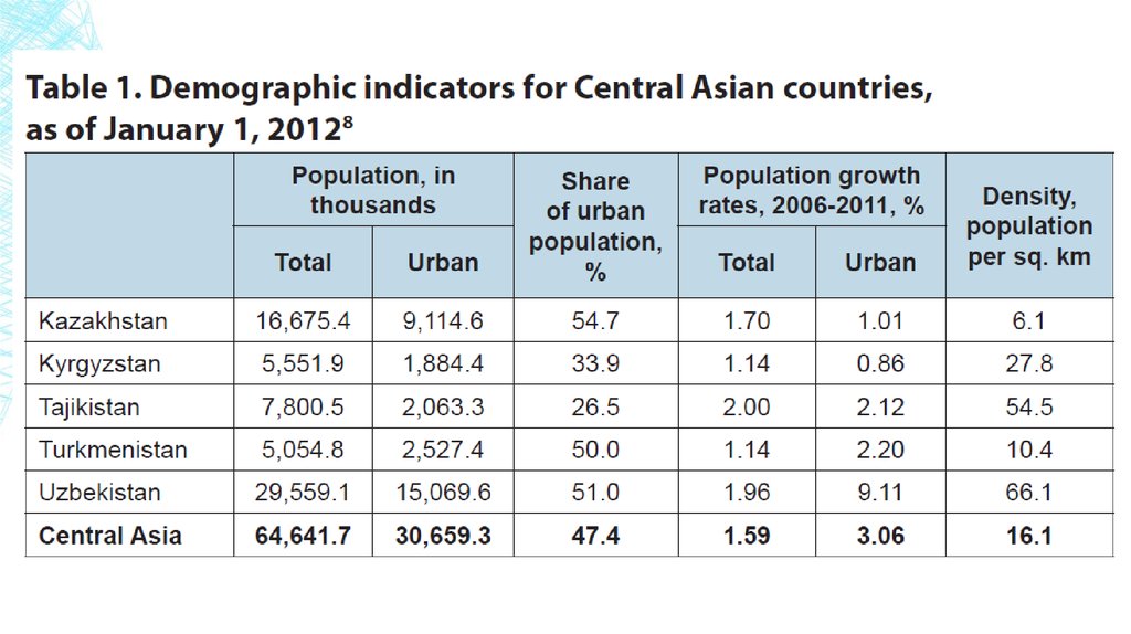
Kazakhstan. From 1926 to 1989, the population of Kazakhstan
increased 2.7-fold - from 6 million to 16.5 million people. From the 1950s
through the 1980s, Kazakhstan’s population growth was mainly driven by
natural factors.
3.
4.
5.
6.
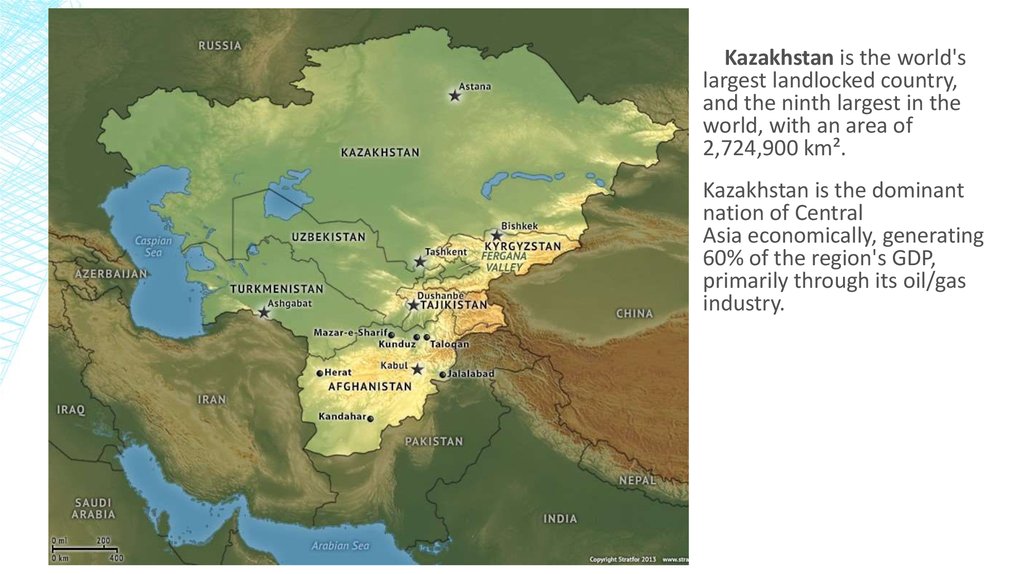
Kazakhstan is the world'slargest landlocked country,
and the ninth largest in the
world, with an area of
2,724,900 km².
Kazakhstan is the dominant
nation of Central
Asia economically, generating
60% of the region's GDP,
primarily through its oil/gas
industry.
7. Industrial policy and spatial development
INDUSTRIAL POLICY AND SPATIALDEVELOPMENT
Urbanization in Kazakhstan was mainly driven by the creation of industrial
areas. In 1939 the country had 28 cities and 53 urban-type settlements; by 1945
their numbers had risen to 38 and 100, respectively. The scale of urbanization
continued to grow in the postwar period, resulting in 40 new cities.
By the early 1980s, the share of urban population in Karaganda,
Mangyshlak and Dzhezkazgan, reached 83-89% of total population, a very high
proportion compared with the rest of Central Asia.
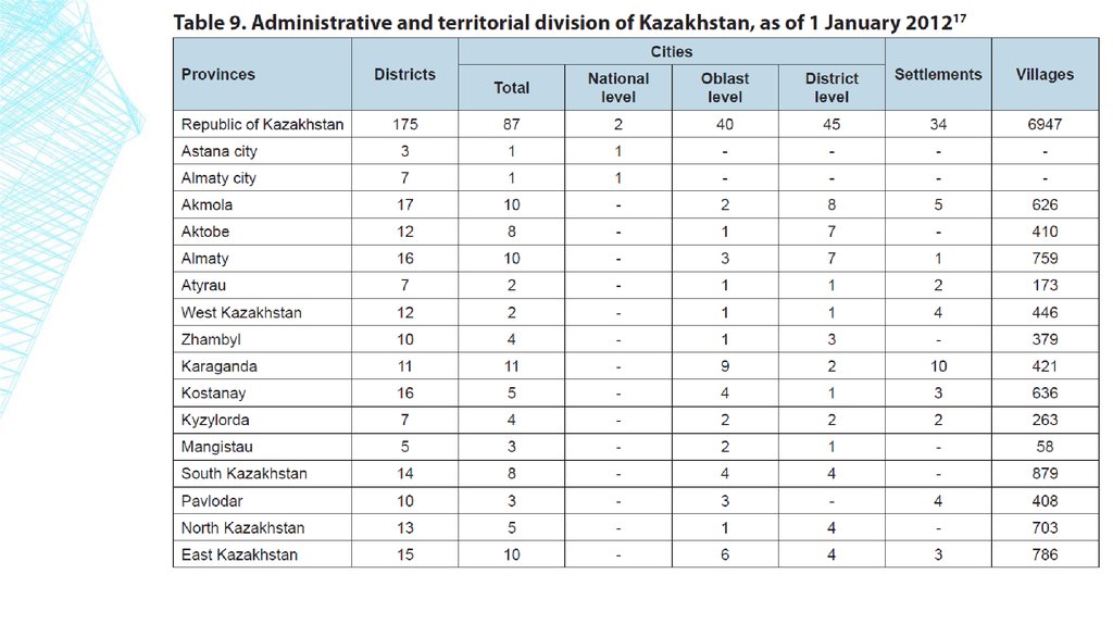
Kazakhstan currently has 87 cities, of which two cities have national status
(Almaty and Astana); 40 are oblast-level cities , including 14 oblast centers; and 45
are district-level cities. The 16 oblast centers (including Almaty and Astana) are
home to 67% of Kazakhstan’s total urban population.
8.
9.
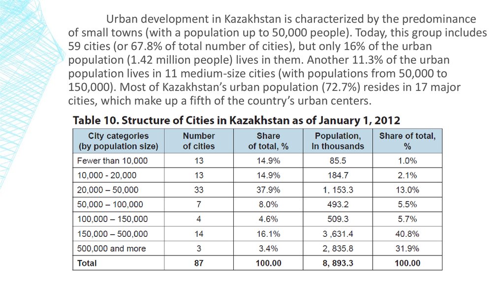
Urban development in Kazakhstan is characterized by the predominanceof small towns (with a population up to 50,000 people). Today, this group includes
59 cities (or 67.8% of total number of cities), but only 16% of the urban
population (1.42 million people) lives in them. Another 11.3% of the urban
population lives in 11 medium-size cities (with populations from 50,000 to
150,000). Most of Kazakhstan’s urban population (72.7%) resides in 17 major
cities, which make up a fifth of the country’s urban centers.
10.
11. major cities of Kazakhstan
MAJOR CITIES OF KAZAKHSTAN▪ Almaty: The Old Capital
Almaty is a beautiful city perched among the mountains in Southern Kazakhstan. Its name comes
from the Kazakh word “alma” which means “apple;” apple orchards have long surrounded the city.
Almaty is the largest city in Kazakhstan, with a population of 1,797,431 people, about 8% of the
country's total population. It served as capital of the Kazakh state in its various forms from 1929 to
1997.
From 1966 to 1971, 1,400,000 square meters of public and cooperative housing were built.
Annually, around 300,000 square meters of dwellings were under construction. The Soviet
government tried to diversify architectural forms to create a more varied cityscape. During this
period, many schools, hospitals, cultural, and entertainment facilities were constructed, including
Lenin's Palace, the Kazakhstan Hotel, and the "Medeo" sports complex.
12.
“Medeo” sportcomplex
13.
The MedeuDam, designed to
protect the city of
Almaty and the
Medeo skating
rink from
catastrophic mud
flows during
flood season, was
built in 1966. It
was reinforced a
number of times
in the 1960s and
1970s.
14.
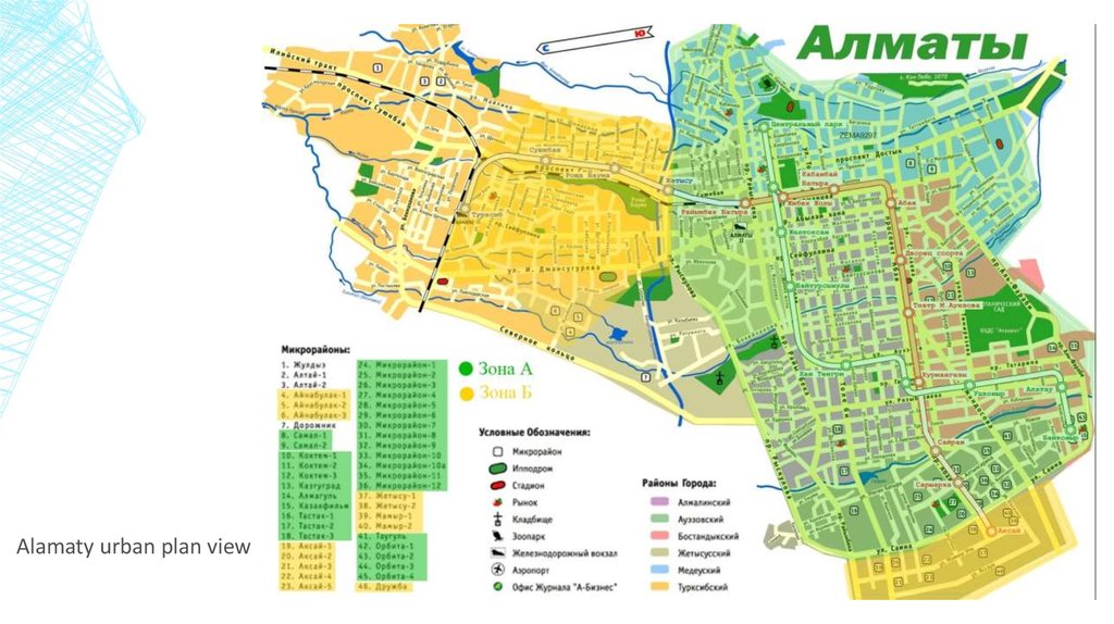
Current city plan ofAlmaty
(On the map figured map
of metro lines and future
plans)
15.
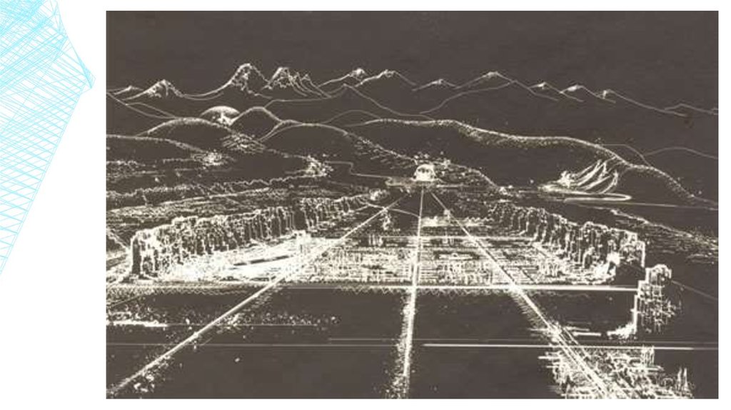
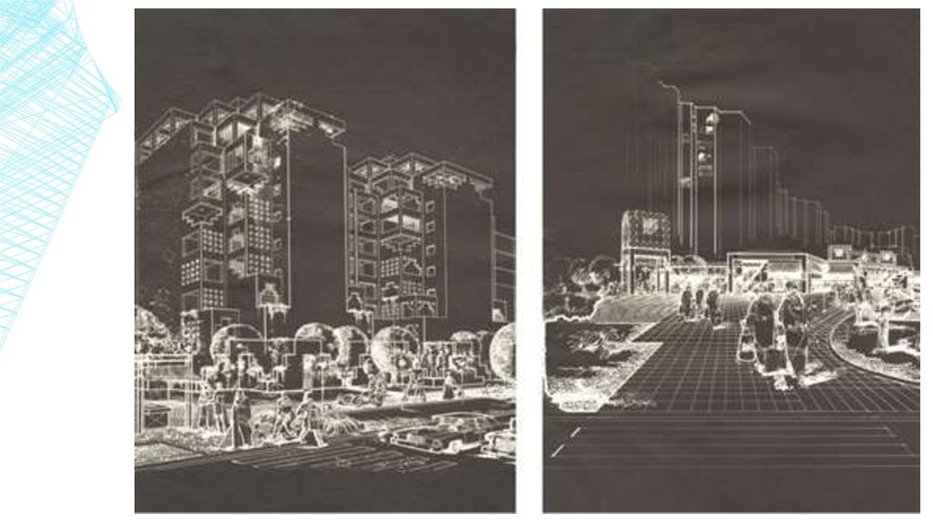
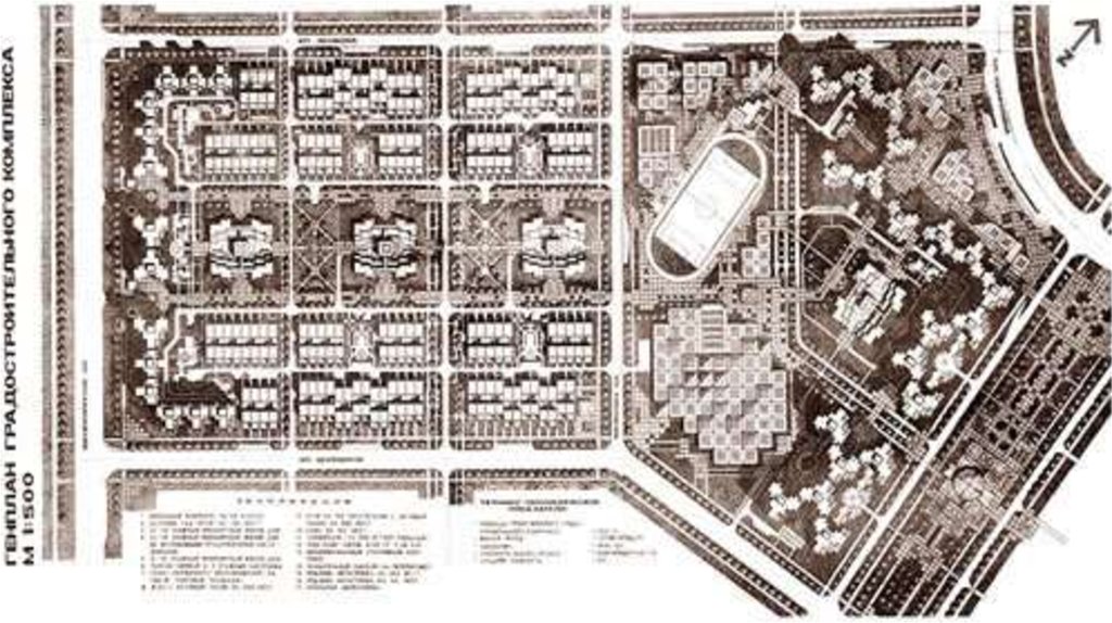
Alamaty urban plan view16.
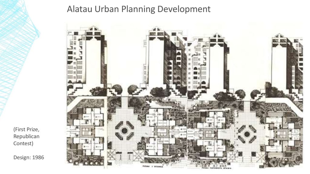
Alatau Urban Planning Development(First Prize,
Republican
Contest)
Design: 1986
17.
18.
19.
20.
21.
22.
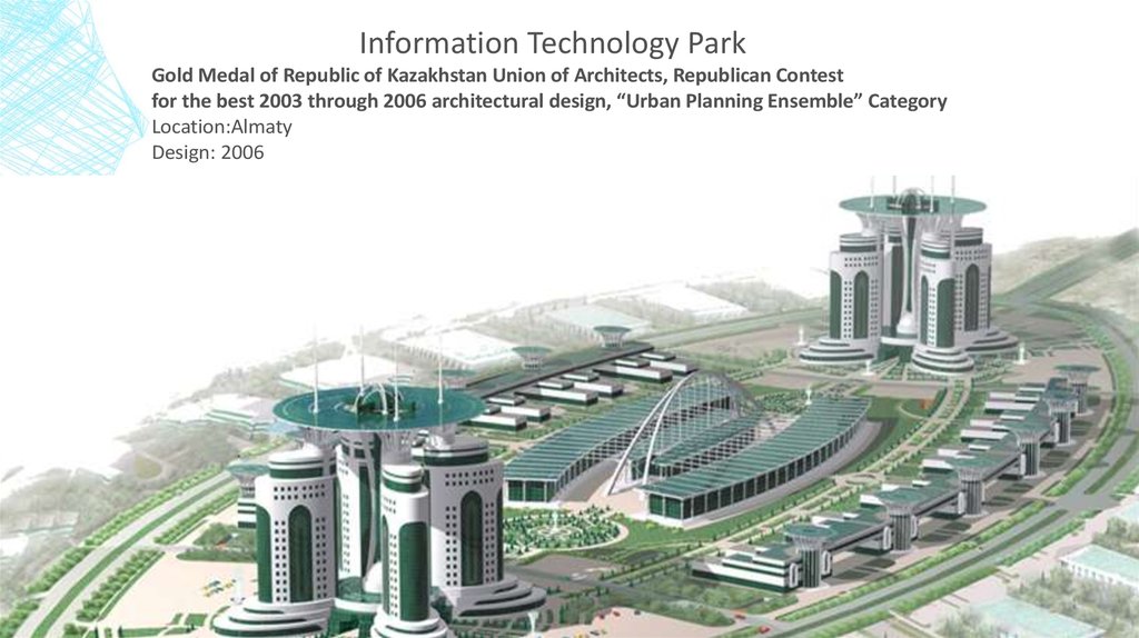
Information Technology ParkGold Medal of Republic of Kazakhstan Union of Architects, Republican Contest
for the best 2003 through 2006 architectural design, “Urban Planning Ensemble” Category
Location:Almaty
Design: 2006
23.
24.
25.
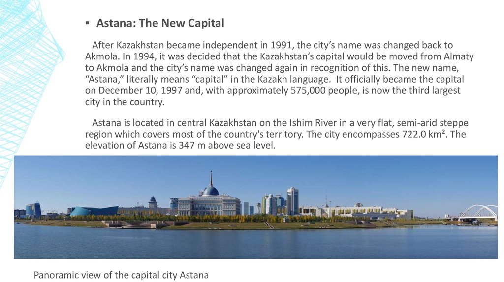
▪ Astana: The New CapitalAfter Kazakhstan became independent in 1991, the city’s name was changed back to
Akmola. In 1994, it was decided that the Kazakhstan’s capital would be moved from Almaty
to Akmola and the city’s name was changed again in recognition of this. The new name,
“Astana,” literally means “capital” in the Kazakh language. It officially became the capital
on December 10, 1997 and, with approximately 575,000 people, is now the third largest
city in the country.
Astana is located in central Kazakhstan on the Ishim River in a very flat, semi-arid steppe
region which covers most of the country's territory. The city encompasses 722.0 km². The
elevation of Astana is 347 m above sea level.
Panoramic view of the capital city Astana
26.
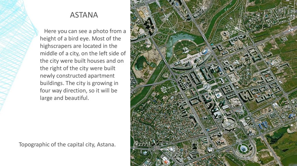
ASTANAHere you can see a photo from a
height of a bird eye. Most of the
highscrapers are located in the
middle of a city, on the left side of
the city were built houses and on
the right of the city were built
newly constructed apartment
buildings. The city is growing in
four way direction, so it will be
large and beautiful.
Topographic of the capital city, Astana.
27.
28.
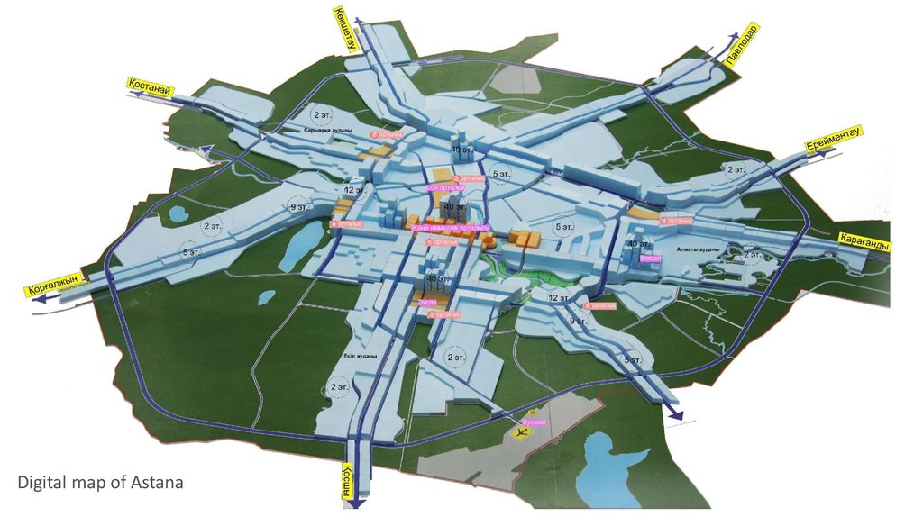
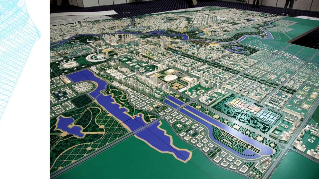
Digital map of Astana29.
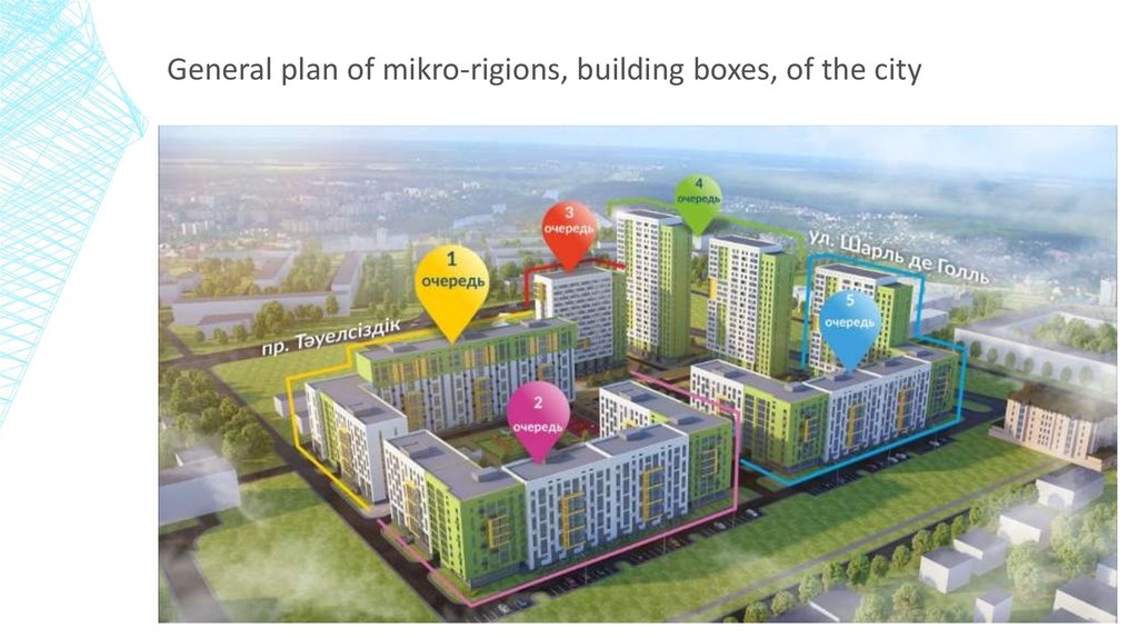
General plan of mikro-rigions, building boxes, of the city30.
31.
32.
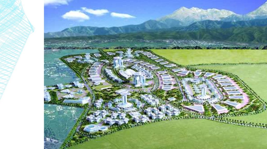
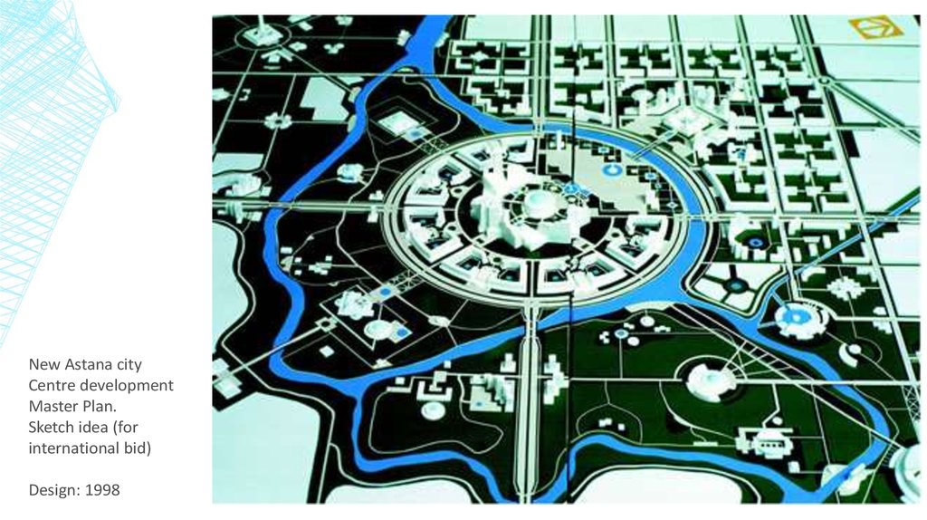
New Astana cityCentre development
Master Plan.
Sketch idea (for
international bid)
Design: 1998
33.
34.
Launch of Five Express Routes is planned in AstanaOn August 29, 2015, it is planned to launch five express routes in Astana. This measure was initiated
by Astana Office of Passenger Transport and Highways jointly with Astana LRT to link the densely
populated areas of the capital and unload regular passenger transport that runs in these
destinations.
The main advantages of the
express routes are as follows:
fewer stops
significant time savings
comfortable conditions
because new, reliable and highspeed buses will be operating
safety due high attention to
rolling stock from a technical
point of view.
35. Conclusion
CONCLUSIONIf we take a look back for 20 years, the process of urbanization and urban
development has been a difficult for the Central Asian countries. This was due
primarily to the consequences of Soviet urbanization.
Further on, most of the countries the transition period has deepened divisions
between regions in terms of social and economic development, also widened the
gaps between rural and urban populations at last magnified the problem of small
and medium-size towns.
The solution for the urban issues will be the dynamic processes of urbanization in
Kazakhstan in the medium and long term will create new opportunities for industrial
and agricultural development, forming megacities of regional and interregional
scope, and improving the quality of urban life.
36. References
REFERENCESUrban, Social, Rural and Resilient Global Practice (GPSURR)
United Nations: Economic and Social Commission for Asia and the Pacific (ESCAP)“Urbanization in Central Asia:
Challenges, Issues and Prospects”, Tashkent 2013
National Economy of Kazakhstan in 1983. p. 5. Quoted by Iskakov. The cities of Kazakhstan: Issues of Socioeconomic
Development. Alma-Ata, Nauka, 1985 (Народное хозяйство Казахстана в 1983 г. с. 5. Цитируется по Искаков У.М.
Города Казахстана: проблемы социально-экономического развития. – Алма-Ата; Наука, 1985)
Kazakhstan Statistics Agency. 2009
Websides:
http://www.kazgor.com/
http://astana.gov.kz/en/modules/material/47
https://astanatimes.com/2015/12/astana-architecture-and-city-building-management-chief-highlights-capitals-plan-for-harmoniousarchitectural-development/
https://www.oecd-ilibrary.org/urban-rural-and-regional-development/oecd-urban-policy-reviews-kazakhstan/governing-urbanisationin-kazakhstan_9789264268852-7-en