


 economics
 geography
Similar presentations:


")
Study and research issues of water resources in Ukraine
1.
Study and research issuesof water resources in
Ukraine
PhD in water engeeniring, Assoc. Prof.
Lyudmyla Kuzmych
2.
3.
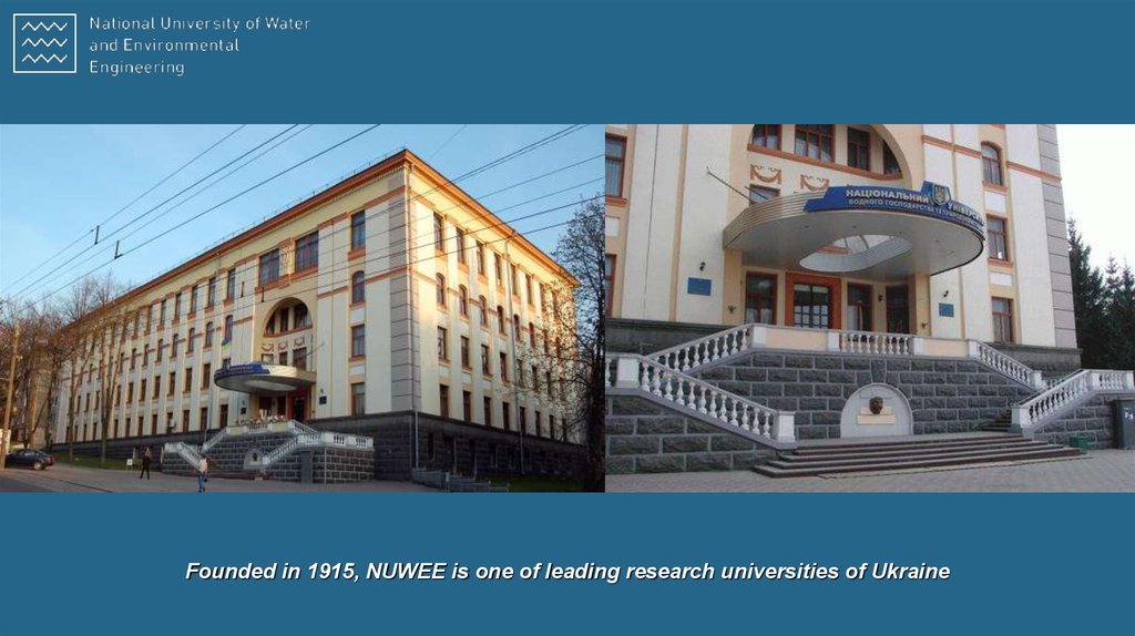
Founded in 1915, NUWEE is one of leading research universities of Ukraine4.
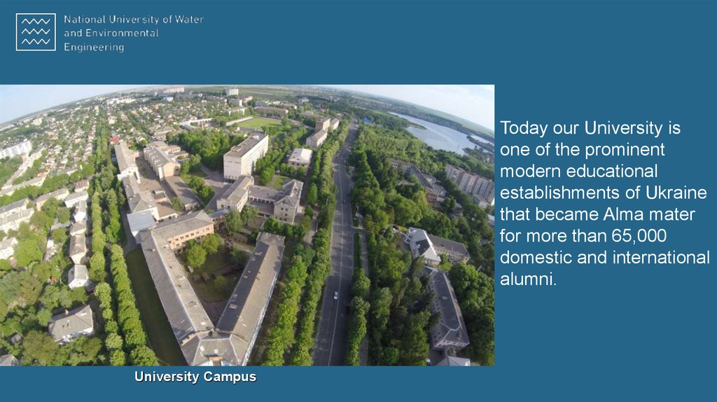
Today our University isone of the prominent
modern educational
establishments of Ukraine
that became Alma mater
for more than 65,000
domestic and international
alumni.
University Campus
5.
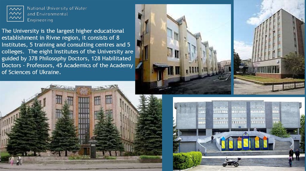
The University is the largest higher educationalestablishment in Rivne region, it consists of 8
Institutes, 5 training and consulting centres and 5
colleges. The eight Institutes of the University are
guided by 378 Philosophy Doctors, 128 Habilitated
Doctors - Professors, 45 Academics of the Academy
of Sciences of Ukraine.
6.
День кар'єри - 20167. INSTITUTE OF WATER MANAGEMENT AND ENVIRONMENTAL ENGINEERING
Departments:Department of Hydraulic Engineering
Department of Hydropower, Thermal Power and Hydraulic Machines
Department of Water Engineering and Water Technology
Department of Hydroinformatics
Department of Geology and Hydrology
Specialities:
Building (Hydraulic Engineering Construction)
Hydropower Engineering
Water Engineering (Water Resources)
Heat Power Engineering
8.
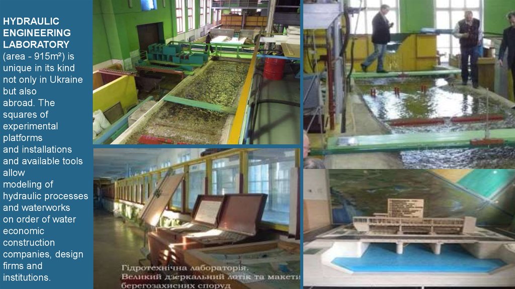
HYDRAULICENGINEERING
LABORATORY
(area - 915m²) is
unique in its kind
not only in Ukraine
but also
abroad. The
squares of
experimental
platforms
and installations
and available tools
allow
modeling of
hydraulic processes
and waterworks
on order of water
economic
construction
companies, design
firms and
institutions.
9.
Areas of research activities Institute of WaterManagement and Environmental Engineering (IWMEE):
development of scientific foundations and water management in Ukraine;
water management and use;
develop criteria and modeling of permissible anthropogenic pressures on ecosystems of water bodies and their basins;
improving the construction and operation of water systems and nature protection objects;
developing of improved structures drainage systems and water regulation technologies of drained soils;
riverbed processes and flood protection on mountain and lowland rivers;
studying conditions of formation of surface and underground runoff, its qualitative and quantitative assessment in
conditions of intensive and comprehensive anthropogenic load;
strategy for environmentally sound water use on river basins and ecologically allowable water withdrawal from rivers;
a complex environmental assessment of water resources and around water ecosystems;
water management and Ecological regionalization of river basins to identify priority investments in environmental protection
measures;
streamlining water protection zones of rivers;
improving of the constructions, methods of calculation and design of hydropower facilities and hydraulic machines;
improving thermal and hydraulic calculations of energy installations and apparatus;
control optimization of water regime drained land with using modern computer and information technology;
development of measures to improve operational reliability and efficiency of water use in the Danube rice irrigation systems;
functioning problems of irrigation systems Ukraine and ways of their use;
hydraulic study of open and closed watercourses;
investigation of filtration processes in earthen dams and protecting dams;
full-scale survey and research of hydraulic structures and channel processes;
participation in the expertise, counseling, planning, in construction and in the hydraulic research of hydraulic structures;
assessment of engineer geological conditions built-up areas.
10. Development of scientific foundations and water management in Ukraine
11. Water resources of Ukraine are formed at the expense of inflow of transit river waters from foreign countries, local flow and
underground waters. The potential resources of river waters are 209.8 km3, ofwhich only a quarter is formed within Ukraine, the rest comes from Russian Federation, Belarus, Romania,
Moldova.
12.
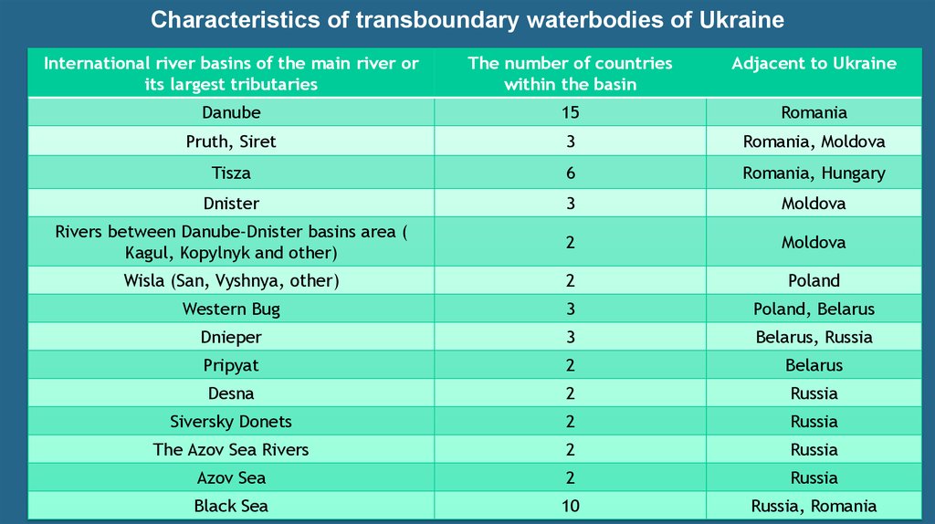
Characteristics of transboundary waterbodies of UkraineInternational river basins of the main river or
its largest tributaries
The number of countries
within the basin
Adjacent to Ukraine
Danube
15
Romania
Pruth, Siret
3
Romania, Moldova
Tisza
6
Romania, Hungary
Dnister
3
Moldova
Rivers between Danube-Dnister basins area (
Kagul, Kopylnyk and other)
2
Moldova
Wisla (San, Vyshnya, other)
2
Poland
Western Bug
3
Poland, Belarus
Dnieper
3
Belarus, Russia
Pripyat
2
Belarus
Desna
2
Russia
Siversky Donets
2
Russia
The Azov Sea Rivers
2
Russia
Azov Sea
2
Russia
Black Sea
10
Russia, Romania
13.
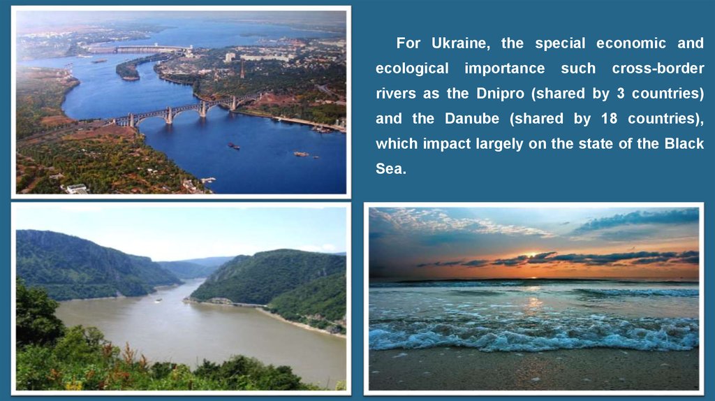
For Ukraine, the special economic andecological
importance
such
cross-border
rivers as the Dnipro (shared by 3 countries)
and the Danube (shared by 18 countries),
which impact largely on the state of the Black
Sea.
14.
The Dnipro River became a transboundary water body afterthe collapse of the USSR. There is no an agreement
between Ukraine, Russia and Belarus on the use of this
river and its protection. Some aspects of this issue are
regulated on the basis of common bilateral agreements.
15. Dnipro hydroelectric power station
16. Kakhovka HES
Kamyanska HESKyiv HES
Kremenchuk HES
17. Tisza, Pruth and Siret are the tributaries of the Danube, which is located within Ukraine
18. The automated information and measuring system “Tisza” for flood forecasting and water management in the Tisza river basin
gives anopportunity to solve the
following issues:
Prediction of rain, thaw-rain and mudflow flood;
Monitoring parameters and predicting the quality of natural and sewage waters;
Forecasting of flood zones and possible damages from flooding by rain;
Development of operational plans for flood control measures;
Operation of the water sector during a special period.
19. The Prut and Siret rivers basins cover the territory of Chernivtsi region in Ukraine and Romania
20. The line scheme of the Siret river basin
21. Consequences of destructive action of water
22. A main cause of frequent flooding in the region of the Siret and Prut rivers basins is the hydrometeorological situation and
structure of the river, andeconomic activity in the basins. These include :
• global climate change;
• cyclic occurrence of periods of raising the level of undergroundwater;
• uncontrolled economic activity in the catchment area and violation of the rules of
construction on this area, including floodplains of mountain district of the Siret and
Prut rivers basins;
• large sloping of the rivers and significant slopes and a lack of the water transport
capacity;
• significant reduction of the area of forests and forest plantations, especially
unsystematic deforestation on the slopes, which accelerating the runoff water in the
rivers and floods abrupt formation of high levels;
• consumerism practice in the valleys of the rivers and the mountains, especially in the
areas of forests;
• lack of water regulating structures financing.
23. Deformations of the channel which arise when extracting gravel
24. Gravel deposits, a mass of trees, roots, twigs that have accumulated during the annual flooding
25. At present, about 20 km among 139 km flood objects which have been on the balance of Chernivtsi water management agency require
major repairs and completereconstruction. As a result, under the threat of flooding and destruction along the Prut
and Siret rivers are 73 settlements with an area of a possible flooding more than 200
km2, where about 40 thousand people live. And the similar situation on small rivers
during floods might have negative impact on an area of 370 km2 and 156 settlements.
26.
Concluding the abovementioned facts, the main issues of water resourcesmanagement of the Siret and Prut rivers include:
• Adequate and stable funding existing flood control programs;
• Allocation of funds to fully recover the destroyed water structures, which were
damaged during the floods of previous years;
• Repairing of the existing water structures and building new structures in the border
area of Chernivtsi region;
• Lack of funding for the creation of bench protection strips along rivers, around
reservoirs, ponds and other water bodies and drainage channel strips, as required
by the Water Code of Ukraine;
• Cutting down forests, plowing, building of floodplain of the rivers, etc. lead to
increased stress on water intake, resulting in disturbed natural regime of the river,
changing conditions of the flow, frequent floods and rising losses on them.
27. Indicators of a comprehensive assessment of the ecological condition of the Tsir River
INDICATORS OF A COMPREHENSIVE ASSESSMENT OF THE ECOLOGICAL CONDITION OF THE TSIR RIVERCharacteristic of the
coefficient
Indicator
ecological and
economic
condition of
the territory
ecological
stability of the
landscape
agricultural use
К1
general
anthropogenic
tension
Estimated
value
Characteristic of
quantitative
significance
2.07
high
anthropogen
ic tension
К2
balance
anthropogenic
tension
1.23
mediumbalanced
anthropogen
ic tension
ESFL1
ecological
stability of the
landscape
1.19
conditionally
stable
ESFL2
ecological
stabilization of
biotechnical
elements and
the entire
landscape
0.48
little stable
Кс
the degree of
agricultural use
of the territory
0.56
high
28.
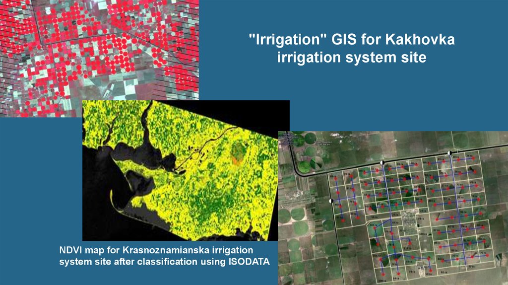
"Irrigation" GIS for Kakhovkairrigation system site
NDVI map for Krasnoznamianska irrigation
system site after classification using ISODATA
03/05/18
29.
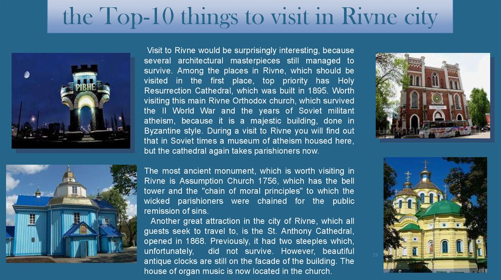
the Top-10 things to visit in Rivne cityVisit to Rivne would be surprisingly interesting, because
several architectural masterpieces still managed to
survive. Among the places in Rivne, which should be
visited in the first place, top priority has Holy
Resurrection Cathedral, which was built in 1895. Worth
visiting this main Rivne Orthodox church, which survived
the II World War and the years of Soviet militant
atheism, because it is a majestic building, done in
Byzantine style. During a visit to Rivne you will find out
that in Soviet times a museum of atheism housed here,
but the cathedral again takes parishioners now.
The most ancient monument, which is worth visiting in
Rivne is Assumption Church 1756, which has the bell
tower and the "chain of moral principles" to which the
wicked parishioners were chained for the public
remission of sins.
Another great attraction in the city of Rivne, which all
guests seek to travel to, is the St. Anthony Cathedral,
opened in 1868. Previously, it had two steeples which,
unfortunately,
did not survive. However, beautiful
antique clocks are still on the facade of the building. The
house of organ music is now located in the church.
29
30.
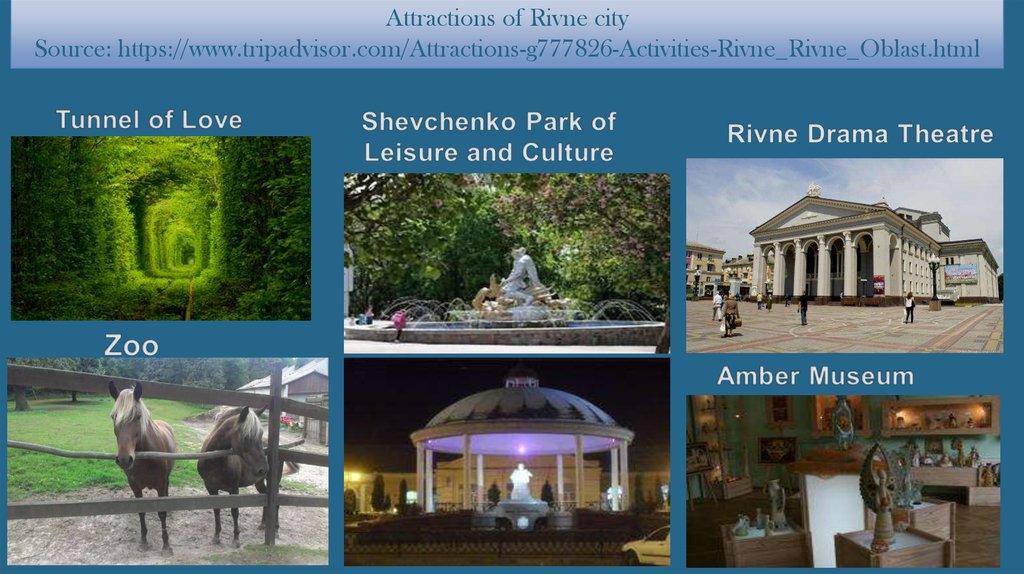
Attractions of Rivne citySource: https://www.tripadvisor.com/Attractions-g777826-Activities-Rivne_Rivne_Oblast.html
30