
 life safety
Similar presentations:


Water flood
1. Water flood - melting snow, rain, wind driven water and congestion in the rivers, lakes and seas water level rises as a result
FloodWater flood - melting snow, rain, wind driven water and
congestion in the rivers, lakes and seas water level rises as a
result of significant flooding. The river floods caused by the
wind and water injection type.
2.
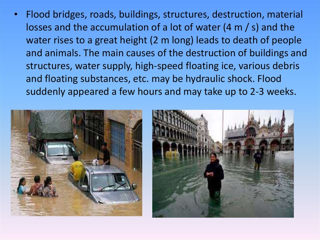
• Flood bridges, roads, buildings, structures, destruction, materiallosses and the accumulation of a lot of water (4 m / s) and the
water rises to a great height (2 m long) leads to death of people
and animals. The main causes of the destruction of buildings and
structures, water supply, high-speed floating ice, various debris
and floating substances, etc. may be hydraulic shock. Flood
suddenly appeared a few hours and may take up to 2-3 weeks.
3.
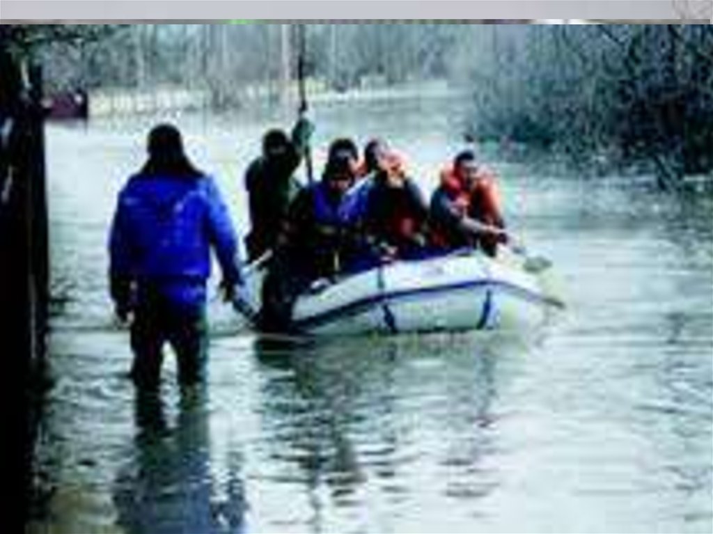
• . How to prepare for flooding? If so, have suffered frequent flooding in your area,flooding land borders, as well as the place of residence of the nearby flooded
convex with rare earths, remember that the shortest path to the study. ? Action
during the transfer of organizational and individual members of the family, as well
as sudden and bwırqanıp growing in the provisions of the floods. Boats, rafts and
remember that building materials storage. When copying documents from the
estate and to make a preliminary list of medications. Special suitcase or backpack
values and standards required in stocks of food, water and medicines into the
• How to act during a flood? Alarm about the threat of floods and copying in
accordance with the küttirmesten with him after two days of food items and nondestructive flooding emergency fund and potentially dangerous territory to go
beyond the safe area or convex with a (loss ). Having reached the point of copying
register
4.
5.
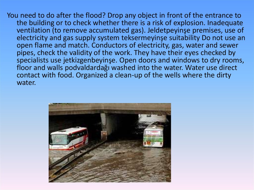
You need to do after the flood? Drop any object in front of the entrance tothe building or to check whether there is a risk of explosion. Inadequate
ventilation (to remove accumulated gas). Jeldetpeyinşe premises, use of
electricity and gas supply system teksermeyinşe suitability Do not use an
open flame and match. Conductors of electricity, gas, water and sewer
pipes, check the validity of the work. They have their eyes checked by
specialists use jetkizgenbeyinşe. Open doors and windows to dry rooms,
floor and walls podvaldardağı washed into the water. Water use direct
contact with food. Organized a clean-up of the wells where the dirty
water.
6.
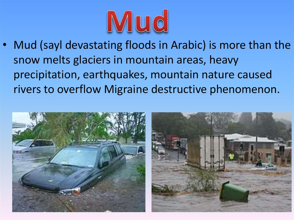
• Mud (sayl devastating floods in Arabic) is more than thesnow melts glaciers in mountain areas, heavy
precipitation, earthquakes, mountain nature caused
rivers to overflow Migraine destructive phenomenon.
7.
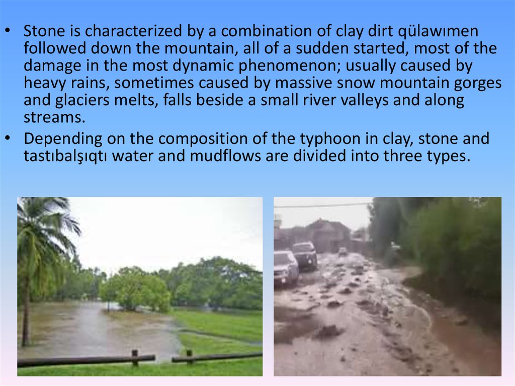
• Stone is characterized by a combination of clay dirt qülawımenfollowed down the mountain, all of a sudden started, most of the
damage in the most dynamic phenomenon; usually caused by
heavy rains, sometimes caused by massive snow mountain gorges
and glaciers melts, falls beside a small river valleys and along
streams.
• Depending on the composition of the typhoon in clay, stone and
tastıbalşıqtı water and mudflows are divided into three types.
8.
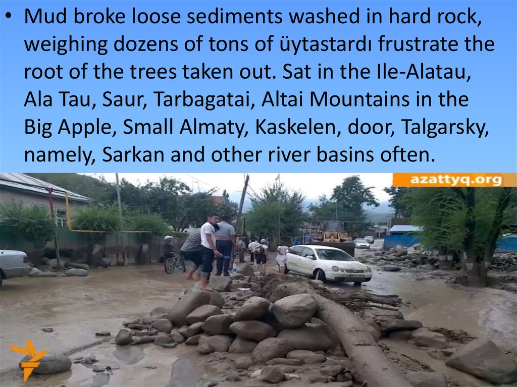
• Mud broke loose sediments washed in hard rock,weighing dozens of tons of üytastardı frustrate the
root of the trees taken out. Sat in the Ile-Alatau,
Ala Tau, Saur, Tarbagatai, Altai Mountains in the
Big Apple, Small Almaty, Kaskelen, door, Talgarsky,
namely, Sarkan and other river basins often.
9.
10.
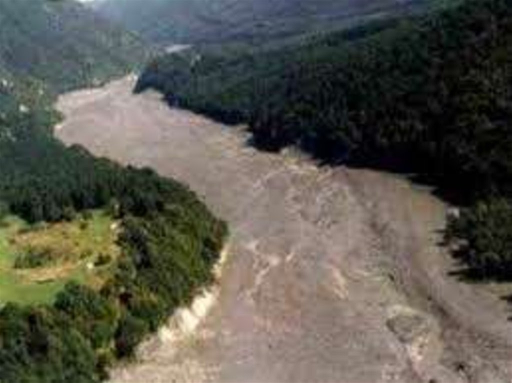
Mud prevention• In July 1963, a few days long, hot heat under the
influence of a lot of ice and snow melts Jarsay
muzdığındağı water over the edge of the lake, about
half an hour door to the lake about 6 million. m3 of
mud and stone led to the drain.
• Boarded the greatest threat to the rivers, dams, canals,
digging, planting trees and forecasting organization to
inform the public in advance reduces the effects of
flood events. Almaty in 1966 for flood protection
jılıMedew by the demolition of a mountain for the first
time in the world Medeo gorge dam was built. Against
the land area of 40 km2 surface scientific research,
design and engineering work is complex. In order to
prevent floods in Kazakhstan "Kazselzashita" institution,
and the flood monitoring organized
11.
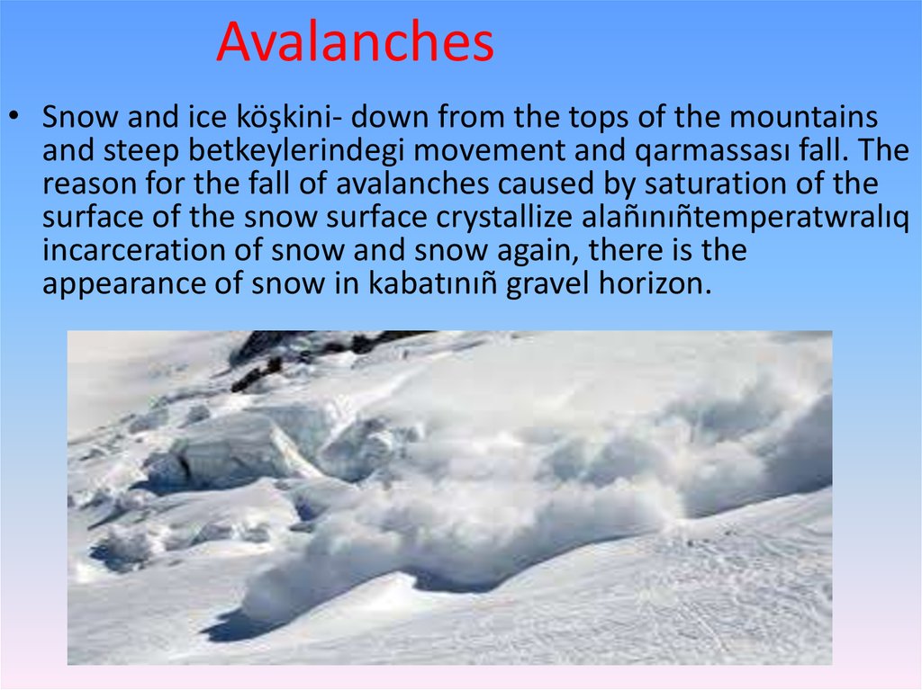
Avalanches• Snow and ice köşkini- down from the tops of the mountains
and steep betkeylerindegi movement and qarmassası fall. The
reason for the fall of avalanches caused by saturation of the
surface of the snow surface crystallize alañınıñtemperatwralıq
incarceration of snow and snow again, there is the
appearance of snow in kabatınıñ gravel horizon.
12.
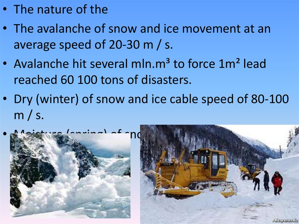
• The nature of the• The avalanche of snow and ice movement at an
average speed of 20-30 m / s.
• Avalanche hit several mln.m³ to force 1m² lead
reached 60 100 tons of disasters.
• Dry (winter) of snow and ice cable speed of 80-100
m / s.
• Moisture (spring) of snow and ice cable 10-20 m / s.
13.
• Research and protective measures• Snow and ice avalanche control special work stations where
the constant avalanche of snow and ice studied:
• snow and ice condition of the formation of the cable and the
spread of their basic patterns, snow cover is determined by
fluctuations of the physical and mechanical properties of
features and modes;
• Nov qatqabatı status almağayıp conditions are identified
landslide forecasting methods;
• is the estimated value of avalanches hydrological
characteristics;
• landslips determined by the influence of the formation of the
flood waters and mudflows mode;
• By measuring the snow routes of snow and ice avalanches on
the map.
• The national economy as a result of the research done in the
form of snow and ice avalanches timely protection measures,
flood or avalanche built qarsığïmarattar.
14.
The fate of the fate of the people on the island• The Aral Sea in Uzbekistan and Kazakhstan (Kyzylorda
and Aktobe region.) Turan depression in the desert
beldeminde, the lake is located in the eastern edge of
the plateau. Intensive anthropogenic activities in the
basin (1960 - 70). Dün. one hundred. which is at a
height of 53.0 meters above sea level (table.). This
room rink. 66.1 km2 (including the islands), the waters
of the lake. 1064 km3 average deepened. 16.1 m
(maximum depth of 67 m), Uz. 428 km, a width of 235
km, the catchment basin district. 69000 km2. During
the purposes of continuous water in the basin in 1998.
down to 18 m above sea level (1997). As a result, the
sea is divided into 2 reservoirs Large Aral and the Small
Aral
15.
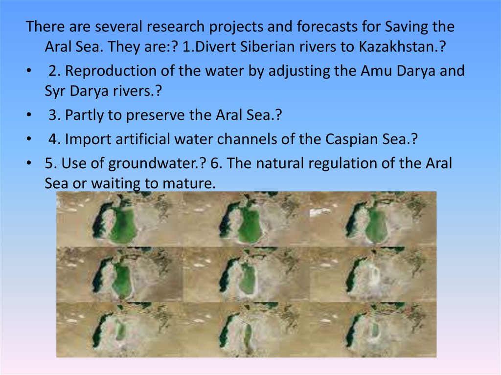
There are several research projects and forecasts for Saving theAral Sea. They are:? 1.Divert Siberian rivers to Kazakhstan.?
• 2. Reproduction of the water by adjusting the Amu Darya and
Syr Darya rivers.?
• 3. Partly to preserve the Aral Sea.?
• 4. Import artificial water channels of the Caspian Sea.?
• 5. Use of groundwater.? 6. The natural regulation of the Aral
Sea or waiting to mature.