


 geography
Similar presentations:


")


The geographical position of the uk
1. The geographical position of the uk
2. The geographical position of the uk
The United Kingdom of Great Britain and Northern Irelandcovers an area of some 244 thousand square miles. It is
situated on the British Isles. The British Isles are separated from
Europe by the Strait of Dover and the English Channel. The
British Isles are washed by the North Sea in the east and the
Atlantic Ocean in the west
The population of Great Britain is about 60 million. The
largest cities of the country are London, Birmingham,
Liverpool, Manchester, Glasgow and Edinburgh.
The territory of Great Britain is divided into four parts:
England, Scotland, Wales and Northern Ireland.
England is in the southern and central part of Great
Britain. Scotland is in the north of the island. Wales is
in the west. Northern Ireland is situated in the northeastern part of Ireland.
3. The geographical position of the uk
England is in the southern and central part of GreatBritain. Scotland is in the north of the island. Wales is
in the west. Northern Ireland is situated in the northeastern part of Ireland.
4. england
England is the richest, the most fertile and mostpopulated part in the country. There are mountains
in the north and in the west of England, but all the
rest of the territory is a vast plain. In the northwestern
part of England there are many beautiful lakes. This
part of the country is called Lake District.
5. scotland
Scotland is a land of mountains. The Highlands ofScotland are among the oldest mountains in the
world. The highest mountain of Great Britain is in
Scotland too. The chain of mountains in Scotland is
called the Grampians. Its highest peak is Ben Nevis. It
is the highest peak not only in Scotland but in the
whole Great Britain as well.
6.
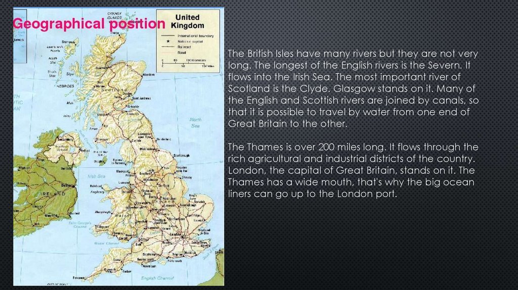
The British Isles have many rivers but they are not verylong. The longest of the English rivers is the Severn. It
flows into the Irish Sea. The most important river of
Scotland is the Clyde. Glasgow stands on it. Many of
the English and Scottish rivers are joined by canals, so
that it is possible to travel by water from one end of
Great Britain to the other.
The Thames is over 200 miles long. It flows through the
rich agricultural and industrial districts of the country.
London, the capital of Great Britain, stands on it. The
Thames has a wide mouth, that's why the big ocean
liners can go up to the London port.
7.
Geographical position of Great Britain is rather good as the countrylies on the crossways of the see routes from Europe to other parts of
the world. The sea connects Britain with most European countries such
as Belgium, Holland, Denmark, Norway and some other countries. The
main sea route from Europe to America also passes through the
English Channel.