


 history
Similar presentations:


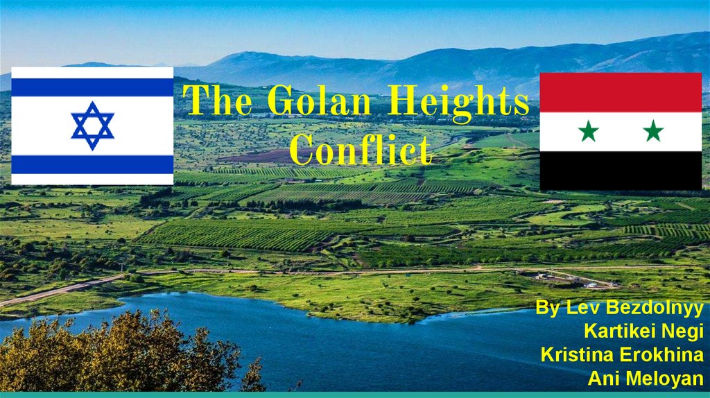
The Golan Heights Conflict
1.
The Golan HeightsConflict
By Lev Bezdolnyy
Kartikei Negi
Kristina Erokhina
Ani Meloyan
2.
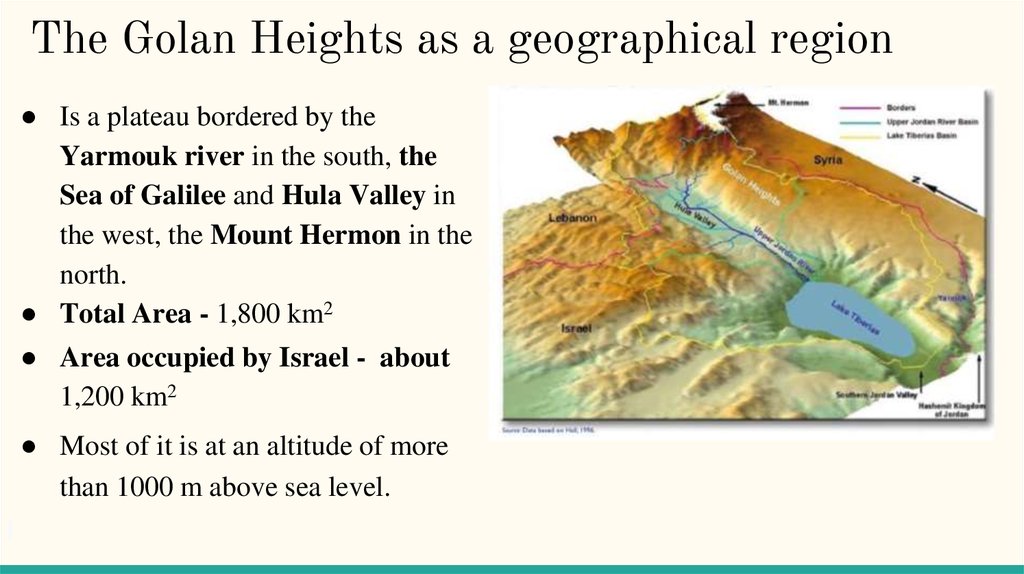
The Golan Heights as a geographical region● Is a plateau bordered by the
Yarmouk river in the south, the
Sea of Galilee and Hula Valley in
the west, the Mount Hermon in the
north.
● Total Area - 1,800 km2
● Area occupied by Israel - about
1,200 km2
● Most of it is at an altitude of more
than 1000 m above sea level.
3.
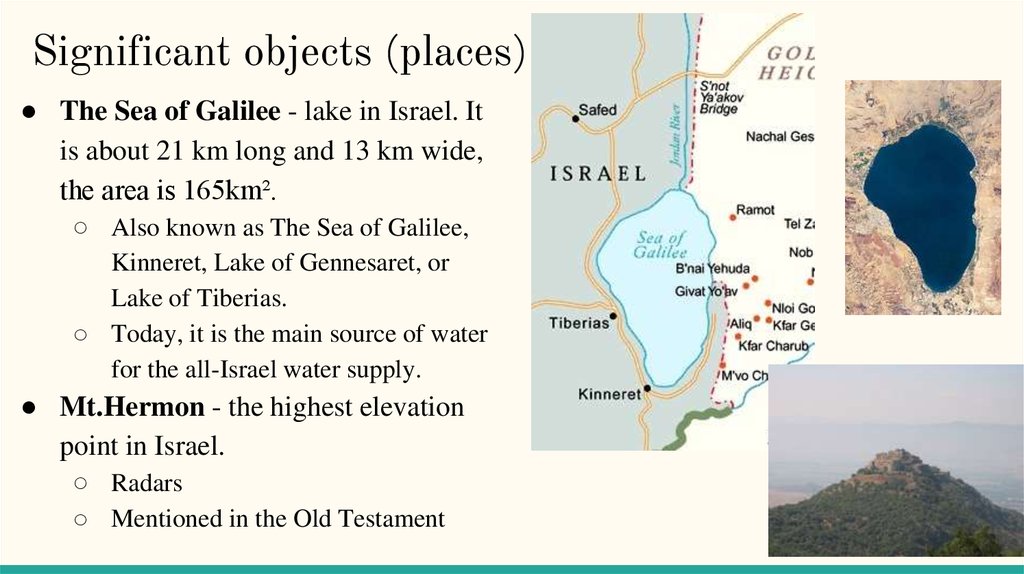
Significant objects (places)● The Sea of Galilee - lake in Israel. It
is about 21 km long and 13 km wide,
the area is 165km².
○ Also known as The Sea of Galilee,
Kinneret, Lake of Gennesaret, or
Lake of Tiberias.
○ Today, it is the main source of water
for the all-Israel water supply.
● Mt.Hermon - the highest elevation
point in Israel.
○ Radars
○ Mentioned in the Old Testament
4.
The Golan Heights as ageopolitical region
Situated between Jordan, south Lebanon, south Syria,
and northern Israel.
Today Israel possesses ⅔ of the Golan
Area captured from Syria and occupied by Israel during the
Six-Day war, territory which Israel annexed in 1981. This
region includes the western two-thirds of the geographical
Golan Heights, as well as the Israeli-occupied part of Mount
Hermon.
The Golan is a strategically important geopolitical region
5.
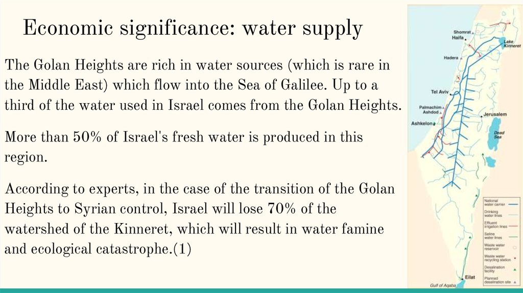
Economic significance: water supplyThe Golan Heights are rich in water sources (which is rare in
the Middle East) which flow into the Sea of Galilee. Up to a
third of the water used in Israel comes from the Golan Heights.
More than 50% of Israel's fresh water is produced in this
region.
According to experts, in the case of the transition of the Golan
Heights to Syrian control, Israel will lose 70% of the
watershed of the Kinneret, which will result in water famine
and ecological catastrophe.(1)
6.
Economic significance: agriculture and viticulture8,100 hectares of land are under cultivation, producing a wide variety of crops, the
Golan produces from 30 to 50% of certain types of fruits and vegetables;
Golan Heights is also a suitable place for viticulture (cultivation of grapes).About a
quarter of all wines, including 40% of those for export, are produced here(3);
The loss of these territories poses a significant threat to the agriculture of Israel,
because the Golan Heights were used by the Syrians to fire at Israeli farmland.
7.
OilThe geologist of Israeli subsidiary Genie Energy, Afek Oil & Gas, said in an
interview (2013) with the Israeli channel Channel 2 that his company discovered
large oil deposits in the Golan Heights.(2)
In April 2013, the State of Israel granted a license to search for oil in the southern
Golan Heights of the company "Afek", a subsidiary of Genie Energy Ltd.
The production potential is billions of barrels of oil, but at the moment the specialists
of the company still need to find out how high the recoverability of oil is.This greatly
exacerbates the contradictions between Israel and Syria.
8.
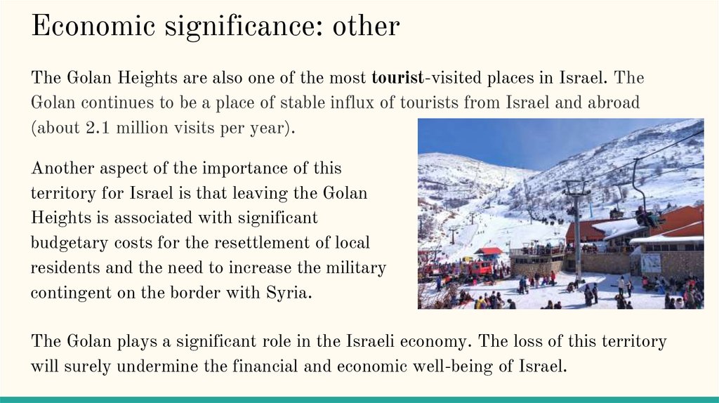
Economic significance: otherThe Golan Heights are also one of the most tourist-visited places in Israel. The
Golan continues to be a place of stable influx of tourists from Israel and abroad
(about 2.1 million visits per year).
Another aspect of the importance of this
territory for Israel is that leaving the Golan
Heights is associated with significant
budgetary costs for the resettlement of local
residents and the need to increase the military
contingent on the border with Syria.
The Golan plays a significant role in the Israeli economy. The loss of this territory
will surely undermine the financial and economic well-being of Israel.
9.
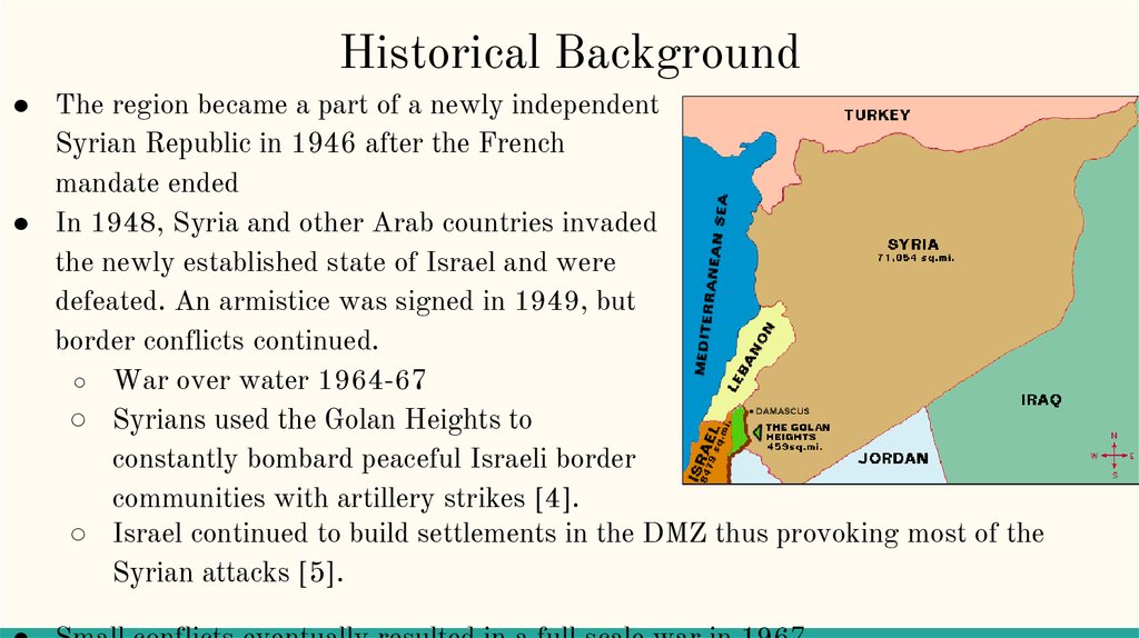
Historical Background● The region became a part of a newly independent
Syrian Republic in 1946 after the French
mandate ended
● In 1948, Syria and other Arab countries invaded
the newly established state of Israel and were
defeated. An armistice was signed in 1949, but
border conflicts continued.
○ War over water 1964-67
○ Syrians used the Golan Heights to
constantly bombard peaceful Israeli border
communities with artillery strikes [4].
○ Israel continued to build settlements in the DMZ thus provoking most of the
Syrian attacks [5].
10.
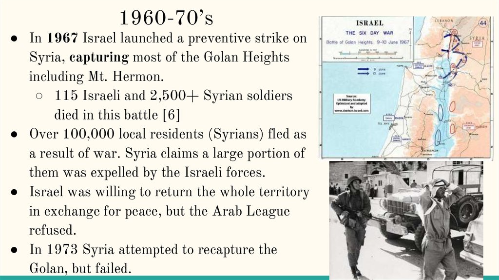
1960-70’s● In 1967 Israel launched a preventive strike on
Syria, capturing most of the Golan Heights
including Mt. Hermon.
○ 115 Israeli and 2,500+ Syrian soldiers
died in this battle [6]
● Over 100,000 local residents (Syrians) fled as
a result of war. Syria claims a large portion of
them was expelled by the Israeli forces.
● Israel was willing to return the whole territory
in exchange for peace, but the Arab League
refused.
● In 1973 Syria attempted to recapture the
Golan, but failed.
11.
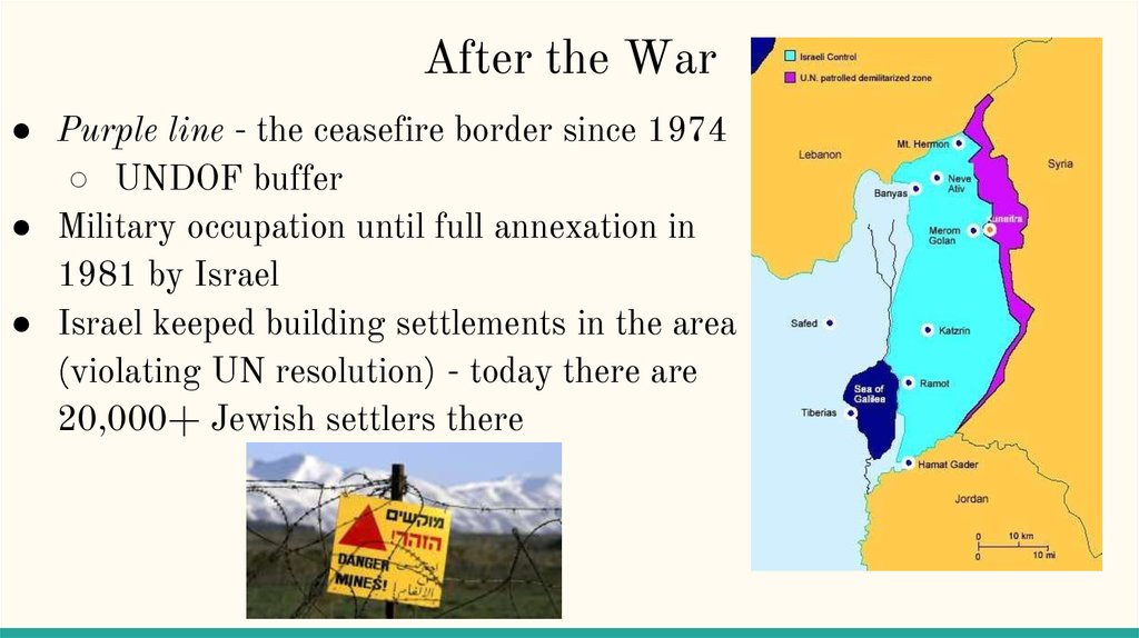
After the War● Purple line - the ceasefire border since 1974
○ UNDOF buffer
● Military occupation until full annexation in
1981 by Israel
● Israel keeped building settlements in the area
(violating UN resolution) - today there are
20,000+ Jewish settlers there
12.
UNUnited Nations Disengagement Observer Force
(UNDOF) was established in 1974 in order to monitor
the implementation of Agreement of Disengagement.
Agreement of Disengagement was signed on 31 May,
1974 in Geneva, Switzerland. It requires Israel and
Syria to end ceasefire and restrain from any military
actions [8]
UN does not recognize the Israeli annexation of the
Golan
13.
Attempts to resolve the crisisdiplomatically
● Israel and Syria finally began to negotiate in 1999.
The peace talks were mediated by the USA.
○ Syria demanded a withdrawal to pre-67 borders
when she still controlled some of the Sea of
Galilee shore. Water is very important to Syria
○ Israel agreed to return the whole Golan except
for the strip of the Sea of Galilee shore. It is
crucial for Israel to control 100% of the lake.
Israel also demanded Syria to cut ties with Iran.
● The talks failed and never fully reopened
14.
Thank you15.
References(1) Tatro, Nicolas. “The Golan Heights: A Battlefield of the Ages”
(2) Barkat, Amiram. “Israel awards first Golan oil drilling license” (2013)
(3) Tarnopolsky, Noga (15 September 2006). "Upstart Wineries Drench
Previously Arid Country".
(4) Sicker, Martin, Israel's quest for security, New York. Praeger Publishing
(1989), p. 92-95
(5) Richman, Sheldon L. “The Golan Heights: A History of Israeli
Aggression.” Washington Report, 12 Nov. 1991
(6) Robert Slater. Warrior Statesman: The Life of Moshe Dayan, Robson
Books, London (1992), pg. 277.
(7) http://www.encyclopedia.com/places/asia/middle-eastern-physicalgeography/golan-heights
(8) http://ecf.org.il/media_items/595
(9) https://www.mapsofworld.com/physical-map/lebanon.html